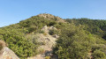
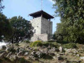
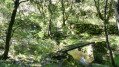
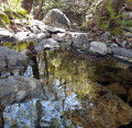
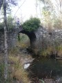
The Beaume Gorges and the Tour de Brison as seen from the Pont du Gua

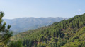
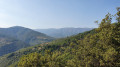
This circular path begins with a beautiful path running alongside the Gorges de la Baume. From the Tour de Brison, a 360° view of the Ardèche mountains unfolds before you.

Details

4046829
Creation:
Last update:
Last review:
  • Walking
    Activity: Walking
  • ↔
    Distance: 8.57 mi
  • ◔
    Average duration: 6h 35 
  • ▲
    Difficulty: Difficult

  • ⚐
    Back to start: Yes
  • ↗
    Ascent: + 2,992 ft
  • ↘
    Descent: - 2,989 ft

  • ▲
    Highest point: 2,559 ft
  • ▼
    Lowest point: 853 ft

Photos

Description of the walk

Park in the small car park at Pont du Gua.

(S/E) Cross the Pont du Gua and turn left. Leave the road about 100 metres further on to take theGRP® Tour du Tanargue path on the right, marked in yellow and red, and follow it towards the hamlet of La Roche.

(1) When you reach a road, turn right. A few metres after the hairpin bend to the right, continue along the road on the left towards Vaneyre. The road ends and gives way to a footpath, which you follow to the hamlet of Peytot.

(2) At the Peytot signpost, take the path on the right which heads north and joins a road; follow this road to the right for a few hundred metres.

(3) Leave the road and take the path on the right. Cross back over the road and continue straight ahead to the bridge.

(4) Cross the bridge over the river and take the road on the right.

(5) Shortly afterwards, leave the road and take a path that climbs to the left. Continue to the signpost at the entrance to Champussac.

(6) Take the road on the right towards Rocles, then a few metres further on, head down the path on the right to the D24. Take this on the right, then turn left to cross the bridge.

(7) Take the path on the left which climbs up to Le Sauze and carry on until you reach a fork.

(8) Follow the path on the right until you reach the road.

(9) Turn right, then, at the next fork in the road, take the left-hand fork. A little further on, turn onto the path leading off to the left until you reach the road at a junction.

(10) Carry on straight ahead (south), then keep to the right at the next junction to reach a three-way junction.

(11) Turn right onto the track towards the Tour de Brison. Continue along this track until you reach the “Small Pass of Berle” signpost.

(12) Follow the track on the left which leads to the Tour de Brison.

(13) Retrace your steps back to the small pass of Berle.

(12) Take theGRP® on the left and follow it straight on until you reach the Pont du Gua (S/E).

Waypoints

  1. S/E : mi 0 - alt. 876 ft - Pont du Gua
  2. 1 : mi 0.71 - alt. 1,519 ft - Road, on the right
  3. 2 : mi 2.07 - alt. 1,496 ft - Peytot signpost
  4. 3 : mi 2.9 - alt. 1,368 ft - Trailhead on the right
  5. 4 : mi 3.18 - alt. 1,119 ft - Bridge over the - Beaume (rivière)
  6. 5 : mi 3.28 - alt. 1,168 ft - Trailhead on the left
  7. 6 : mi 3.92 - alt. 1,460 ft - Signpost: Entrance to Champussac
  8. 7 : mi 4.35 - alt. 1,132 ft - Path on the left towards La Sauze
  9. 8 : mi 4.92 - alt. 1,617 ft - Junction
  10. 9 : mi 5.51 - alt. 1,745 ft - Arrival on the road
  11. 10 : mi 6.01 - alt. 1,995 ft - Junction
  12. 11 : mi 6.29 - alt. 1,995 ft - Three-way junction, track on the right
  13. 12 : mi 6.56 - alt. 2,087 ft - Small Pass signpost
  14. 13 : mi 6.86 - alt. 2,559 ft - Tour de Brison
  15. S/E : mi 8.57 - alt. 876 ft - Pont du Gua

Notes

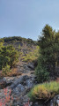
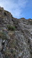
The return trip to the Tour de Brison, which proves to be somewhat technical, and the final section of the circular route, which is a very steep descent, mean that this walk can be classified as ‘difficult’.

Reviews and comments

4.3 / 5
Based on 3 reviews

Reliability of the description
4.3 / 5
Ease of following the route
4.3 / 5
Route interest
4.3 / 5
Marie-Aimée DURAND
Marie-Aimée DURAND

Overall rating : 4 / 5

Date of your route : Jan 05, 2026
Reliability of the description : ★★★★☆ Good
Ease of following the route : ★★★★☆ Good
Route interest : ★★★★☆ Good
Very busy route : No

I did this route clockwise as indicated on the Viso Rando map. The climb up the Tour de Brison is superb. But this climb and the descent to the Pont du Gua is difficult, requiring a lot of attention, especially at the end of the hike. I recommend doing this route anticlockwise. Enjoy your hike ⛰️👍

Machine-translated

User 27458849
• Edited:

Overall rating : 4 / 5

Date of your route : Dec 07, 2025
Reliability of the description : ★★★★☆ Good
Ease of following the route : ★★★★☆ Good
Route interest : ★★★★☆ Good
Very busy route : No

Beautiful hike with a variety of paths, moderate difficulty until point 12, where it becomes very difficult. The route includes slippery rocks in some places due to humidity. Magnificent view during the descent, but if I had to do it again, I would take the opposite route, as the last part of the descent is really dangerous: crossing flat, smooth rocks on a steep slope.

Machine-translated

Fred24007
Fred24007

Overall rating : 5 / 5

Date of your route : Aug 19, 2024
Reliability of the description : ★★★★★ Very good
Ease of following the route : ★★★★★ Very good
Route interest : ★★★★★ Very good
Very busy route : No

A lovely walk
Thank you.

Machine-translated

Other walks in the area

For more walks, use our search engine .

The GPS track and description are the property of this route's author. Please do not copy them without permission.