Country:

 City:
City:


Park in the village square in Beaumont, near the town hall.
(S/E) Cross the village square heading west, go under the stone arch, continue along the pedestrianised street, then take the yellow and white-marked path which descends to the left between two houses.
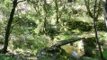
(1) Cross the road and, at the two letterboxes, take the path that leads down to your left into the chestnut grove. At the junction, turn left, follow the yellow and white markings and walk past an old caravan. Continue downhill and, at the next junction, take the small, steep and stony path on the left (take care). Walk down through the tree heath and cross the stream to reach a clearing.
(2) Cross the Ribouna Stream and take the path opposite that climbs, marked in yellow and white. Follow this old drovers' road, which overlooks the Ribouna amongst holm oaks and tree heath, and admire the view over the Ribouna valley.
(3) After the coniferous forest, turn left onto the path leading downhill, then left again a few dozen metres further on.
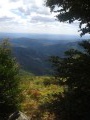
Optional detour: turn right for about a hundred metres to admire the view over the Drobie Valley, then retrace your steps to rejoin the main route.
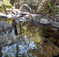
Continue downhill and follow the path to the Ribouna Stream, which has carved out some lovely, deep gours.
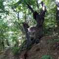
(4) Cross the stream and take the path leading uphill opposite on your right. Halfway up, admire the beautiful view of the hamlet of Issac. Carry on until you reach the old chestnut tree lying across the path, a testament to the force of the Cévenol storms in this area. Go round it and rejoin the path to emerge at the hamlet of La Garingale, a centre for market gardening as the village’s two market gardeners are based there.
(5) Climb over the electric fence and continue along the path, following the yellow and white markings. Head back up to the village road and follow it to the departmental road, where you’ll reach the signpost for ‘l’Abeurador’.
Head up the departmental road to the left, go round the first bend, turn right at the two letterboxes, then immediately left onto the small path that climbs alongside the sheep fence. Please note that this path is steep in places. Follow the yellow and white markings to the water reservoir and rejoin the departmental road.
(6) Turn right and follow the departmental road up to the Collet du Ranc, passing the Croix de Largenac. Then take the path on your right which climbs up through the pine trees (yellow and white markings).
(7) At the signpost for the small pass of Collet du Ranc, follow the sign for ‘Table d’orientation, Beaumont’ on your left. Enjoy the view of the Tour de Brison and the hamlet of Le Gua.
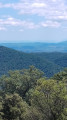
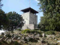
Climb up to the Croix de la Tourasse orientation point, which offers a magnificent panoramic view.
Take the path leading down to the right beneath the old holm oak and follow it to the village square (S/E).


 Visorando Member
 Difficult