


 Country:

 City:



Start: Market square in Calw
(S/E) The market square in Calw, the start and finish point of our tour, is a cosy, homely-feeling spot in the beautiful town of Hermann Hesse. Idyllic half-timbered houses with inviting cafés line the cobbled streets. Hesse himself once raved about Calw as the most beautiful town between Bremen and Naples, Vienna and Singapore. He might well have been right!
First, we walk uphill along Salzgasse (the access route to the ‘Genießerpfad’) into Calw’s Stadtgarten, with its ‘Path of Poems’ entwined in lush greenery. The literary works of the famous writer Hermann Hesse accompany us for a few metres along the way. We eventually leave the park via a flight of steps and cross the Schießbach over a wooden bridge. In the shade of the canopy of leaves, we reach the information board, the official starting point of the Genießerpfad. We take another look at it and examine the photos. Before long, we’ll be there ourselves, experiencing it first-hand. Let’s get going!
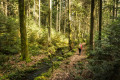
A narrow path marks the start of the walk and leads us pleasantly uphill through the refreshing, green surroundings of the mixed woodland. We climb a few shallow stone steps and pass a mighty tree by the side of the path. A few metres further on, the first magnificent vantage point opens up before us: the Gimpelstein.
(1) Read on the information board how it got its name and what significance it has, or had. From the jagged red sandstone cliff, we have a magnificent view of Calw and the hills surrounding it. The tablet-shaped rock formation is the perfect spot for a short breather. Afterwards, we carry on hiking to explore the magnificent countryside on the heights above Calw.
We climb a few more metres, then keep to the left and continue along a path on the mountainside. On the so-called ‘Felsenweg’ (Rock Path), we have to tackle a few isolated, almost alpine-like sections. We then cross a forest track and soon come across the Calw scaffold, a round, brick-built platform on which a replica of a sword is mounted.
(2) The stone circle was erected in 1800 and used by the town of Calw as a place of execution until 1818. An information board provides detailed information about the ‘Blutgerüst’, as it is translated from the French. A rather eerie place!
After 100 metres along a boardwalk, we turn left onto a gravel path, which we follow for about a kilometre. Soon we turn right onto a wonderfully soft forest path and, after a short while, rejoin the gravel path. After about another kilometre, we need to take care, as our signpost now points at a right angle to the left.
(3) At the information board, we follow the steep path downhill. From here, we walk along the over 100-year-old ‘Butterstaffeln’, which got their name because farmwives used to walk this way to take their wares to the market in Calw. It is a magnificent stretch of the route, leading us over roots, sticks and stones and up a few steps into a true natural idyll. As the steps are almost always a bit slippery, we need to exercise caution.
(4) In the Rötelbach Valley, the stream of the same name has carved its own path – a route through the most beautiful natural surroundings. We cross the stream over three ancient stone blocks and immediately keep to the left, following the stream. Stones thickly covered in moss, lichen hanging wildly down, fascinating reflections of light, birdsong and the gurgling and rushing of the wild little stream accompany us. If you’re lucky, you might occasionally spot a small trout darting under a stone. We cross to the other side of the stream via a small bridge. We can immerse ourselves a little deeper in the ‘Rötelbach Valley’ experience. So why not simply take off your shoes and walk a few metres barefoot in the stream? The tingling sensation in your feet afterwards takes you back to simpler times, and the children particularly enjoy it.
This magnificent natural spectacle accompanies us down the valley for some time. We make sure to keep to the right at a fork in the path, crossing the Rötelbach, and shortly afterwards find ourselves on a forest track, which we follow further down towards Kentheim. Already, the first gables of the little village come into view. We now turn sharply right onto a steep, almost alpine path that leads us to a bizarre Bund sandstone formation, the Stubenfelsen.
(5) Fancy a little test of courage? Then simply try to squeeze through the narrow, approximately two-metre-long crevice (tip: take off your rucksack – it’ll be easier that way). But be warned: local legend has it that anyone who cheats will be crushed inside. After this adventure – which we hope ended well – we climb a few more metres and cross a forest track.
(6) Following the markings, we now climb the wild, winding rocky path – lined with huge stone blocks – up to the small hamlet of Lützenhardt. Once there, a magnificent view, stretching in places as far as the Swabian Alb, rewards us for the effort of the climb.
We walk along Birkenwaldstraße, then turn left and immediately right again. As we cross the village road, we keep a close eye out for the signpost on the opposite side and continue along a gentle meadow path which turns to the right and leads us past fields and into the woods. We follow the path through the shady copse and, after a sharp left-hand bend followed by a right-hand turn, arrive at the Zavelstein hiking lodge.
(7) Beautifully situated on the edge of the woods and boasting a lovely beer garden, the restaurant offers a welcome opportunity to refuel and give our weary feet a rest.
Well-refreshed, we carry on our walk. Directly opposite the hiking lodge, a small path branches off to the left into the woods. Shortly afterwards, we cross a small road and find ourselves back in the woods straight away. After leaving the woods, we come across a covered wooden bench, beautifully situated on the edge of the forest. Even though our last break was only a short while ago, we should pause here and enjoy the silence. As we do so, we look out over meadows and fields towards Speßhardt, a hamlet of Calw.
(8) Our path continues across lovely meadows, now heading downhill into the village. We cross a road and immediately head back up the hill until we reach a wall.
(9) There, we turn right onto a dirt track; passing orchard meadows, we then re-enter the woods until we reach a small road, which we cross once more before following an easy forest track.
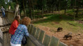
We take the first turn-off to the left. Along the way, we can make a short detour to the Wölflesbrunnen, where many travellers used to stop on their way home from Calw to collect water for their homes and farms. The path continues past the wild boar enclosure.
(10) We leave the wild boar enclosure behind us, turn right and, about 500 metres later, come to a rest area with a shelter and a barbecue area.
(11) An inviting spot where we can take a rest. We then continue along a boardwalk and keep to the right at the end of it. Information boards, which provide an informative insight into the traditional forestry trades in the region, line the gently downhill footpath.
(12) At the ‘Steinerne Bank’, we turn right and walk back along the Schießbach to our starting point.
(S/E) Back in town, we turn left and follow the same route we came along. Now we can round off our walk with a stop for refreshments in the heart of Calw.

 Tourist office

 Easy
 Tourism professional

