


Refine your search for walks in Gare des Yvris-Noisy-le-Grand
Gare des Yvris-Noisy-le-Grand walks


 Saint-Martin and Célie Woods Loop - Malnoue Castle and Ponds
 Visorando Member
 7.04 mi
 +66 ft
 -66 ft
 3h 20
3h 20
 Moderate
 Departure from Noisy-le-Grand (Seine-Saint-Denis)
Discover the Bois Saint-Martin. This woodland, managed by the Île-de-France region, has been open to the public since October 2021. It spans three departments: Seine-Saint-Denis (Noisy-le-Grand), Val-de-Marne (Plessis, Trévise, Villiers-sur-Marne) and Seine-et-Marne (Émerainville). You will discover areas preserved for wildlife, large oak trees and the region's ponds.
Looking for a bit of greenery in Noisy-le-Grand
7.04 mi
+98 ft
-121 ft
3h 20
Moderate
Departure from Noisy-le-Grand (Seine-Saint-Denis)
A round trip to Noisy-le-Grand via Champs-sur-Marne and Emerainville in search of a bit of greenery.
From Ozoir-la-Ferrière to Yvris via the Ferrières Regional Forest
 10.59 mi
+46 ft
-59 ft
4h 55
Moderate
Departure from Ozoir-la-Ferrière (Seine-et-Marne)
10.59 mi
+46 ft
-59 ft
4h 55
Moderate
Departure from Ozoir-la-Ferrière (Seine-et-Marne)
The Grande Randonnée trail, which crosses the massif from one side to the other, offers walkers idyllic scenes, such as the surroundings of the Mare du Cormier, or bucolic moments, such as chestnut picking! Within the Ferrieres and Armainvilliers forests, the route follows sections of the GRP® and PR® trails of the Briardes Valleys and Forests.
From Noisiel to Saint-Maur via the Bois Saint-Martin
 8.09 mi
+39 ft
-203 ft
3h 45
Moderate
Departure from Noisiel (Seine-et-Marne)
8.09 mi
+39 ft
-203 ft
3h 45
Moderate
Departure from Noisiel (Seine-et-Marne)
A hike in three very different parts. From Noisiel station to Yvris station, the route is mainly wooded and damp in places. Then you cross Le Plessis-Trévise, avoiding the main roads but remaining in a very urbanised area. Finally, you follow the paths and lanes of Champigny before walking along the Marne.
Slices of Brie from station to station
 258.96 mi
+8,763 ft
-8,609 ft
31 days
Moderate
Departure from Coulommiers (Seine-et-Marne)
258.96 mi
+8,763 ft
-8,609 ft
31 days
Moderate
Departure from Coulommiers (Seine-et-Marne)
From the medieval town of Coulommiers to Provins, via a loop around the Marne in the Paris suburbs, a series of walks starting from a station and crossing the Brie plain, its villages and its rich heritage.
Walks near Gare des Yvris-Noisy-le-Grand
The sprawling plain: from Le Plessis-Trévise to Chennevières-sur-Marne
 Local authority
 6.20 mi
+20 ft
-236 ft
2h 50
6.20 mi
+20 ft
-236 ft
2h 50
 Easy
Departure from Le Plessis-Trévise (Val-de-Marne)
Easy
Departure from Le Plessis-Trévise (Val-de-Marne)
Discover or rediscover the Grand Paris Sud-Est Avenir area by exploring its various walking routes, which showcase the main points of interest and the often-overlooked treasures of our 16 municipalities, each with their own unique and distinctive histories.
The Parc départemental du Plateau and the banks of the Marne
 3.74 mi
+108 ft
-217 ft
1h 50
Easy
Departure from Villiers-sur-Marne (Val-de-Marne)
3.74 mi
+108 ft
-217 ft
1h 50
Easy
Departure from Villiers-sur-Marne (Val-de-Marne)
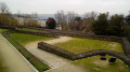
An urban route that first passes through a residential area and then runs alongside a commercial area. Crossing the Parc du Plateau, in several sections, allows you to enjoy some greenery and provides an opportunity to visit a few memorial sites. The walk ends with a pleasant stroll along the Marne and its islands.
From Noisy-le-Grand to Villiers-sur-Marne via the Arènes de Picasso
 3.91 mi
+30 ft
-82 ft
1h 50
Easy
Departure from Noisy-le-Grand (Seine-Saint-Denis)
3.91 mi
+30 ft
-82 ft
1h 50
Easy
Departure from Noisy-le-Grand (Seine-Saint-Denis)
A short urban walk taking us from Seine-Saint-Denis to Val-de-Marne. Along the way, the Arènes de Picasso with two buildings featuring cylindrical façades, residential areas and two public gardens.
From Noisy-le-Grand to Gagny and Mont Guichet
 11.80 mi
+338 ft
-453 ft
5h 45
Moderate
Departure from Noisy-le-Grand (Seine-Saint-Denis)
11.80 mi
+338 ft
-453 ft
5h 45
Moderate
Departure from Noisy-le-Grand (Seine-Saint-Denis)
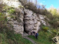
A surprising walk which, on the map, looks very urban, but which, with very few exceptions, avoids tarmac roads. You’ll come across many remarkable buildings, passing from one green space to another – some landscaped (the Croissant Vert) and others wild (the Haute-Île) – and finish with a circular route along well-marked trails through the former gypsum quarries of Mont Guichet, which have been abandoned for decades.
From Noisiel to Sucy-en-Brie via Bois St-Martin and Forêt Notre-Dame
 14.10 mi
+105 ft
-262 ft
6h 35
14.10 mi
+105 ft
-262 ft
6h 35
 Difficult
Departure from Noisiel (Seine-et-Marne)
Difficult
Departure from Noisiel (Seine-et-Marne)
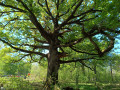
An easy walk along very good paths or trails, with no significant elevation gain. The main attraction lies in passing through several beautiful, varied deciduous forests, whose most remarkable inhabitants are majestic oak trees. The oldest is at point (8). There are also a few castles along the route, and the church at Sucy, which is usually open and well worth a visit.The map shows several urban areas, but for much of these urban sections, the walk takes place along tree-lined avenues or through green corridors, making it easy to forget that you are ‘in town’.
Along the banks of the Marne from Noisiel to Neuilly-Plaisance
 7.07 mi
+13 ft
-197 ft
3h 15
Moderate
Departure from Noisiel (Seine-et-Marne)
7.07 mi
+13 ft
-197 ft
3h 15
Moderate
Departure from Noisiel (Seine-et-Marne)
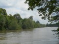
A beautiful walk from station to station (RER line A) along the landscaped banks of the Marne. This walk can be done in either direction.
Ponds, lakes, the banks of the Marne: natural spaces in the heart of Marne-la-Vallée
17.06 mi
+322 ft
-282 ft
7 hrs
 Very difficult
Departure from Lognes (Seine-et-Marne)
Very difficult
Departure from Lognes (Seine-et-Marne)
An easily accessible hike via the RER A, almost entirely on footpaths, trails or pedestrian routes. A highly flexible route: a circular 19 km loop, which can be shortened to 14 km or less thanks to several shortcut options, or extended to almost 30 km if you take all the suggested options.
Beautiful waterside scenery, with numerous birds, some remarkable trees and the listed architectural sites of the former Menier chocolate factory and the Ferme du Buisson.
From Lognes to Noisiel
 7.13 mi
+207 ft
-180 ft
3h 30
Moderate
Departure from Lognes (Seine-et-Marne)
7.13 mi
+207 ft
-180 ft
3h 30
Moderate
Departure from Lognes (Seine-et-Marne)
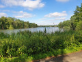
This hike takes you through the various parks and gardens, woods and ponds of Val Maubuée (Lognes, Torcy, Noisiel and Champs s/Marne), from station to station between Lognes and Noisiel.There are some beautiful views along the way, including ponds, the Menier chocolate factory and Noisiel Park.
Please note: check the opening times of Noisiel Park (see "Practical Information" below).Picnics are permitted in the park.
From Bry-sur-Marne to Lagny-sur-Marne
 Association / Club / Walk leader
 12.42 mi
+46 ft
-13 ft
5h 45
Difficult
Departure from Bry-sur-Marne (Val-de-Marne)
12.42 mi
+46 ft
-13 ft
5h 45
Difficult
Departure from Bry-sur-Marne (Val-de-Marne)
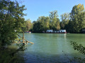
The spread of Columbanian rule led to the establishment of more than forty monasteries in Western Europe. Queen Bathilde founded one of the most important women's abbeys in France in Chelles.
This second journey, or path of exile, was travelled by Columbanus and his compatriots between 610 and 613, from Paris to Rebais. It marked the beginning of a new journey eastwards to Bregenz on Lake Constance and then Bobbio.
Old Saint-Maur and the banks of the Marne
 4.62 mi
+66 ft
-102 ft
2h 10
Easy
Departure from Saint-Maur-des-Fossés (Val-de-Marne)
4.62 mi
+66 ft
-102 ft
2h 10
Easy
Departure from Saint-Maur-des-Fossés (Val-de-Marne)
After walking along the Marne from Champigny station, we stroll through Old Saint-Maur and visit the remains of the former abbey that gave the town its name. The walk ends at the water's edge, along the Saint-Maur Canal and then, once again, the Marne.