Country:
 City:
City:


Starting point and access: Noisy-le-Grand – Mont d’Est station.
- RER – Line A, on the section between Paris and Marne-la-Vallée – Chessy.
Take Exit 4 onto Avenue du Pavé Neuf and, after the ticket barriers, head out opposite towards the bus station.
No signposting
(S) On leaving the station, turn left twice and walk along the right-hand side of the fence separating the station from the lake. At the end of the fence, turn right and head down to the lakeside. Turn right again to cross the floating bridge. At the end, follow a gravel path along the lakeside.
When you reach a wooden dovecote, veer to the right and head uphill. Then turn right onto the footbridge spanning the railway line. At the traffic lights, cross Avenue du Pavé Neuf in two stages, then follow it to the right.
Yellow signposting
(1) Before a roundabout, turn left onto Allée André Malraux and walk past a building surrounded by a pond on your right. At the end, turn left and climb a flight of steps.
No signposting
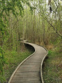
Then cross a street and, opposite, enter the Jardin des Sources. Follow a wooden footbridge. Here, there are two options:
- Following the route shown on the map, go straight on to the far end of the garden and the “Nymphée de l’Ubac” pond. Head down to the left and cross the pond via the bridge made of black stone blocks. Climb a flight of steps, return to the footbridge and follow it to the left. Turn right three times in succession and head towards the church bell tower, which is clearly visible.
- Alternatively, take thefirst footbridge on the left and head towards the church’s bell tower, which is clearly visible.
Yellow markings
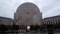
Leave the garden and you’ll arrive at the foot of the Church of Saint-Paul des Nations. Keep the church on your left and take the Mail Victor Jara. Pass the Allée Georges Brassens (on your left) and the Allée Jacques Brel (on your right), then go under the porch of a building with a cylindrical façade. You’ll emerge onto a large square, in the heart of the Arènes Picasso.
(2) In the middle of the square, turn right, follow a gravel path and walk alongside a school on your right. At the end of the path, go round a metal sculpture on the right. At the traffic lights, cross Rue de l’Université. On the other side, climb a flight of steps. Then take the footbridge over the A4 motorway and go back down via a flight of steps.
Then, turn left and follow Rue Vauban, with the Stade Alain Mimoun on your left and the former Fort de Villiers on your right. Carry on straight ahead and pass the Allée de la Tourelle on your left. At the traffic lights, cross the Avenue du Fort and turn left. Take the cycle path, which initially runs parallel to the avenue before quickly veering to the right and away from it.
(3) At the end, turn right into Rue Octave Lapize and immediately ignore Rue des Trente Arpents on your left. Carry straight on and ignore all the side streets and dead ends on your left.
At the end, go round Place du Combat on the left and take thethird left, Avenue Médéric. You’ll pass Rue de Picardie on your left, followed by Rue des Halles. At the traffic lights, cross the avenue (N303) and follow it to the left. After a few dozen metres, turn right towards Le Plessis-Trévise. Do not cross the road; instead, take the bridge over the railway line.
No signposting
(4) As you come off the bridge, take thefirst right onto Chemin Latéral (tarmac) and follow the railway line on your right. Ignore Rue de Macon on your left and carry on straight ahead along the railway line. Further on, continue along Rue de Beaune. At the roundabout, take thesecond left onto Rue de Dijon (due south).
At the end, turn right onto Place des Châtaigniers, then left towards the town centre. Cross Avenue du Lac and follow Avenue de la Chênaie opposite (not signposted here; cycle signs). Take thefirst right onto Avenue de la Haute Chênaie. At the end, turn left onto Avenue des Elzévirs. At the end, cross Route de Combault.
(5) Follow Route de Combault to the right and carry on straight ahead, ignoring the side roads. Go round a roundabout on the left and continue straight ahead along Avenue de Gaumont, towards the A4 motorway. Go slightly uphill and cross over the railway line.
About twenty metres past the bridge, and before a roundabout, leave the avenue and turn left down a path between two walls. Continue along a narrow lane through a residential area. At a small open space, turn left. Ignore the next street on the right. Cross the Allée des Chapelles on the right-hand side (incorrectly labelled Rue des Chapelles on the map) and continue straight ahead along Rue des Chapelles (on the left is the Grand Paris Metro construction site, closed to the public).
(6) At a pedestrian crossing, turn left onto the Sentier des Marins (cobbled). After a few dozen metres, turn right onto the cobbled street. Before a left-hand bend, turn right onto the Sentier des Chapelles and enter the Parc du Bois Saint-Denis. Carry straight on, leaving a sandy area on your right. Pass a small table with a chessboard drawn on it and you’ll come to a rotunda.
Then turn right and walk gently uphill along a tarmac path. Leave the park by passing under some arcades. Next, cross a small car park and continue straight ahead, crossing Rue des Chapelles on your left. Immediately, at number 24, turn left onto a stony path. Pass under two porticoes in succession, emerge onto a street and follow it to the left. After about fifty metres, ignore Rue Louis Lenoir on the left and turn right onto Rue du Général de Gaulle.
(7) Take thefirst left onto Place de l’Église. Walk past the church and go down a flight of steps. In the square (with a metal sculpture in the shape of a globe), turn left (ignore a yellow arrow indicating a right turn). Climb the steps that start at the foot of a statue. At the top, walk past a museum on your right.
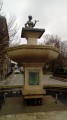
At the end of the alley, turn right onto Rue Louis Lenoir. Cross Rue du Belvédère on the right-hand side and go down a flight of steps. Carry on straight ahead along Rue Louis Lenoir. Go round Place Saint-Christophe (fountain) and continue straight ahead along Rue Louis Lenoir. Carry on straight ahead and, at the end of the street, cross a boulevard to reach Villiers-sur-Marne – Le Plessis-Trévise station on the opposite side.
To get back home:
- RER – Line E, towards Paris or Tournan.


 Visorando Member
 Moderate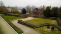
 Association / Club / Walk leader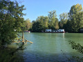
 Difficult
  Local authority