Country:
 City:
City:


The starting point is not far from the Noisy-le-Grand Mont d’Est RER station.
(S/E) Take Avenue du Maréchal Joffre, pass Rue du Clos (on your right), carry on straight ahead across Avenue Georges Clémenceau, and turn right onto Avenue de la République.
(1) Cross Avenue du Général de Gaulle and carry on along Avenue de la République. Cross Rue de Malnoue and continue along Rue de la Justice.
(2) Cross Rue Rouget de Lisle, then turn left onto Rue des Femmes de France. Cross Rue de la Red Cross and turn right onto Rue de Stalingrad. After a few metres, turn left onto Rue des Marguerites to come out onto Avenue Michel Goutier.
(3) Turn right and, after a few dozen metres, enter the Cité des Cormiers on your left via Rue Charles Pranard. Follow this street until you reach Rue Arthur Rimbaud, which you’ll take on your right. You’ll come out onto Rue Jules Ferry, where you’ll turn left.
(4) Cross Boulevard de Champy Nesles and continue straight ahead onto Boulevard de Nesles. Cross Rue Jean Wiener (on your right) and, after passing a block of flats still on your right, turn right before a pond onto the path running alongside a cycle path. Walk past the school complex (Collège Jean Wiener and École Élémentaire Henri Wallon) and when you come out onto Rue Nelson Mandela, turn left to join Boulevard Copernic.
(5) Turn right. Carry on straight ahead, go over the RER tracks and, immediately after this, turn left onto Boulevard Newton. Walk past the buildings in the university area.
(6) Before you reach a roundabout, veer left towards a small copse, taking the narrow path marked by two lampposts and a few large boulders at the entrance (Allée des Marronniers). Walk through the copse; you’ll come out at a small pond and turn right onto the path running alongside it.
When you reach the roundabout, take thesecond exit on your right (D51) towards Émerainville. Walk alongside the departmental road on your left (a pedestrian section protected by a concrete central reservation), go over the A4 motorway, then cross Avenue de l’Europe, staying on the D51.
(7) Turn into the first right, Rue Boris Pasternak. When you come to the car park, walk along its right-hand side: you should see a pond on your right and the Espace Sportif Guy Drut on your left. When you come out onto Avenue Charles Bras, take this road on your left as far as the pedestrian crossing, then turn right onto the shaded Allée des Cygnes, which runs alongside another pond.
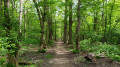
At the end of this path, look out for the Malnoue School Complex on your left. Cross the roundabout and continue along Rue Philippe Buchez, which changes name to Rue Lilienthal and then Chemin des Princes as it bends to the right. Walk alongside the Bois des Yvris on your left. After a short while, look out for a path on your left that leads into the woods and takes you to a playground and picnic area. Continue along this route until you reach the junction of Avenue Médéric and Avenue des Graviers, at the north-western corner of the woods.
(8) Cross Avenue Médéric and continue along Rue du Ballon, passing between the Training and Apprenticeship Centre on your left and the Amazon warehouse on your right. Cross Rue des Aérostiers and carry on straight ahead; when you reach the École de l’Image des Gobelins, look out for a monument on your right commemorating the balloonists who died when their balloon crashed in Noisy-le-Grand in 1913.
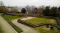
Continue along Rue du Ballon until you reach the roundabout, then turn right onto Boulevard des Astronautes. Cross back over the A4 motorway and, a few metres further on, take the path on your right leading into the Parc de la Butte Verte. At the junction opposite the Butte Verte sports hall, follow the path on your right, then turn left to cross the footbridge leading into the park.
(9) Keep left to stay on the main path (with play areas on both sides), which curves to the left and runs alongside buildings on your right. At the bottom of the path, leave the park and join Boulevard de Champy-Richardets, which you follow to the right.
Go round a roundabout and continue along the boulevard (with a skate park on your right), which turns left then right, leading onto Rue de la Forêt, opposite Rue Camille Flammarion.
(10) Turn left and carry on until you reach Rue du Docteur Vaillant. Cross the road, keep left and turn immediately right into Rue des Abeilles.
When you reach Rue Étienne Dolet, turn right. Quickly take the path between the block of flats and the houses on your left (green gate). At the end of this path, turn left onto an avenue with a central reservation: Avenue du Pavé Neuf.
(11) Cross it and carry on straight ahead (on Mondays and Fridays you’ll be walking through the small market) along Allée Louis Aragon. Keep going straight on, passing between the blocks of flats on the Mail Federico Garcia Lorca, and go under the first of the two blocks nicknamed the “camemberts” to emerge onto the esplanade of Place Pablo Picasso: this whole complex forms the “Arènes de Picasso”.
Leave the esplanade on your right, cross Rue Pierre Mendes France, and continue along Allée Léon Blum until you reach the traffic lights. Cross Avenue du Pavé Neuf and its central reservation again, then turn left towards the coach station (with the railway line on your right).
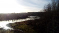
(12) Just before the coach station, turn right, take the footbridge and head towards Lac du Cur. Walk partly along the lake, taking the path on your right, and after a good hundred metres, you’ll reach Rue du Docteur Sureau.
Turn left, then right onto Avenue du Maréchal Joffre. You’re just a few steps away from the starting point (S/E).


 Visorando Member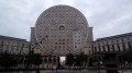
 Easy
Easy 
 Association / Club / Walk leader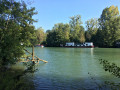
 Difficult
  Local authority