Fort Lachaux via the north face

Hiking route starting from Grand-Charmont Town Hall, via Rue du Paquis and Rue de Sochaux, allowing you to explore the local shops. Take Rue des Prés towards Fort Lachaux. Pass through the Graverots neighbourhood, then the Bleuets neighbourhood. Visit the fort and its Jan Ross farm (see details in the summit section of the route). Descend from the fort via Montbéliard and the Charmontet neighbourhood before turning off towards Les Jonchets and its lake, then return to the Town Hall.

Details

n°2031592
Creation:
Last update:
Last review:
  • Walking
    Activity: Walking
  • ↔
    Distance: 3.23 mi
  • ◔
    Average duration: 1h 40 
  • ▲
    Difficulty: Easy

  • ⚐
    Back to start: Yes
  • ↗
    Ascent: + 223 ft
  • ↘
    Descent: - 223 ft

  • ▲
    Highest point: 1,312 ft
  • ▼
    Lowest point: 1,070 ft

Photos

Description of the walk

Start from the car park in front of the town hall. The sign is on the front of the town hall. Route No. 2 is marked with two horizontal yellow and blue stripes (URV standard).

(S/E) Turn right onto Rue Pierre Curie; at the roundabout, turn left onto Rue du Paquis. Walk past the fountain; at the traffic lights, turn left into Rue de Sochaux and continue to the roundabout. Carry on to the right along Rue de Sochaux for 50 metres. After the shop, turn right into Rue des Prés and continue for 400 metres. Stay on this street until you reach Rue de Montbéliard at the ‘Stop’ sign.

Turn right onto it and immediately turn left onto the footpath, which ends in a flight of steps. Cross Rue des Pervenches and turn left onto it. At the junction, turn right into Rue des Bleuets, then continue along Rue des Myosotis. You’ll soon reach the junction with Impasse des Dahlias.

Turn left onto it, then immediately turn right onto the path that runs alongside the fence towards the woodland leading up to the fort. At the signpost, go straight on until you come to a crash barrier.

(1) Turn left and walk alongside the crash barrier for 20 metres. On the other side of the road, a signpost directs you to continue along this road. In front of the leisure centre building, at the signpost, follow Route No. 2, straight on for 200 metres to the foot of a radio mast. Turn left and walk alongside the pastures to reach the footpath.

(2) Take this path to reach the eastern viewpoint. Enjoy the view over the Savoureuse valley, the Vosges, etc. An orientation board describes the landscape.
Note: Alternatively, you can follow the Caponnière route, which is marked in red. After visiting the viewpoint, the signpost indicates you should take the path on the left. Follow the edge of the ditch until you reach a flight of steps. Turn left for 20 metres and then veer right. Continue along a grassy path; on your left is the southern slope of the fort, which overlooks the town of Sochaux. The path curves slightly to the right and climbs gently. You’ll come to a crossroads.

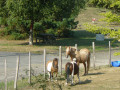
(3) It’s worth taking a quick look around the farmyard here. To do this, at the crossroads, go straight on to a tarmac road and take the path between the two fences. After your visit, turn back and return to the crossroads.
Turn right towards Route No. 2 along the grassy path. When you reach a white building and a signpost, continue along Route No. 2 by heading straight on. Here, two large boulders prevent vehicles from using the path.

Head towards a street lamp and go round it on the left to arrive between two copses. You’ll emerge at the fort’s car park. Turn right and walk for 110 metres. You’ll reach the junction you passed earlier.

(1) At the sign for the fort’s esplanade, turn left for 30 metres. At the sign for the woods of Fort Lachaux, turn left and walk downhill for 70 metres. Exit the woods at the foot of the blocks of flats. Turn right. At the roundabout, take the third exit onto Rue des Pâquerettes, then turn right onto Rue des Campenottes and right again onto Rue des Primevères.

Turn right onto the footpath that runs alongside the school and go down the steps towards Rue des Marguerites. Cross the street, turn left, then cross Rue de la Libération and turn left onto it. Turn right onto Rue Louis Jeanperrin. At the roundabout, turn right towards the post office and continue straight on along a footpath which crosses an orchard and leads further on to Rue des Jonchets.

(4) Turn left. At the next junction, turn left. You’ll arrive at Parc des Jonchets. Follow the grassy path, then take the wooden footbridge across it; at the signpost, turn right, staying on the footbridge, onto a grassy path. Turn left onto a concrete path until you reach the signpost indicating a right turn.
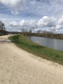
Alternative route: turn left onto a path leading to a copse and two benches with a view of a lake.

(5) At the signpost, turn right towards Grand-Charmont along a stony path. Join the Allée des Prelots; turn right onto it for 10 metres, then continue to the right onto the footpath that runs alongside the Allée des Roselières. At the junction, go straight on, continuing along the Allée des Chézeaux. Take the pedestrian crossing opposite, between two detached houses, which leads back to the starting car park (S/E).

Waypoints

  1. S/E : mi 0 - alt. 1,089 ft - Car park at Grand-Charmont Town Hall - Fontaine du Pâquis
  2. 1 : mi 0.84 - alt. 1,293 ft - Esplanade sign
  3. 2 : mi 1.2 - alt. 1,296 ft - East Viewpoint
  4. 3 : mi 1.43 - alt. 1,309 ft - Farmyard
  5. 4 : mi 2.49 - alt. 1,083 ft - Conservation orchard
  6. 5 : mi 2.79 - alt. 1,070 ft - Lake in the Parc des Jonchets
  7. S/E : mi 3.23 - alt. 1,089 ft - Car park at Grand-Charmont Town Hall

Notes

Who is the URV
After the walk
- Museum of the Castle of the Dukes of Württemberg, Montbéliard.
- Peugeot Adventure Museum, Sochaux.
- Brewery Museum, Sochaux.
- Près-la-Rose Science Centre, Montbéliard.
- Outdoor swimming pool (July/August), Montbéliard.
- Pré la Rose and Île en Mouvement parks, Montbéliard.
- La Citédo, Sochaux.
- Pays de Montbéliard Leisure Centre, Brognard.
- Stade Bonal, Montbéliard.
- Hôtel Beurnier Rossel Museum of Art and History, Montbéliard.

We also recommend that you take along the 1:25,000-scale IGN paper maps for this walk.
Always exercise caution and plan ahead when out walking. Visorando and the author of this guide cannot be held liable for any accidents or incidents of any kind that may occur on this route.

Worth a visit

The various neighbourhoods of the village leading up to the hill of Fort Lachaux:
- Fort Lachaux, known as ‘La Montagnette’, was completely cleared of undergrowth during work carried out by Jean Bauhin in the16th century (1577–1579) in order to plant vines there. It was then known as ‘la Chaux’.
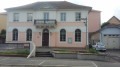
- The Village. Shops are clustered around the town hall and the church.
- The other shopping area. Opposite the Carrefour Express, you’ll find the town’s second shopping area.
- The village and Place Godard. It was very close to the Peugeot factories in Sochaux. Only Fort Lachaux stood in the way. This is why, in the early 1930s, Peugeot’s management decided to purchase land – undoubtedly not very fertile – within the area now bounded by Rue de Montbéliard, Rue du Nord, Rue de Sochaux and Rue Boillot, in order to house its workforce, some of whom came from abroad.
Between 1931 and 1936, the population rose from 462 to 823.
From 1948, buildings were constructed around Place Godard.
- Les Graverots. The name ‘Les Graverots’ already appears in the land registry drawn up in 1835. Shortly before the Second World War, this entire rugged part of Grand-Charmont served as a golf course – the Peugeot Golf Club. With the outbreak of the war, due to restrictions of all kinds, particularly on food supplies, the golf course disappeared. It was converted and divided into allotments cultivated by Peugeot workers. At that time, the slopes of Fort Lachaux were considered unsuitable for building as they did not receive enough sunlight in winter and were riddled with springs.
In 1965, construction began on the Graverots housing estate. The first residents moved in at the end of 1966 and the last in 1971.
- Les Jonchets. Since 2000, PMA has developed a park at Les Jonchets, whilst the town has established a conservation orchard. Historically, this plain was a wetland area with irrigated meadows and clay pits which partly supplied the tile works on Rue du Stade.

Reviews and comments

5 / 5
Based on 1 review

Reliability of the description
5 / 5
Ease of following the route
5 / 5
Route interest
5 / 5
EMMANU
EMMANU

Overall rating : 5 / 5

Date of your route : Nov 17, 2024
Reliability of the description : ★★★★★ Very good
Ease of following the route : ★★★★★ Very good
Route interest : ★★★★★ Very good
Very busy route : No

A walk through the town and the woods, with a stop at the farm where we saw various animals, as well as the fort – we had a lovely time, thank you

Machine-translated

Other walks in the area

For more walks, use our search engine .

The GPS track and description are the property of this route's author. Please do not copy them without permission.