On the ridges of Vassieux-en-Vercors

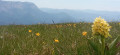
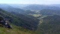
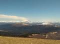
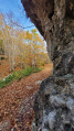
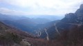
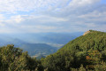
This walk will take you along the ridges above Vassieux-en-Vercors, where you’ll discover breathtaking views and exceptional flora and fauna in season. A walk where taking your time is essential!

Details

n°76078922
Creation:
Last update:
Last review:
  • Walking
    Activity: Walking
  • ↔
    Distance: 7.05 mi
  • ◔
    Average duration: 4h 55 
  • ▲
    Difficulty: Moderate

  • ⚐
    Back to start: Yes
  • ↗
    Ascent: + 1,909 ft
  • ↘
    Descent: - 1,837 ft

  • ▲
    Highest point: 5,367 ft
  • ▼
    Lowest point: 4,075 ft

Photos

Description of the walk

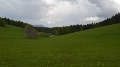
The route starts from this small grassy car park at the end of a short, bumpy road (Route de la Hâle) taken from Plaine de Charose, heading towards the Museum of Prehistory in Vassieux-en-Vercors.

(S/E) Head south on the Route Forestière du Lauset (GRP®).

(1) Walk past the Lauset Forest Lodge, then the Fontaine du Plainet. Continue along the GRP® for approximately 450 m.

(2) Keep left, heading due south, on the GRP® until you reach the junction with a track.

(3) At the Coras sign , take the forest track to the left, still heading due south towards Fontaine du Plainet (GRP®).

(4) Follow the forest track to the left for 150 m and take a lovely path to the right (GRP®).

(5) Walk past the Refuge du Col de Vassieux (alt. 1,360 m) and continue towards Entrecols. Reach the ridge (elevation 1,359).

(6) Leave the GRP® and head up to the right towards Entrecols to reach the Col de la Chau (elevation 1,431 m).

(7) Continue climbing straight ahead, heading west-south-west along the ridge to But St-Genix (elevation 1,643).

(8) Stunning scenery. Follow the ridge northwards, taking every precaution depending on the weather. This will take you to the Pas Bouillanain (elevation 1,444) at a crossroads.

(9) Head up the small path opposite, ignoring the ones on the right and left. Walkthrough the woodland heading north-east.

(10) At the ‘Crêtes des Clos’ sign, head down to the right towards the south-east through the woodland along the stony path (GR® 93). 

(11) At the ‘Piarrou’ sign, head down the path opposite (GR® 93) to reach the car park on the left at the bottom (S/E).

Waypoints

  1. S/E : mi 0 - alt. 4,075 ft - Car park
  2. 1 : mi 0.43 - alt. 4,108 ft - Lauset Forest Lodge. Towards the - Fontaine du Lauset (Vassieux-en-Vercors)
  3. 2 : mi 0.67 - alt. 4,173 ft - Junction
  4. 3 : mi 1.42 - alt. 4,446 ft - Coras
  5. 4 : mi 1.84 - alt. 4,409 ft - Fontaine du Plainet (Vassieux-en-Vercors)
  6. 5 : mi 2.31 - alt. 4,498 ft - Col de Vassieux Mountain Hut
  7. 6 : mi 2.49 - alt. 4,432 ft - Entrecols
  8. 7 : mi 2.94 - alt. 4,642 ft - Col de la chau (1434m)
  9. 8 : mi 3.68 - alt. 5,364 ft - But Saint-Genix (1643 m)
  10. 9 : mi 4.91 - alt. 4,806 ft - Pas de Bouillanain (1445 m)
  11. 10 : mi 6.22 - alt. 4,659 ft - Crêtes des Clots
  12. 11 : mi 6.63 - alt. 4,321 ft - Piarrou
  13. S/E : mi 7.05 - alt. 4,137 ft - Car park

Notes

There is only one water point shortly after setting off. On the ridges, watch out for wind and fog. There are mountain huts near the route where you can stay overnight (1) and (5).

Worth a visit

Always be cautious and plan ahead when you're outdoors. Visorando and the author of this route cannot be held responsible for any accidents occurring on this route.

The GR® and PR® markings are the intellectual property of the Fédération Française de Randonnée Pédestre.

Reviews and comments

3.8 / 5
Based on 2 reviews

Reliability of the description
3.5 / 5
Ease of following the route
3.5 / 5
Route interest
4.5 / 5
V G
V G

Overall rating : 4 / 5

Date of your route : Aug 06, 2025
Reliability of the description : ★★★★☆ Good
Ease of following the route : ★★★★☆ Good
Route interest : ★★★★☆ Good
Very busy route : No

Follow the GPS to get to the starting point. Do not follow the signs for "But St Genix" at the start, otherwise you will do the hike backwards. It is sometimes advisable to navigate with the Visiorando/GPS map to find your way around the intersections.
A varied and fairly easy hike that takes 4 hours (not including a lunch break at "But St Genix"). Contrary to the information provided, the elevation gain is closer to 400 metres according to our Visiorando route.
The landscape is varied and pretty, including the sections in the forest. There is a beautiful view of the Fond d'Urle once you reach the top of "But St Genix"
This is an ideal hike in hot weather as many sections are in the forest.

Machine-translated

User 16803611

Overall rating : 3.7 / 5

Date of your route : Jul 12, 2025
Reliability of the description : ★★★☆☆ Average
Ease of following the route : ★★★☆☆ Average
Route interest : ★★★★★ Very good
Very busy route : No

It was a bit of a struggle just to find the starting point: “between Vassieux and the Col du Rousset” – it might be worth adding: “so many kilometres from Vassieux”.
At the start, there were no signs for this walk, nor for the final destination, ‘But de Nève’, nor the name of the walk itself… There are two paths… Then, there was a sign for the first three-way junction, which we must have missed as there were no markers…
As there are several “three-way junctions”…
It was only when we reached an open plateau that we realised we were in the wrong place, as we’d ended up at the “Col de Chironne” when we should have been at “But de Nève”.
It was lovely, with wild strawberries all along the path (😂), but it wasn’t the right hike!!!
We’re not sure whether we went wrong right from the start or later on…
That’s it!
Thanks anyway for all your walks!!!

Machine-translated

Other walks in the area

For more walks, use our search engine .

The GPS track and description are the property of this route's author. Please do not copy them without permission.