Fond des Trois Bois

Setting off from the Route de la Croix Maga, over hill and dale and through woodland, we reach the Fond des Trois Bois and return via Pepinster.

Details

n°10805203
Creation:
Last update:
Last review:
  • Walking
    Activity: Walking
  • ↔
    Distance: 8.10 mi
  • ◔
    Average duration: 4h 30 
  • ▲
    Difficulty: Moderate

  • ⚐
    Back to start: Yes
  • ↗
    Ascent: + 866 ft
  • ↘
    Descent: - 876 ft

  • ▲
    Highest point: 935 ft
  • ▼
    Lowest point: 374 ft

Photos

Description of the walk

Start on Route de la Croix Maga heading towards Croix Maga.

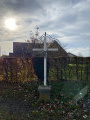
(S/E) Turn right and head towards the Croix Maga crossroads.

(1) Turn left, then left again. Continue straight on until you reach the Cornesse cemetery.

(2) Turn right onto Rue de Réfawtay, ignoring the Route de la Saute. Follow the road until you reach a Fork in the road.

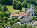
(3) Turn left and head down to the village of Goffontaine, which you will see perched above you on your left. Continue straight on to the church.

(4) Turn right and join the RN61.

(5) Cross the road carefully towards the railway line, which you will cross. Continue along the road to cross over the Vesdre. Head up the street on the left until you reach the first left.

(6) Take the hairpin bend onto Chemin Albert Dress and keep to the left. Follow this small road and take the path on the right, ‘Fond des Trois Bois’. You are now on the ‘D’Artagnan’ road and on theGR®573Liège–Veviers. Continue along theGR® by taking a path on the far left.

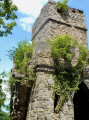
(7) Cross the ford and continue along the same path. Cross another stream via a footbridge and you’ll reach a fork in the path. Turn left for a detour to the Tour de Louhau if you wish.

(8) Retrace your steps and continue to the left to pass behind the Château des Mazures.

(9) Continue along theGR® on the right and head uphill until you reach a tarmac road. Follow it to the left.

(10) Head back down towards Pepinster, via the Mousset neighbourhood on your left. Cross the Hoëgne alongside the railway line, then take the steps leading down to the left onto Quai Ferdinand Nicolaï

(11) Follow this quay and turn left onto Rue de la Régence (N690) to cross the Vesdre. At the junction, turn left onto Rue Masseau towards Liège.

(12) At the next junction, head up Rue Jonckay to the right until you reach the Grande Fontaine junction. Cross the road and take the path straight ahead, Chemin du Bois Herman.

(13) Follow this path, which is flat at first but then climbs, until you reach the first house on the right, then take the path on the left. At the end of this path, turn left. At the top, take the footpath that climbs to the right and turns into a track; follow this until you reach a tarmac road (Route de Soiron), passing the water tower on your left.

(14) Cross this road, then take the second path on the right. At the end of this path, turn left onto Route de la Croix Maga to reach the car park (S/E).

Waypoints

  1. S/E : mi 0 - alt. 928 ft - Route de la Croix Maga
  2. 1 : mi 0.19 - alt. 919 ft - Croix Maga
  3. 2 : mi 0.82 - alt. 886 ft - Cornesse Cemetery
  4. 3 : mi 1.3 - alt. 886 ft - Fork in the road on Rue Réfawtay
  5. 4 : mi 1.97 - alt. 509 ft - Église Saint-Monon (Goffontaine)
  6. 5 : mi 2.13 - alt. 397 ft - N61 road. Towards the - Vesdre (rivière)- Belgique à finaliser
  7. 6 : mi 2.61 - alt. 499 ft - Chemin Albert Dresse
  8. 7 : mi 3.66 - alt. 574 ft - Fond des Trois Bois stream
  9. 8 : mi 4.57 - alt. 594 ft - Louhau Tower
  10. 9 : mi 5.02 - alt. 518 ft - Château des Mazures
  11. 10 : mi 5.71 - alt. 479 ft - Le Mousset neighbourhood
  12. 11 : mi 5.82 - alt. 446 ft - Quai Ferdinand Nicolaï - Hoëgne (rivière) - Belgique - Affluent de la Vesdre
  13. 12 : mi 6.15 - alt. 446 ft - Rue Jonckay
  14. 13 : mi 6.6 - alt. 699 ft - Chemin du Bois Herman
  15. 14 : mi 7.68 - alt. 932 ft - Crossing the Route de Soiron
  16. S/E : mi 8.1 - alt. 932 ft - Route de la Croix Maga

Worth a visit

(8) The Tower of Louhau

Always be cautious and plan ahead when you're outdoors. Visorando and the author of this route cannot be held responsible for any accidents occurring on this route.

The GR® and PR® markings are the intellectual property of the Fédération Française de Randonnée Pédestre.

Reviews and comments

5 / 5
Based on 1 review

Reliability of the description
5 / 5
Ease of following the route
5 / 5
Route interest
5 / 5
Pierre Alleman
Pierre Alleman

Overall rating : 5 / 5

Date of your route : Jul 13, 2021
Reliability of the description : ★★★★★ Very good
Ease of following the route : ★★★★★ Very good
Route interest : ★★★★★ Very good
Very busy route : No

A lovely route despite the rainy weather. The scenery in the drizzle is truly charming.
A couple of minor issues… the end of section 6 and the start of section 7 (the path to the rear left is very difficult to spot, even with GPS, as it’s heavily overgrown and there’s a fording point that’s completely submerged)… the return route towards Louhau Tower is signposted as ‘private road’ and ‘no entry’.
Thanks to the creator of this route.
P. All.

Machine-translated

Other walks in the area

For more walks, use our search engine .

The GPS track and description are the property of this route's author. Please do not copy them without permission.