


Refine your search for walks in Hoëgne (rivière) - Belgique - Affluent de la Vesdre
Hoëgne (rivière) - Belgique - Affluent de la Vesdre walks


 From La Statte to La Hoëgne in Solwaster
 Visorando Member
 9.10 mi
 +981 ft
 -965 ft
 5h 00
5h 00
 Moderate
 Departure from Jalhay (Province de Liège)
Solwaster, a small village at the foot of the fagne, 16 km from Verviers, is unique in that it is located between two of the most beautiful rivers in the fagne: the Statte, which rises in the peat bogs of the Hautes-Fagnes, in the Wihonfagne fagne, and the Hoëgne, which rises in the Polleur fagne. These two rivers welcome us into a magical landscape of fens and forests.
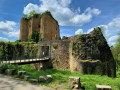
Around Theux, from Franchimont to Oneux via Le Thier du Gibet
 7.48 mi
+738 ft
-728 ft
4h 05
Moderate
Departure from Theux (Province de Liège)
7.48 mi
+738 ft
-728 ft
4h 05
Moderate
Departure from Theux (Province de Liège)
Discover Franchimont Castle, the village of Oneux and the town centre of Theux via country lanes and urban paths.
The village of Fays and its countryside
 6.60 mi
+512 ft
-492 ft
3h 30
Moderate
Departure from Theux (Province de Liège)
6.60 mi
+512 ft
-492 ft
3h 30
Moderate
Departure from Theux (Province de Liège)
Discover the village of Fays, situated on the heights of the municipality of Theux. You’ll love the countryside here. Make sure you wear sturdy, mud-resistant walking boots in wet weather.
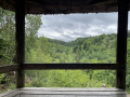
The Belvédère de la Reine, starting from Hockal
 2.26 mi
+262 ft
-262 ft
1h 15
2.26 mi
+262 ft
-262 ft
1h 15
 Easy
Departure from Jalhay (Province de Liège)
Easy
Departure from Jalhay (Province de Liège)
This lovely, short and easy walk will take you to the Pont du Centenaire and the Belvédère de la Reine.
La Hoëgne and La Statte
 10.57 mi
+1,115 ft
-1,106 ft
5h 50
10.57 mi
+1,115 ft
-1,106 ft
5h 50
 Difficult
Departure from Jalhay (Province de Liège)
Difficult
Departure from Jalhay (Province de Liège)
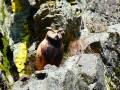
This magnificent walk, mainly through woodland, offers a leisurely exploration of two of the three iconic streams of the Hautes-Fagnes on the south-western side of Baraque Michel. The route follows one stream upstream and the other downstream.Feel free to walk the route in both directions, as the experience of a rushing stream is often better when walking upstream. You will most likely discover other aspects of it.The third stream in the region is the Sawe, which the route follows very briefly between kilometres 2 and 3. Numerous footbridges and boardwalks make it easier to navigate this wild, picturesque, sometimes chaotic, sometimes muddy environment, where the paths are covered in rocks and roots.
Fond des Trois Bois
 8.10 mi
+866 ft
-876 ft
4h 30
Moderate
Departure from Pepinster (Province de Liège)
8.10 mi
+866 ft
-876 ft
4h 30
Moderate
Departure from Pepinster (Province de Liège)
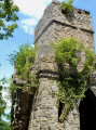
Setting off from the Route de la Croix Maga, over hill and dale and through woodland, we reach the Fond des Trois Bois and return via Pepinster.
From Spa to Franchimont (circular route)
 13.18 mi
+1,923 ft
-1,939 ft
7h 45
Moderate
Departure from Spa (Province de Liège)
13.18 mi
+1,923 ft
-1,939 ft
7h 45
Moderate
Departure from Spa (Province de Liège)
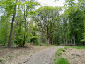
Starting from Spa railway station, you’ll take paths through the Staneux woods and the Lonhue woods, following the Grand-Chaxion and its beaver dams. Further on, you will see the Chène-de-Poleuhe and then the 11th-century Franchimont Castle. On your way back towards Spa, there is another remarkable tree, the Chène-de-la-Vierge, and you can then stop for a short break by the Chawion pond before returning to the station.
On the heights of Theux
11.28 mi
+1,490 ft
-1,470 ft
6h 30
Difficult
Departure from Theux (Province de Liège)
Starting from the ruins of Franchimont Castle, discover Theux and its surroundings, including some remarkable trees, including an impressive sequoia, the Ru de Chawion Nature Reserve, the hamlets of Sassor and Sasserotte, passages along the Wayai and Hoëgne rivers, some beautiful panoramic views, long stretches through the magnificent Bois de Staneux and a " work dedicated to crayfish".