Country:
 City:
City:


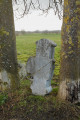
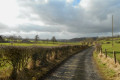
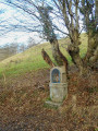
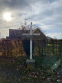
Park on Route de la Croix Maga in Cornesse, just past the last house on the street.
(S/E) Head towards the Soiron football pitch. Take the stony track on the right until you reach a small tarmac road, then turn left onto it. Take care when crossing the Route de Soiron. Take the dirt track directly opposite. At the end of this track, turn onto the small path leading down to your left and follow it to a small tarmac road.
(1) Take thesecond path on the right. Stay on the path until you reach a small tarmac road, which you follow to the right. Turn onto thefirst path on your left. Walk past two ponds on your left, stay on the main path and head for the Doux Fonds crossroads.
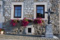
(2) Turn onto the path leading uphill to the left. This path is wide and leads to the Wegnez cemetery. At the end of this track, turn left onto Rue de la Paix and follow it to the left. Before reaching the five-way junction, turn right onto Rue Laurent Mairlot. This is a tricky section. You’ll be on the road (for about 300 m); keep well to the left and take care as you approach the left-hand bend.
(3) After this left-hand bend and a right-hand bend, take the path that opens up between two properties, leading you to the Val du Fierain. Walk through the woods of the Domaine de Tribomont. Stay on the path until you reach a crossroads within the Domaine de Tribomont.
(4) Take thefirst path on the right which runs alongside the meadow, cross a small bridge and follow this path until you reach a red-and-white gate.
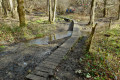
(5) Turn onto the path on the right and follow the wooden walkway to cross the Fierain without getting your feet wet. At the end of the walkway, follow the path on the left which runs alongside the stream, leading you to a small tarmac road.
(6) Turn immediately right onto it. It climbs quite steeply; this is Rue du Calvaire, which leads to Lambermont Cemetery. Carry on straight ahead until you reach a main road, then cross it towards Rue des Combattants.
(7) Take this slightly downhill street and, at a right-hand bend, continue along the gravelled path straight ahead.
(8) This is Ruelle Muller, named after the owner of the large estate (château) which you walk past without, unfortunately, ever seeing the château itself. You’ll come to a tarmac road; take this to the right. Be careful: keep to the left-hand verge. Follow this road until you reach the sign for Petit-Rechain.
(9) Turn onto the path on the left. At the end of this path, take the small tarmac road on the left until you reach the main road. Continue straight on towards Tribomont. At the junction, turn right, then immediately take the path on the left.
(10) Starting as tarmac, then stony, then a dirt track, this is the path leading to the village of Soiron.
(11) Then take thefirst path on the left and head up towards the Voie Creuhy. You’ll come to a small tarmac road; take this to the right. Keep to the left as this road is quite busy. At the end of the road, turn left and then immediately right towards Saint-Germain.
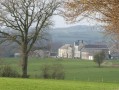
(12) Go round the Château de Scassin. Continue along the Route de Saint-Germain until you reach the Chêne crossroads.
(13) Cross this junction to take the Route de la Croix Mag and head for the car park (S/E).


 Visorando Member

 Easy
Easy 
 Local authority
 Difficult