Country:
 City:
City:


GRP® 127 Tour du Brabant Wallo ® Yellow-Red markers
(S/E) Leave the car park in front of the main entrance and turn right onto Rue du Plagniau.
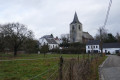
Follow Rue du Plagniau, which becomes a path, first through the countryside and then into the Rixensart woods. Keep going straight ahead, enter the woods and come out again until you reach the first house on your left.
(1) Opposite this house, take the path on the right (still following the yellow-red GR® signs).
Keep going straight on through the Rixensart woods until you reach Avenue de Mérode.
From this junction, we will no longer follow the yellow-red GR® signs.
(2) When you reach Avenue de Mérode, do not cross the road (it is dangerous) but stay on the same pavement. Turn right and then immediately right again onto Avenue de la Résistance.
You will come to a Y-junction in front of Square de la Résistance. Continue left onto Beau Site Première Avenue. This continues until Avenue Royale.
(3) Cross Avenue Royale at the Proxy Delhaize. Take Avenue Josephine Charlotte straight ahead. Take the second right onto Avenue Albert Prince de Liège. Cross Avenue du Fond Marie Monseu. Take the first right onto Avenue Reine Elisabeth.
You will come to a T-junction with Rue de Froidmont. Turn right. Follow Avenue de la Paix to the left for about thirty metres, then take the first left onto Avenue Clermont-Tonnerre. Go past the back of the sports stadium. Take the first right onto Avenue du Château.
(4) You will come to Rue de l’Église. Cross Rue de l’Église and follow this street by turning left. Just after the École de la Source, turn right onto Chemin des Forsythias. At the end of this path, turn left and then take the first street on the right. You are now on Rue Adelin Hautfenne. At the end of this street, there is a path called Chemin du Cimetière. Follow this path to the end. It leads onto Rue du Plagniau. Turn left to reach the Fedasil centre (S/E).
 Visorando Member
 Moderate
 Difficult
 Association / Club / Walk leader