Sainte-Barbe Cliffs (climbing routes) – round trip

This route describes the access path to the crag at the Sainte-Barbe climbing site from the car park at the chapel of the same name.
It is not a hike in its own right but is intended to provide climbers with easier access to this lovely cliff in a small valley.

Details

88918239
Creation:
Last update:
Last review:
  • Walking
    Activity: Walking
  • ↔
    Distance: 0.25 mi
  • ◔
    Average duration: 0h 05 
  • ▲
    Difficulty: Easy

  • ⚐
    Back to start: Yes
  • ↗
    Ascent: + 13 ft
  • ↘
    Descent: - 13 ft

  • ▲
    Highest point: 1,060 ft
  • ▼
    Lowest point: 1,043 ft

Description of the walk

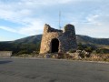
Parking is available at the Sainte-Barbe Chapel car park.

(S/E) From the car park, head up the track and follow it north-east for about 40 metres. When it turns left, take the path north-east through the vegetation to reach a field below.

(1) Cross the field, still heading north-east, and follow a path opposite uphill to a junction about 120 metres past the car park.

(2) Take the right-hand fork to head towards the cliff. Follow the path through the valley for a few minutes to reach the foot of the climbing routes.

(3) Return via the same route as the outward journey, but in the opposite direction (S/E).

Waypoints

  1. S/E : mi 0 - alt. 1,056 ft - Sainte-Barbe Chapel car park
  2. 1 : mi 0.03 - alt. 1,047 ft - Champ
  3. 2 : mi 0.07 - alt. 1,056 ft - Crossroads
  4. 3 : mi 0.13 - alt. 1,056 ft - Sainte-Barbe Cliffs
  5. S/E : mi 0.25 - alt. 1,056 ft - Sainte-Barbe Chapel car park

Worth a visit

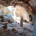
This path runs alongside the cliffs of Sainte-Barbe and can be extended through the heath, passing by the Grotte d’Opoul. The route takes about 1 hour, not including the time spent in the cave.

Other walks in the area

For more walks, use our search engine .

The GPS track and description are the property of this route's author. Please do not copy them without permission.