Circular walk from Perillos to Montolier de Perellós

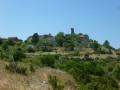
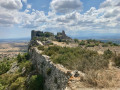
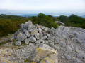
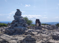
As the northernmost point of the Pyrénées-Orientales, the Montolier de Perellós offers a remarkable view of the Roussillon, the Aude, the Pyrenees, the Montagne Noire, Sète and the lakes.

Details

n°51780964
Creation:
Last update:
Last review:
  • Walking
    Activity: Walking
  • ↔
    Distance: 9.74 mi
  • ◔
    Average duration: 5h 55 
  • ▲
    Difficulty: Difficult

  • ⚐
    Back to start: Yes
  • ↗
    Ascent: + 1,608 ft
  • ↘
    Descent: - 1,617 ft

  • ▲
    Highest point: 2,316 ft
  • ▼
    Lowest point: 1,033 ft

Photos

Description of the walk

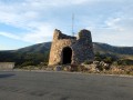
The route starts at the Santa Bàrbara Chapel, just before the small village of Perillos. Parking is available in a small car park.

(S/E) Head towards the chapel, then take a small path heading north-east. Descend into a small field, then head towards a cliff. Follow this path, which runs the entire length of the Coume de Ferro and passes a climbing site.

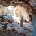
(1) Leave the path to the right to take a short detour and explore the Cauna cave (pleonasm). Then head left to rejoin the path, which heads east and quickly turns into a track. Follow this track for about 2 km, ignoring all side paths. You’ll reach a three-way junction.

(2) Leave the track and take the path branching off to the left, heading north, clearly marked by a large cairn. This path winds through the woods, where the vegetation can be rather dense at times, and climbs to reach a junction clearly marked by two large cairns.

(3) Turn right; otherwise, you risk heading straight up to the radar station and missing out on the superb view to the east. Follow this well-marked path until you reach, on the ridge, another path coming from the right (north-east).

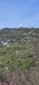
(4) Turn left to follow this enjoyable path through the limestone, keeping an eye on the cairns and the blue paint markings. You’ll reach Montolier de Perellós with its weather station, a white sphere visible from everywhere, particularly from the motorway.

(5) Go round the station on the right and enjoy the view over the Aude. You have now reached the northernmost point of the Pyrénées-Orientales. Continue along the track heading west-south-west. Carry on until you reach a hairpin bend to the left.

(6) Turn right onto another, narrower track that winds along the ridge, going up and down. Head for the Coll de Ladàs.

(7) Leave the track that continues straight ahead and take the one on the left. Walk for about 500 m.

(8) Leave the track that turns right, towards the south, and take the path opposite, heading due east. This path, clearly marked by cairns, is sometimes overgrown and crosses several streams before joining a wider track.

(9) Turn right, then rejoin a track and follow it to the right. Pass a fire tank and join the access road to Périllos.

(10) Follow it, turning left.

(11) Take the path on the left, which serves as a shortcut, rejoin the road, then take another path – this time on the right – to avoid a hairpin bend and head straight back to the chapel car park (S/E).

Waypoints

  1. S/E : mi 0 - alt. 1,047 ft - Santa Barbara Chapel car park
  2. 1 : mi 0.58 - alt. 1,217 ft - La Cauna
  3. 2 : mi 2.1 - alt. 1,325 ft - End of the track
  4. 3 : mi 2.53 - alt. 1,604 ft - Junction, turn right
  5. 4 : mi 3.37 - alt. 1,880 ft - Ridge, on the left. Towards the - Pech de Catari (641m)
  6. 5 : mi 4.26 - alt. 2,316 ft - Montolier de Perellós
  7. 6 : mi 6.26 - alt. 1,919 ft - Turn right
  8. 7 : mi 7.57 - alt. 1,532 ft - Coll de Ladàs
  9. 8 : mi 7.9 - alt. 1,450 ft - Leave the track and go straight on
  10. 9 : mi 8.76 - alt. 1,227 ft - End of the path, turn right
  11. 10 : mi 9.28 - alt. 1,207 ft - Road, on the left
  12. 11 : mi 9.52 - alt. 1,161 ft - Shortcut
  13. S/E : mi 9.74 - alt. 1,050 ft - Santa Barbara Chapel car park

Notes

There is no water along the route.
Sturdy footwear is essential.

The route is challenging (but it’s worth the effort) because
- it is sometimes poorly marked.
- vegetation sometimes encroaches on the path. It’s best to wear long trousers.
- it’s steep over the limestone rocks and you need sturdy shoes to support your ankles.
- There is no water along the route.

Reviews and comments

4 / 5
Based on 2 reviews

Reliability of the description
4.5 / 5
Ease of following the route
4.5 / 5
Route interest
3 / 5
Manya Luc
Manya Luc

Overall rating : 4 / 5

Date of your route : Nov 05, 2025
Reliability of the description : ★★★★☆ Good
Ease of following the route : ★★★★☆ Good
Route interest : ★★★★☆ Good
Very busy route : No

Machine-translated

gege66
gege66

Overall rating : 4 / 5

Date of your route : Aug 31, 2025
Reliability of the description : ★★★★★ Very good
Ease of following the route : ★★★★★ Very good
Route interest : ★★☆☆☆ Disappointing
Very busy route : No

Apart from the cave, nothing of interest in my opinion
Very well marked trail, GPS recommended with the Visio track

Machine-translated

Other walks in the area

For more walks, use our search engine .

The GPS track and description are the property of this route's author. Please do not copy them without permission.