


Refine your search for walks in Étang Laveyssière
Étang Laveyssière walks


 From Juvisy to Choisy-le-Roi via Lac Montalbot
 Visorando Member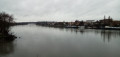
 8.58 mi
 +16 ft
 -20 ft
 4h 00
4h 00
 Moderate
 Departure from Juvisy-sur-Orge (Essonne)
A walk that starts in the Port aux Cerises park, with its ponds and Neolithic menhir. You then walk alongside a large lake and cross an urbanised area. The final third of the walk takes place mainly on the towpath along the Seine.
Walks near Étang Laveyssière
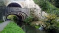
Following the Orge from Sainte-Geneviève-des-Bois to Athis-Mons
 8.52 mi
+184 ft
-269 ft
4h 05
Moderate
Departure from Sainte-Geneviève-des-Bois (Essonne) (Essonne)
8.52 mi
+184 ft
-269 ft
4h 05
Moderate
Departure from Sainte-Geneviève-des-Bois (Essonne) (Essonne)
A hike from station to station that constitutes the last stage of this route along the Orge River, ending at its confluence with the Seine. Although the area is highly urbanised, the walkway along the river, which takes us back and forth across it, often offers a bucolic setting.
Along the Yerres and Réveillon rivers and through the Bois de la Grange
7.13 mi
+230 ft
-210 ft
3h 30
Moderate
Departure from Brunoy (Essonne)
A pleasant walk along two rivers, the Yerres and the Réveillon. You completely forget the nearby urban environment.
From Brunoy to Combs-la-Ville
 8.11 mi
+348 ft
-279 ft
4h 00
Moderate
Departure from Brunoy (Essonne)
8.11 mi
+348 ft
-279 ft
4h 00
Moderate
Departure from Brunoy (Essonne)
A hike from station to station in a semi-urban environment, following paths through gardens and pleasant riverside trails.
Along the Seine from Choisy-le-Roi to Alfort
 4.68 mi
+23 ft
-20 ft
2h 10
4.68 mi
+23 ft
-20 ft
2h 10
 Easy
Departure from Choisy-le-Roi (Val-de-Marne)
Easy
Departure from Choisy-le-Roi (Val-de-Marne)
An urban walk that starts on the elevated quays and continues along the towpath, right by the river. After the confluence, the walk ends by following the Marne upstream for the final kilometre.
Adjust your route according to flood levels on the Seine or the Marne: see the practical information section.
From Créteil to Maisons-Alfort via the lake and the Juliottes neighbourhood
 4.56 mi
+46 ft
-16 ft
2h 10
Easy
Departure from Créteil (Val-de-Marne)
4.56 mi
+46 ft
-16 ft
2h 10
Easy
Departure from Créteil (Val-de-Marne)
An urban route starting along Lake Créteil from its southern tip to its northern tip, set amongst lawns and reed beds. You then cross, via footpaths, the ‘Du Chou et des Épis’ neighbourhood, with its cylindrical tower blocks featuring original designs, and the University district. The end of the route takes you to Maisons-Alfort via the Juliottes neighbourhood.
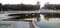
Over hill and dale in the Hauts-de-Seine
 207.73 mi
+9,721 ft
-9,551 ft
43 days
Easy
Departure from Hauts-de-Seine
207.73 mi
+9,721 ft
-9,551 ft
43 days
Easy
Departure from Hauts-de-Seine
Although densely urbanised, the Hauts-de-Seine department offers wonderful opportunities for walkers, with a rich heritage and often a little elevation. This series of hikes, almost all of which are accessible by public transport, takes you on a journey of discovery through this department, avoiding major roads as much as possible and favouring footpaths and alleys, public parks and wooded areas.
From Corbeil to Ballancourt via Villeroy Park and the Fontenay Marshes
 12.46 mi
+354 ft
-302 ft
6h 00
12.46 mi
+354 ft
-302 ft
6h 00
 Difficult
Departure from Corbeil-Essonnes (Essonne)
Difficult
Departure from Corbeil-Essonnes (Essonne)
A walk from station to station starting in Vieux Corbeil (large mills, cathedral). After following the Seine, the route climbs before descending to Moulin Galant, then follows the Essonne. The walk concludes with a stroll through Villeroy Park, set in a wooded landscape, followed by an exploration of the Fonteanay Marshes and their birdwatching hides.
Following the Essonne
 97.78 mi
+3,153 ft
-3,136 ft
10 days
Moderate
Departure from Corbeil-Essonnes (Essonne)
97.78 mi
+3,153 ft
-3,136 ft
10 days
Moderate
Departure from Corbeil-Essonnes (Essonne)
Named after Acionna, the Gallo-Roman goddess of rivers, the Essonne flows through the north of the Loiret department and the south of the Île-de-France region. The first five stages follow its course downstream, while the last four follow it upstream. These nine stages are accessible by train. One stage, which is not accessible by train, forms a circular route upstream. The route alternates between paths along the river, passages through woods and those across cultivated plateaus.
Along the Seine from Corbeil to Juvisy
 8.46 mi
+13 ft
-23 ft
3h 55
Moderate
Departure from Corbeil-Essonnes (Essonne)
8.46 mi
+13 ft
-23 ft
3h 55
Moderate
Departure from Corbeil-Essonnes (Essonne)
A walk from station to station with a relatively straightforward route, as it mainly follows the right bank of the Seine. Apart from the approach from the starting station and the approach to the finishing station, the route stays as close as possible to the river.
Bonneuil-sur-Marne through the eyes of graffiti artists
 Local authority
 1.51 mi
+33 ft
-7 ft
0h 45
Easy
Departure from Bonneuil-sur-Marne (Val-de-Marne)
1.51 mi
+33 ft
-7 ft
0h 45
Easy
Departure from Bonneuil-sur-Marne (Val-de-Marne)
Discover or rediscover the Grand Paris Sud-Est Avenir area by exploring its various walking routes, which showcase the main points of interest and the sometimes little-known treasures of our 16 municipalities, each with their own unique and distinctive histories.