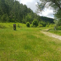
Exploring the Area Faunistica del Cervo (wheelchair accessible)

The deer reserve offers an immersive experience of their natural habitat. The path is accessible to all; part of it is paved and part is a gravel surface, allowing access for adapted wheelchairs. Along the 1.5 km route, you’ll see a stream and a natural lake, the woods, and you’ll walk alongside the enclosure where deer and other wild animals live in semi-freedom. A small chapel is also easily accessible (you’ll need to walk a few dozen metres uphill from the start of the walk).

Details

n°109371668
Creation:
Last update:
Last review:
–
  • Walking
    Activity: Walking
  • ↔
    Distance: 1.04 mi
  • ◔
    Average duration: 0h 35 
  • ▲
    Difficulty: Easy

  • ⚐
    Back to start: Yes
  • ↗
    Ascent: + 167 ft
  • ↘
    Descent: - 174 ft

  • ▲
    Highest point: 5,105 ft
  • ▼
    Lowest point: 4,911 ft

Description of the walk

The walk starts from the car park at the Area Faunistica del Cervo, at the end of the SP172 road, which is itself accessible from the SP164.

The path is signposted. Along the 1.5 km route, you will see a stream and a natural lake, the woods and walk alongside the enclosure where deer and other wild animals live in semi-freedom.

Waypoints

  1. S/E : mi 0 - alt. 4,938 ft - Cervo Wildlife Reserve car park
  2. 1 : mi 0.07 - alt. 5,003 ft - Access (optional) to the chapel
  3. 2 : mi 0.1 - alt. 5,043 ft - Chiesa di Sant'Antonio (Ateleta)
  4. 3 : mi 0.19 - alt. 5,010 ft - Shaded picnic area
  5. 4 : mi 0.58 - alt. 5,010 ft - Junction of the circular loop
  6. 5 : mi 0.62 - alt. 5,007 ft - Barrier
  7. S/E : mi 1.04 - alt. 4,934 ft - Cervo Wildlife Reserve car park

Notes

During the summer months, there is a restaurant and toilets at the car park.

Other walks in the area

For more walks, use our search engine .

The GPS track and description are the property of this route's author. Please do not copy them without permission.