fabienneriehl

 Visorando Member
 Premium user
 - Location: Aurillac (15000)
- Gender: woman
Sign up:
Published route(s)
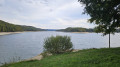
 Tour of the lakes between Cantal and Puy de Dôme

 6.01 mi
 +472 ft
 -486 ft
 3h 10
3h 10
 Moderate
 Departure from Trémouille (Cantal)
A lovely walk that partly follows theGR®®30along a wooded path with little elevation gain. Beautiful views over the various lakes – Crégut, Tact, Laspialade and Taurons – and towards the Monts du Sancy.
Short tour starting from Petite-Pierre
 3.60 mi
+709 ft
-725 ft
2h 15
3.60 mi
+709 ft
-725 ft
2h 15
 Easy
Departure from La Petite-Pierre (Bas-Rhin)
Easy
Departure from La Petite-Pierre (Bas-Rhin)
This is an easy, short walk around La Petite-Pierre with a lovely view of the castle from the Rocher Blanc
But be careful, there is a slight incline!