Between Vaumeilh and Nibles

A walk around the Rocher de Hongrie, between the Siriez and Sasse valleys.

Details

72861
Creation:
Last update:
Last review:
  • Walking
    Activity: Walking
  • ↔
    Distance: 5.09 mi
  • ◔
    Average duration: 3h 00 
  • ▲
    Difficulty: Easy

  • ⚐
    Back to start: No
  • ↗
    Ascent: + 794 ft
  • ↘
    Descent: - 781 ft

  • ▲
    Highest point: 2,566 ft
  • ▼
    Lowest point: 1,942 ft

Description of the walk

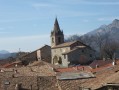
The walk starts from the village of Vaumeilh (car park on the main square).

(S) Walk uphill through the village and join the hiking trail leading towards the Tête des Monges. Continue along this path until you reach a road (near the Ferme des Chênes).

(1) Turn right onto the road, then quickly take a path branching off to the right. Follow the path to the Escuyer farm, then on to the André and Borelli farm (caution: the dogs there are small but very aggressive).

(2) At the junction, turn left onto theGR® (Way of St James) and head down until you reach the road in the Sasse valley.
Cross the D951 and take the road on the right; the village of Nibles is about a hundred metres further on, on the left (E).

Waypoints

  1. S : mi 0 - alt. 1,962 ft - Vaumeilh
  2. 1 : mi 1.44 - alt. 2,392 ft - Ferme des Chênes
  3. 2 : mi 2.92 - alt. 2,530 ft - Borelli Farm
  4. E : mi 5.09 - alt. 1,975 ft - Nibles

Notes

There are numerous paths leading off in all directions, but with the map it is very easy to follow this walking route.
Arrange for a car to be waiting at the start and finish of this route, or complete a round trip covering a distance of 16 km and an elevation gain of over 400 m.

Always be cautious and plan ahead when you're outdoors. Visorando and the author of this route cannot be held responsible for any accidents occurring on this route.

The GR® and PR® markings are the intellectual property of the Fédération Française de Randonnée Pédestre.

Reviews and comments

3.6 / 5
Based on 4 reviews

Reliability of the description
3.5 / 5
Ease of following the route
3.3 / 5
Route interest
4 / 5
phillipe
phillipe

Overall rating : 3.3 / 5

Date of your route : Sep 14, 2020
Reliability of the description : ★★★★☆ Good
Ease of following the route : ★★★☆☆ Average
Route interest : ★★★☆☆ Average
Very busy route : No

Thursday 10 September 2020

As other reviewers have noted, there are few signposts at the start of the Vaumeilh route, and it is difficult to find your way even along the trail itself,

Machine-translated

bibi
bibi ★

Thank you for your feedback. What should we add to the description to make it clearer and more precise for the start?
Thank you for your cooperation; it is thanks to your feedback that the descriptions are becoming increasingly accurate.
Kind regards

Machine-translated

woodywoudou
woodywoudou

Overall rating : 4 / 5

Date of your route : Dec 05, 2016
Reliability of the description : ★★★☆☆ Average
Ease of following the route : ★★★★☆ Good
Route interest : ★★★★★ Very good

A lovely walk, but the description – at least for the route starting from Vaumeilh – isn’t very detailed; it has to be said that there are no signs on the ground. At the very top of the village, a sign points left towards La Tour; the path itself is opposite, along the ridge of the ‘terres noires’.

Machine-translated

gazok54
gazok54 ★

Thanks, olivierbraghini
By starting at the wrong end, you’ve certainly made it a bit more challenging.
However, this walk isn’t described in great detail and waypoints would certainly be welcome.
If you do this walk again in the right direction this time, please try to provide us with some information so we can update the description.

Machine-translated

olivierbraghini
olivierbraghini

Overall rating : 3 / 5

Date of your route : Apr 09, 2016
Reliability of the description : ★★★☆☆ Average
Ease of following the route : ★★☆☆☆ Disappointing
Route interest : ★★★★☆ Good

Hello,

I walked part of the route in the opposite direction, starting from Borelly Farm. When I reached Essuyer Farm, I couldn’t find the path and carried on along the tarmac road as far as Les Chênes Farm. Once again, despite a sign pointing to the Tête des Monges, I couldn’t find the path (which is clearly marked as a ridge on the map) that should have led me to Vaumeilh: so I carried on along the road, which no doubt made the walk longer. Next time, I’ll do the walk in the right direction, setting off from Vaumeilh, in the hope of finding the start. The fact remains, however, that the path – which must surely exist – isn’t very visible, and there are no markings to help: what a shame!

Machine-translated

garnierf
garnierf

Overall rating : 4 / 5

Date of your route : Jan 09, 2015
Reliability of the description : ★★★★☆ Good
Ease of following the route : ★★★★☆ Good
Route interest : ★★★★☆ Good

pleasant at this time of year as it’s very sunny

Machine-translated

Other walks in the area

For more walks, use our search engine .

The GPS track and description are the property of this route's author. Please do not copy them without permission.