Country:
 City:
City:


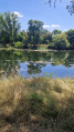
Park in Bléré, in a small car park on Rue de Vauloger: please note, there are few spaces available.
(S/E) Walk down Rue de Vauloger and, at the corner of Rue du Four à Chaux, turn left. Opposite No. 7, cross the road and join the path opposite.
(1) When you reach the top of the path, enter the Moncartier housing estate. Take Rue du Pressoir, then Rue des Sarments, and you’ll come out onto Rue de Tours, opposite the BodinPumps building.
(2) Turn right at the first pedestrian crossing and cross Rue de Tours. At the corner of number 47, turn left onto Rue du Quartier Saint-Marc (which is actually a footpath). Continue to the River Cher.
(3) Facing the River Cher, head left, due west, onto the GR®41 (which, on this stretch, is also the ‘Route du Cher à Vélo’ cycle route).
(4) In Vallet, turn left onto the Sentier de la Vigneraie; carry on straight ahead after the small, very shady copse and the slightly steep section of the path. You’ll come to a clearing with vineyards in front of you; turn immediately left as you emerge from the woodland and follow the path alongside more vineyards. You’ll reach a fork in the path.
(5) Leave the path that leads into the shady woodland on your right and join Rue de la Collinerie. Turn right onto this road and carry on until you reach the ‘Give Way’ sign. Take extra care here : you’re coming onto the D976 , which is a very busy and dangerous road, and you’ll need to cross it to enter the hamlet of Grand’Lay. Carry on straight ahead along Rue d’Athée-sur-Cher, then turn left onto Rue des Grandes Fontaines.
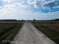
(6) Take a path on your left through the fields and go past the small copse.
(7) After the copse, you’ll see another path on your right with a sign reading ‘Ligne de Démarcation’ – follow this. At the end of this path, you’ll arrive in the hamlet of Haut Village; number 6 will be directly in front of you. Turn immediately right, then, as you leave the hamlet, turn left towards ‘Les Houches’.
(8) At the junction with a path, turn left into Les Grandes Fontaines, a Protected Natural Area (to protect biodiversity, animals must be kept on a lead). After the wooden gate, carry on straight ahead (do not follow the red markings) until you reach a roundabout with a pile of rocks in the centre, situated just after the ‘Lac de Touraine’ sign. Turn right at this roundabout and then carry on straight ahead.
(9) Pass the wooden gate marking the park exit on your right, turn left and follow the path to the road.
(10) Turn immediately right onto the tarmac road, carry on straight ahead, cross the bridge over the ring road, and enter the town of Bléré. Carry on straight ahead along Rue des Canaux.
(11) On your left, opposite the sign for “Hameau de la Touche”, take the path and continue straight on, passing vineyards. On your right is the “Moncartier” residential area, which you passed through at the start of the walk.
(1) Turn left onto the path you also took on the way there, follow it down to Rue du Four à Chaux, turn left until you reach the Stop sign and cross Rue de Vauloger to return to the car park (S/E).
 Visorando Member
 Easy
Easy