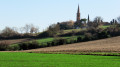
Between Saint-Hilaire and Ox

A flat route through the Muret countryside. Pleasant in spring and autumn. Best avoided in summer: little shade.

Details

3521260
Creation:
Last update:
Last review:
  • Walking
    Activity: Walking
  • ↔
    Distance: 7.58 mi
  • ◔
    Average duration: 3h 30 
  • ▲
    Difficulty: Moderate

  • ⚐
    Back to start: Yes
  • ↗
    Ascent: + 23 ft
  • ↘
    Descent: - 23 ft

  • ▲
    Highest point: 636 ft
  • ▼
    Lowest point: 614 ft

Description of the walk

(S/E) From the Place des Troubadours in Saint-Hilaire, head right along the D15 towards Ox, using the pavement running alongside it.

(1) At the first junction, where there is a wayside cross at the corner of the road, turn left onto Allée du Galant. Pass the castle and the Aussau bridge, then continue along the dirt track until you reach the T-junction.

(2) Turn right, follow the path and cross another bridge over the Aussau. The path becomes tarmac and leads to a junction with the D15. Follow it to the left with care for about a hundred metres.

(3) Turn right into Rue Saint Germer, follow it all the way to Rue de la Capelle d’Ox (D15h).
Turn left and continue along this street until you reach the church on Place Saint-Martin. Walk past the porch and cross the D15 towards the town hall. Walk along the right-hand side of the town hall, heading towards the old farm shed on Rue Jehan de Tilha.

(4) After 70 m, turn right into the passageway between the houses, which joins the same street between numbers 18 and 20. It curves to the left; at the first junction on the right, it joins a T-junction with Rue Jehan de Mascaron.

(5) Turn left onto the street, which quickly becomes a dirt track. After 400 m, at another junction with a wide farm track, turn left and continue for 1.3 km. The track narrows but remains passable, eventually reaching the junction with the D43b (bus shelter visible).

(6) Turn left onto the Chemin Français or Chemin de Camin, heading towards the Cap al Campestre eco-museum. Follow it all the way and continue for 950 m along the farm track that extends from it.

(7) When you reach a junction forming an acute angle, turn left onto the grassy path (which is not very visible) and follow it for about 500 m.

(2) Turn right onto the dirt track towards the Allée du Galant, and follow the route you took at the start in the opposite direction until you reach the Place des Troubadours (S/E).


Waypoints

  1. S/E : mi 0 - alt. 636 ft - Place des Troubadours
  2. 1 : mi 0.22 - alt. 633 ft - Allée du Galant
  3. 2 : mi 1.25 - alt. 633 ft - Junction marking the end of the circular loop
  4. 3 : mi 2.72 - alt. 620 ft - Rue Saint Germer
  5. 4 : mi 3.29 - alt. 617 ft - Passage between the houses
  6. 5 : mi 3.51 - alt. 617 ft - Rue Jehan de Mascaron
  7. 6 : mi 4.95 - alt. 623 ft - Junction with the D43b
  8. 7 : mi 6.02 - alt. 636 ft - Grassy path not easy to spot
  9. S/E : mi 7.57 - alt. 636 ft - Place des Troubadours

Reviews and comments

4 / 5
Based on 4 reviews

Reliability of the description
4 / 5
Ease of following the route
4.5 / 5
Route interest
3.5 / 5
Bernard CONDAMINES
Bernard CONDAMINES

Overall rating : 3.5 / 5

Date of your route : Apr 11, 2024
Reliability of the description : Not used / Not applicable
Ease of following the route : ★★★★☆ Good
Route interest : ★★★☆☆ Average
Very busy route : No

A short, flat walk with no particular point other than the walk itself

Machine-translated

JOADIE
JOADIE

Overall rating : 4.3 / 5

Date of your route : Apr 26, 2022
Reliability of the description : ★★★★☆ Good
Ease of following the route : ★★★★★ Very good
Route interest : ★★★★☆ Good
Very busy route : No

A short, pleasant walk, with no difficulties; nothing in particular to report

Machine-translated

al31
al31

Overall rating : 3.7 / 5

Date of your route : Jan 17, 2022
Reliability of the description : ★★★☆☆ Average
Ease of following the route : ★★★★☆ Good
Route interest : ★★★★☆ Good
Very busy route : Yes

A lovely walk. Best done all year round except in summer, as there’s not much shade.

Machine-translated

Africa-twin
Africa-twin

Overall rating : 4.3 / 5

Date of your route : Apr 24, 2021
Reliability of the description : ★★★★★ Very good
Ease of following the route : ★★★★★ Very good
Route interest : ★★★☆☆ Average
Very busy route : Yes

A bit too much tarmac for my liking.
I’d recommend taking a little detour at the entrance to Ox on your right
A path on the right that leads down to a truly beautiful wash house

Machine-translated

Other walks in the area

For more walks, use our search engine .

The GPS track and description are the property of this route's author. Please do not copy them without permission.