Amongst pine and chestnut trees in Goujounac

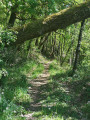
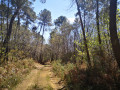
A walk amongst pine trees, chestnut trees and ferns for nature lovers.

Details

8000639
Creation:
Last update:
Last review:
  • Walking
    Activity: Walking
  • ↔
    Distance: 2.92 mi
  • ◔
    Average duration: 1h 35 
  • ▲
    Difficulty: Easy

  • ⚐
    Back to start: Yes
  • ↗
    Ascent: + 289 ft
  • ↘
    Descent: - 305 ft

  • ▲
    Highest point: 984 ft
  • ▼
    Lowest point: 781 ft
  • ⚐ Country: France
  • ⚐ City: Goujounac (46250)
  • ⚑
    Start/End: N 44.584472° / E 1.20372°
  • ❏
    IGN map(s): Ref. 2038O
  • Hour-by-hour weather

Photos

Description of the walk

Park near the Croix de Fraysse.

(S/E) Head towards the four-way junction about thirty metres away, turn left, then take the first path on the right below the hamlet of Fargou. At the first junction, turn right and cross the hamlet to reach the next junction.

(1) Carry on straight ahead. Once you reach the multi-way junction (cross) at Lavalade Haute, take the second path on the left and walk for about two hundred metres.

(2) Turn onto the path on the left and follow it to the village road.

(3) Immediately take the path on the left until you reach the white track (with a cattle shed next to it).

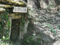
(4) Turn left and walk for about 300 metres, passing the “lo foun de pignol” well. Take the next path on the right towards Fargou: you’ll see a cazelle on the left.

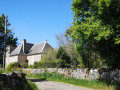
(1) Turn right. After 50 m, pass between an old stone tobacco drying shed and a manor house. Follow the same road to the junction and walk about 50 metres to the right. Then take the dirt track on the left which runs alongside a large meadow (new house at the junction) until you reach the first path on the left.

(5) Turn slightly left to follow this path. After 50 m, walk past the Fontaine washhouse, where you can stop for a break (stone table and benches). Follow this path to the small tarmac road, which you should follow to the left. At the junction, turn left again, pass through the hamlet of Falipot – where you can enjoy a lovely view over the valleys – then walk through the oak woodland to reach the Croix de Fraysse and the starting point (S/E).

Waypoints

  1. S/E : mi 0 - alt. 912 ft - Croix de Fraysse
  2. 1 : mi 0.28 - alt. 942 ft - Fargou
  3. 2 : mi 0.61 - alt. 974 ft - Path on the left
  4. 3 : mi 0.96 - alt. 935 ft - Route de Goujounac
  5. 4 : mi 1.34 - alt. 823 ft - Chemin Blanc
  6. 5 : mi 2.2 - alt. 791 ft - Path on the left
  7. S/E : mi 2.92 - alt. 912 ft - Croix de Fraysse

Notes

This is an easy walk with little elevation gain, and it’s very pleasant amongst pine and chestnut trees and ferns, with the scents of the Bouriane.

Best done in dry weather – and don’t forget a bottle of water.

Reviews and comments

4.3 / 5
Based on 2 reviews

Reliability of the description
4.5 / 5
Ease of following the route
4.5 / 5
Route interest
4 / 5
aloix
aloix

Overall rating : 3.7 / 5

Date of your route : May 20, 2024
Reliability of the description : ★★★★☆ Good
Ease of following the route : ★★★★☆ Good
Route interest : ★★★☆☆ Average
Very busy route : No

A pleasant walk, though there were a few too many roads

Machine-translated

Lise VENDANGEOT
Lise VENDANGEOT

Overall rating : 5 / 5

Date of your route : Aug 16, 2023
Reliability of the description : ★★★★★ Very good
Ease of following the route : ★★★★★ Very good
Route interest : ★★★★★ Very good
Very busy route : No

A lovely, very pleasant walk along shaded paths, with a few sections on roads, but with little traffic.

Machine-translated

Other walks in the area

For more walks, use our search engine .

The GPS track and description are the property of this route's author. Please do not copy them without permission.