Between the meadows and the woods of Saint-Martial

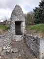
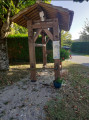
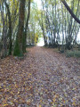
A hilly route with plenty of views and very little road, apart from about 1 km at the start. There are some beautiful country houses along the way, a few remarkable wells and plenty of cattle, meadows and woods.

Details

n°32973476
Creation:
Last update:
Last review:
  • Walking
    Activity: Walking
  • ↔
    Distance: 5.86 mi
  • ◔
    Average duration: 3h 05 
  • ▲
    Difficulty: Easy

  • ⚐
    Back to start: Yes
  • ↗
    Ascent: + 404 ft
  • ↘
    Descent: - 404 ft

  • ▲
    Highest point: 574 ft
  • ▼
    Lowest point: 325 ft

Photos

Description of the walk

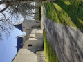
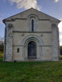
(S/E) From the church square car park, take the small road towards the CD21, past Sureau and Champs de Maurice, which runs alongside the church, leaving it on your left, and head towards the wash house and the cemetery.

(1) Turn right onto the D21, go straight on, initially ignoring the road on the left, then the one on the right leading to Miquelot’s.

(2) Leave the road and turn right onto a track, following it until you reach a junction where three roads and a track meet.

(3) Take the track on the right, heading south-west, continue until you reach a road and turn right, following it until you reach another crossroad and the Suraud cross.

(4) Cross over and follow the track opposite to the pylon and the D70. Continue to the right and, almost immediately, look out for a track on the left.

(5) Follow it until you reach a road, then turn right onto it. Ignore the first road on the left and carry on until you reach the next one on the left, signposted ‘Chez Pinaud’.

(6) Follow it and walk through this hamlet. At the T-junction, turn left and then follow the path branching off to the right. Continue straight on until you reach a crossroad. Cross it and carry on straight ahead towards ‘Chez Boucherie’.

(7) In the hamlet, turn right and then immediately left onto a path between some buildings. Follow this path through meadows and woods until you reach a road, then turn right onto it. Continue until you reach the first path on the right.

(8) Follow it to a road and a cross, then turn left. Continue along the D142, ignoring the turn-off for Hautbois, until you reach the start of a path on the right.

(9) Leave the departmental road and follow this track, which leads to a street and then on to the church square (S/E).

Waypoints

  1. S/E : mi 0 - alt. 364 ft - Church Square
  2. 1 : mi 0.29 - alt. 328 ft - Cemetery
  3. 2 : mi 0.74 - alt. 341 ft - Fork in the path
  4. 3 : mi 1.13 - alt. 420 ft - Junction of three roads and a track
  5. 4 : mi 1.9 - alt. 571 ft - Suraud Cross
  6. 5 : mi 2.47 - alt. 528 ft - Fork in the path
  7. 6 : mi 3.51 - alt. 377 ft - Junction towards the hamlet of Chez Pinaud
  8. 7 : mi 3.83 - alt. 358 ft - Hamlet of Chez Boucherie
  9. 8 : mi 4.58 - alt. 499 ft - Woodland destroyed by fire
  10. 9 : mi 5.34 - alt. 367 ft - Fork in the path
  11. S/E : mi 5.86 - alt. 364 ft - Church Square

Reviews and comments

4.7 / 5
Based on 1 review

Reliability of the description
5 / 5
Ease of following the route
5 / 5
Route interest
4 / 5
User 9852256

Overall rating : 4.7 / 5

Date of your route : Mar 01, 2026
Reliability of the description : ★★★★★ Very good
Ease of following the route : ★★★★★ Very good
Route interest : ★★★★☆ Good
Very busy route : No

The description of the hike is accurate and very well written. The landscapes are varied: flat terrain, a few climbs and a pleasant stretch along the ridge of the hill.

Machine-translated

Other walks in the area

For more walks, use our search engine .

The GPS track and description are the property of this route's author. Please do not copy them without permission.