Country:
 City:


Car park at the Centre Nature de la Loutre. Unmarked route.
(S/E) Head towards the buildings of the Centre Nature de la Loutre and take the small path through the woods heading due south, which leads onto the D20.
(1) Turn left onto this departmental road and then turn right towards L’Écho. Turn left onto the Chemin de Bas-Félix and follow it to the left.
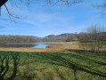
(2) Turn left, walk alongside a pond and head towards the causeway leading to a larger pond. Cross the causeway and continue to the right.
(3) Turn left and walk through the hamlet of Haut Félix. Take the Allée de Haut Félix on the right, admiring the Limousin-style architecture.
(4) Cross the Ruisseau de Mallevialle and, opposite, begin the long climb – the only one on the walk – which offers stunning views of the landscape from the top.
(5) At the end of the path, turn left onto the road leading to the beautiful hamlet of Puy de Mont.
(6) Take the small road on the left, then turn right at the farm. At the end of the path, at the junction, you’ll notice a beautiful cross, though it’s overgrown with brambles
(7) Follow the road to the right, then take the path to the left. When you reach a road, follow it to the left, then turn left.
(8) Turn right onto the Chemin d’Isle until you reach the D20
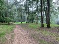
(9) Cross the D20 carefully and continue straight ahead towards the Forêt des Vaseix. Take the first path on the left after the mast, then turn right until you reach a junction.
(10) Turn left and carry on to a junction near a car park.
(11) Turn right, heading due north, to reach a lake.
(12) Head left, then immediately right, and follow the small path back to the car park at the Centre Nature de la Loutre (S/E).
 Visorando Member

 Moderate
 Association / Club / Walk leader