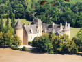
Sousceyrac circular route via Le Cayla

A lovely circular walk, with no major difficulties, offering a chance to discover some of the Quercy countryside in open and wooded areas.

Details

1231854
Creation:
Last update:
Last review:
  • Walking
    Activity: Walking
  • ↔
    Distance: 5.43 mi
  • ◔
    Average duration: 3h 05 
  • ▲
    Difficulty: Moderate

  • ⚐
    Back to start: Yes
  • ↗
    Ascent: + 640 ft
  • ↘
    Descent: - 663 ft

  • ▲
    Highest point: 1,900 ft
  • ▼
    Lowest point: 1,532 ft

Photos

Description of the walk

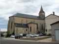
Parking near the church.

(S/E) With your back to the chancel of the church, head left and take the first alleyway on the right (Rue de la Fontaine) towards Vieille Fontaine, the swimming pool and the old washhouse. Walk past the old washhouse. The tarmac gives way to a path. Follow this path along the edge of the woods.

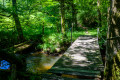
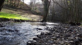
(1) The track widens and crosses the Cayla via a bridge. Immediately afterwards, follow the track to the left. Continue due south until the track joins the D25 departmental road.

(2) Turn left onto this departmental road. 100 metres further on, at the bend, ignore the road on the left and continue along the D25 for 500 metres.

(3) At the left-hand bend, turn right towards Carrofouls.
Carry on for 800 m until you reach a wayside cross, keeping the hamlet on your right.

(4) At the wayside cross, take the path on the right which leads into the forest. The path winds its way down through the woodland for 1,300 metres. The route is not always clearly visible. Make sure you can follow it properly.

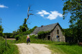
(5) Cross the Cayla via a footbridge. The path climbs steeply. Continue to a farm and pass between the farm buildings.

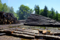
(6) 100 m past the farm, follow the path that runs alongside the road to the right. Do not take the road. Follow this path for 1,200 m. Cross the Mollière stream and continue to a sawmill.

(7) At the sawmill, the path joins the D673. Follow it to the right.

(8) 450 m further on, turn right off the D673 towards the tennis courts and football pitches. Walk alongside them and continue south, ignoring the roads to the right and left, until you reach the junction with the D25.

(9) Follow this road to the left, which takes you back to the starting point (A/D).

Waypoints

  1. S/E : mi 0 - alt. 1,824 ft - Car park at the - Église Saint-Martin (Sousceyrac)
  2. 1 : mi 0.45 - alt. 1,680 ft - Bridge over the Cayla
  3. 2 : mi 0.99 - alt. 1,886 ft - D25 junction
  4. 3 : mi 1.37 - alt. 1,804 ft - Towards Carrofouls
  5. 4 : mi 1.88 - alt. 1,821 ft - Calvary
  6. 5 : mi 2.71 - alt. 1,532 ft - Footbridge over the Cayla
  7. 6 : mi 3.47 - alt. 1,801 ft - Path near the D673
  8. 7 : mi 4.45 - alt. 1,765 ft - Sawmill
  9. 8 : mi 4.72 - alt. 1,804 ft - Sports grounds
  10. 9 : mi 5.27 - alt. 1,778 ft - D25 junction
  11. S/E : mi 5.43 - alt. 1,824 ft - Car park at the - Église Saint-Martin (Sousceyrac)

Notes

Parking is available either at the church or in the village centre.

Worth a visit

15th-, 16th- and 17th-century houses on Rue du Carreyrat in Sousceyrac

Reviews and comments

4.2 / 5
Based on 3 reviews

Reliability of the description
4.3 / 5
Ease of following the route
4.3 / 5
Route interest
4 / 5
zabnicki
zabnicki

Overall rating : 4 / 5

Date of your route : Sep 10, 2024
Reliability of the description : ★★★★☆ Good
Ease of following the route : ★★★★☆ Good
Route interest : ★★★★☆ Good
Very busy route : Yes

Machine-translated

hilaire.vachon
hilaire.vachon

Overall rating : 4.7 / 5

Date of your route : Sep 26, 2023
Reliability of the description : ★★★★★ Very good
Ease of following the route : ★★★★★ Very good
Route interest : ★★★★☆ Good
Very busy route : No

A short, very pleasant walk. You do need to be careful on the descent towards ‘Le Cayla’.

Machine-translated

Kirchenlicht
Kirchenlicht
• Edited:

Thank you for your feedback, Celineetfrederic. I’m glad I was able to guide you on this lovely walk. You’re right, the street where the walk starts is indeed called ‘Rue de la Fontaine’. I got a bit carried away by the direction of the wash house. I’ll correct that.
Kind regards

Machine-translated

Celineetfrederic
Celineetfrederic

Overall rating : 4 / 5

Date of your route : May 01, 2022
Reliability of the description : ★★★★☆ Good
Ease of following the route : ★★★★☆ Good
Route interest : ★★★★☆ Good
Very busy route : No

A pleasant walk.
Please note, the starting point is Rue de la Fontaine, not ‘Rue du Lavoir’.
The section through the woods changes frequently; with the tree felling, there are several paths, but you’ll find your way back with the GPS app.
At the end of the walk, once you reach the stadium, follow the yellow markings to return to the car park.

Machine-translated

Other walks in the area

For more walks, use our search engine .

The GPS track and description are the property of this route's author. Please do not copy them without permission.