The Urbach Forest Adventure Trail

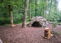
This trail is a nature adventure trail through the forest, designed to raise visitors’ awareness not only of the forest’s practical functions but also of its role in protection and recreation.
Seeing, hearing, tasting and touching are all essential to experiencing nature’s diversity.
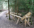
No fewer than 10 activities, skilfully integrated into the forest environment and its diverse wildlife, are sure to make this walk an unforgettable experience for both children and adults.

Details

3556231
Creation:
Last update:
Last review:
  • Walking
    Activity: Walking
  • ↔
    Distance: 1.45 mi
  • ◔
    Average duration: 0h 55 
  • ▲
    Difficulty: Easy

  • ⚐
    Back to start: Yes
  • ↗
    Ascent: + 276 ft
  • ↘
    Descent: - 289 ft

  • ▲
    Highest point: 1,260 ft
  • ▼
    Lowest point: 984 ft

Photos

Description of the walk

To get there, take the B29 from Stuttgart or Aalen to the exit for Plüderhausen, then follow the signs for Urbach and continue towards the Urbach outdoor swimming pool. Then carry on straight ahead to the ‘Hagsteige’ hiking car park.

(S/E) To start the walk, leave the car park and head towards the route information board to the north. This is the starting point of the walk. Don’t forget to pick up a few marbles on your way to take part in the many activities on site, then take the path heading north.

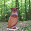
(1) After about 150 m, leave the path to the right and follow the signposts. The signposts are easy to spot and consist of large bird heads carved from wood and painted.

(2) Cross the stream – a great spot for a fun break. Children can build a beaver dam using the materials left there.
Cross the stream and continue to the left after the bridge.

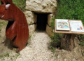
(3) 200 m past the bear’s den, at the junction, turn left, then right, still following the bird signposts. Walk past the fitness trail and carry on to the car park (S/E).

Waypoints

  1. S/E : mi 0 - alt. 1,260 ft - “Hagsteige” hiking car park
  2. 1 : mi 0.1 - alt. 1,243 ft - Head right
  3. 2 : mi 0.8 - alt. 984 ft - The Beavers’ Bridge
  4. 3 : mi 1.17 - alt. 1,109 ft - Turn left and then right
  5. S/E : mi 1.45 - alt. 1,260 ft - “Hagsteige” hiking car park

Notes

Use OpenStreetMap (World) as the base map.

Bring a few 50-centime coins to buy some marbles to take part in the activities.

Link to information on the website: click here

There are no drinking water points along the route.
You can walk in the stream – do bring towels.
You can have a picnic anywhere along the route

Worth a visit

There are plenty of activities on site:
- marble runs,
- true or false quizzes on wildlife and nature
- a short fitness trail
- and many other fun activities to discover

Reviews and comments

For more walks, use our search engine .

The GPS track and description are the property of this route's author. Please do not copy them without permission.