Between Brûlain and Availle

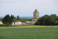
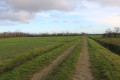
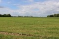
A very accessible walk due to its minimal elevation gain, offering the chance to discover the countryside north of Brûlain. The route also provides an opportunity to see fine examples of traditional architecture.

Details

n°71219313
Creation:
Last update:
Last review:
  • Walking
    Activity: Walking
  • ↔
    Distance: 6.31 mi
  • ◔
    Average duration: 3h 00 
  • ▲
    Difficulty: Moderate

  • ⚐
    Back to start: Yes
  • ↗
    Ascent: + 89 ft
  • ↘
    Descent: - 89 ft

  • ▲
    Highest point: 289 ft
  • ▼
    Lowest point: 174 ft
  • ⚐ Country: France
  • ⚐ City: Brûlain (79230)
  • ⚑
    Start/End: N 46.205046° / W 0.318134°
  • ❏
    IGN map(s): Ref. 1629SB
  • Hour-by-hour weather

Photos

Description of the walk

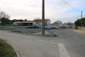
The car park is located next to the Brûlain Village Hall, on Rue du Stade. Alternatively, it is also possible to park in front of the stadium along the road, where there are a good ten parking spaces.

(S/E) Leave the car park by carefully following the road from Brûlain to Fayolle to the right (heading north-east). Ignore a path on the left (marker 62) and you will soon reach a junction with another path.

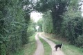
(1) Turn right (south-east) onto a shaded path. The path then heads south and joins the D101. 

(2) Immediately turn left onto a shaded path which runs alongside the Pré Russeau area on your right.

(3) As you approach a road, turn left onto the track. Shortly afterwards, the track forms an ‘S’ shape.

(4) Take the first path on the right, heading downhill. Ignore a path on the left and you’ll come to a road at a place called La Salle. Follow the road to the left, passing a pond on your left, and follow Rue des Jardins.

(5) At the next junction, turn right onto Rue des Clochettes. At the Fork in the road that appears immediately, turn right onto Route de la Rivière. Then take the first left, onto Chemin du Paradis.

(6) At the end, follow Rue des Ouches to the left. Ignore a road coming from the left and you’ll soon reach a junction. Then turn right onto Rue du Château (C4) for about fifty metres.

(7) Take the first track on the left (north), which climbs slightly. Turn left onto the first track as you reach the plateau. At the end, follow the D304 to the left for a good hundred metres.

(8) Take the first track on the right. Further on, cross a road carefully and continue straight ahead along a track.

(9) Shortly afterwards, when the track turns left, carry on straight ahead along a track heading north-west. A little further on, ignore a fork on the right and continue along the track that turns left. Ignore the first track on the left.

(10) Take the next path on the left, which climbs slightly before levelling out. You’ll come out onto the D104; follow it carefully to the left for about 150 metres.

(11) Turn right onto a small road leading to the hamlet of Bouquétienne. Pass through the hamlet and arrive at a crossroads.

(12) Turn left and walk between the fields. At the next junction (marker 63), go straight on. Turn right onto the main track. Ignore a track on the left, then one on the right.

(13) Turn left onto the next path on the left. Pass between two large livestock buildings and join the D104 road.

(14) Follow the road to the right with great care, towards Brûlain.

(15) At the next junction (with the town hall opposite), turn left and you’ll soon come to the village hall (S/E). 

Waypoints

  1. S/E : mi 0 - alt. 200 ft - Village hall – Rue du Stade
  2. 1 : mi 0.54 - alt. 223 ft - Junction on the path
  3. 2 : mi 1.16 - alt. 187 ft - Crossroads near the D101 road
  4. 3 : mi 1.57 - alt. 213 ft - Turn left
  5. 4 : mi 1.79 - alt. 210 ft - Junction
  6. 5 : mi 2.14 - alt. 177 ft - La Motte du Bois – Rue des Clochettes
  7. 6 : mi 2.38 - alt. 174 ft - La Motte du Bois – Rue des Ouches
  8. 7 : mi 2.56 - alt. 184 ft - Road–path junction
  9. 8 : mi 3.03 - alt. 200 ft - Road–path junction
  10. 9 : mi 3.4 - alt. 197 ft - Junction
  11. 10 : mi 3.85 - alt. 256 ft - Junction
  12. 11 : mi 4.31 - alt. 266 ft - T-junction
  13. 12 : mi 4.81 - alt. 220 ft - Crossroads
  14. 13 : mi 5.67 - alt. 226 ft - Junction
  15. 14 : mi 5.99 - alt. 220 ft - Junction of the path and the Route de la Courance
  16. 15 : mi 6.17 - alt. 207 ft - D104 road x Brulain road to Fayolle
  17. S/E : mi 6.31 - alt. 200 ft - Village hall – Rue du Stade

Notes

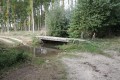
This walk across varied terrain requires suitable footwear.

This unmarked route presents no real difficulties. It follows some marked sections. Consequently, it is advisable to follow the directions in this description and on the map provided by Visorando, whilst also paying attention to the surrounding landscape. Distance information from the starting point, or even the GPS coordinates of waypoints (including the start), can also help hikers find their way.

Hike completed by the author on 20 March 2025.

Worth a visit

Brulain
The name derives from the Romanised Celtic term ‘Brulius’; recorded as ‘Brulenc’ in 1244, ‘Brulent’ in 1258, and ‘Brullain’ in the 18th century. Surrounded by the communes of Saint-Romans-des-Champs, Secondigné-sur-Belle and Saint-Médard, Brûlain is situated 18 km south-east of Niort, the nearest major town. Situated at an altitude of 65 m, the River Courance is the main watercourse running through the village of Brûlain. The commune covers an area of 24.7 km²

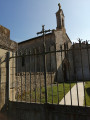
In 1986, at La Chagnée de Brûlain, an archaeological survey carried out by Marie-Claude Lagarde on land surveyed by Mr Pierre revealed evidence of a settlement dating from the Late Neolithic period. Remains from the Gallo-Roman period have been discovered on several occasions at a place known as Le Benchereau. The oldest published discoveries, dating from 1868, are tombs unearthed near the path leading from Brûlain to Les Fosses. Further remains were discovered during the 1970s by Messrs Jacques Jarry and Maurice Marsac. The present church is dedicated to Saint Martin.

Baptiste Paul Grimaud, creator of Grimaud playing cards, was born in Brûlain on 6 May 1817. Roger Baillon, who built up the famous collection of prestigious vintage cars sold at auction in 2015, was born in Brûlain on 9 March 1914.
Source: Wikipedia and the ‘Lavoirs des Deux-Sèvres’ website published by the department.

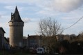
The Château de la Motte du Bois
See: the ‘Châteaux de France’ website‘http://www.chateau-fort-manoir-chateau.e....’

Reviews and comments

4.7 / 5
Based on 1 review

Reliability of the description
5 / 5
Ease of following the route
5 / 5
Route interest
4 / 5
mifo10
mifo10

Overall rating : 4.7 / 5

Date of your route : Mar 31, 2025
Reliability of the description : ★★★★★ Very good
Ease of following the route : ★★★★★ Very good
Route interest : ★★★★☆ Good
Very busy route : No

An easy walk. Flat terrain. A few sections on tarmac roads, but with little traffic.

Machine-translated

Other walks in the area

For more walks, use our search engine .

The GPS track and description are the property of this route's author. Please do not copy them without permission.