Through woods, fields and vineyards, starting from Cormicy

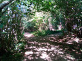
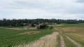
This route, starting from Cormicy, will take you alternately through woods and fields towards Châlons-le-Vergeur. At the highest point of the route, you’ll enjoy some rather lovely views of the surrounding ‘mountains’. The return journey follows a very narrow path and then vineyard tracks with views of Cormicy.

Details

6002150
Creation:
Last update:
Last review:
  • Walking
    Activity: Walking
  • ↔
    Distance: 6.19 mi
  • ◔
    Average duration: 3h 15 
  • ▲
    Difficulty: Moderate

  • ⚐
    Back to start: Yes
  • ↗
    Ascent: + 482 ft
  • ↘
    Descent: - 482 ft

  • ▲
    Highest point: 709 ft
  • ▼
    Lowest point: 282 ft
  • ⚐ Country: France
  • ⚐ City: Cormicy (51220)
  • ⚑
    Start/End: N 49.37046° / E 3.895318°
  • ❏
    IGN map(s): Ref. 2711E
  • Hour-by-hour weather

Description of the walk

Start and car park: the large car park between the town hall and the church in Cormicy.

(S/E) From the car park, take Rue du Puits au Pivot uphill, leaving the town hall on your right, then continue straight on along Rue de la Porte du Bourg, where you’ll see the remains of the gate and some explanatory information.

(1) At the fork in the road, turn right onto Rue Franklin Roosevelt.

(2) Turn slightly left onto Rue du Petit Guyencourt and continue as far as La Cendrière. (Information board).

(3) Continue along the lovely forest path. You’ll pass a small fenced-in property with a small pond on your right. Carry on until you reach the entrance to Châlons-le-Vergeur.

(4) Go round this hamlet on the right, following the boundary wall and then the few houses on your left. You’ll come to a road.

(5) Turn right. After about 100 m (elevation 189), leave the road and turn left onto a field path. The path climbs slightly.

(6) At the top of the hill, follow theGR®145(Via Francigena) to the left (north).

(7) Leave the lovely path and take a very narrow track on the right (still theGR®145). Head down through the woods and emerge into the vineyards.

(8) Continue broadly north-west and stay on the red-and-white marked path, which sometimes zigzags between the vineyard plots. On theGR®145.

(9) You’ll come out onto Rue du Bois de Prè; follow it to the right, still on the GR®.

(1) Turn right and follow the path back along the same route as on the way out until you reach the car park where you started (S/E).


Waypoints

  1. S/E : mi 0 - alt. 289 ft - Car park between the town hall and the - Église Saint-Cyr et Sainte-Julitte (Cormicy)
  2. 1 : mi 0.18 - alt. 299 ft - Crossroads at the end of the circular loop
  3. 2 : mi 0.27 - alt. 302 ft - Rue du Petit Guyencourt
  4. 3 : mi 1.24 - alt. 453 ft - La Cendrière
  5. 4 : mi 2.71 - alt. 387 ft - Châlons-le-Vergeur.
  6. 5 : mi 3.24 - alt. 561 ft - T-junction
  7. 6 : mi 3.87 - alt. 709 ft - Bellevue
  8. 7 : mi 4.65 - alt. 614 ft - Junction
  9. 8 : mi 5.47 - alt. 492 ft - Vineyard trail
  10. 9 : mi 5.92 - alt. 322 ft - Rue du Bois de Prè
  11. S/E : mi 6.19 - alt. 285 ft - Car park between the town hall and the church in Cormicy - Église Saint-Cyr et Sainte-Julitte (Cormicy)

Notes

For certain waypoints, and to avoid missing certain points (6) and (7) in particular, the Visorando app or a GPS is recommended.
Walking poles are recommended, as some sections may be stony or muddy depending on the weather.
Wear a hat as some areas are unshaded or windy.

Worth a visit

Information board along the route about the old town gate and the ash pit.
Champagne house (to be enjoyed in moderation)
Chapel and Château de Châlons-le-Vergeur (unfortunately only visible from a distance).

Always be cautious and plan ahead when you're outdoors. Visorando and the author of this route cannot be held responsible for any accidents occurring on this route.

The GR® and PR® markings are the intellectual property of the Fédération Française de Randonnée Pédestre.

Reviews and comments

4.6 / 5
Based on 3 reviews

Reliability of the description
4.7 / 5
Ease of following the route
4.3 / 5
Route interest
4.7 / 5
virgule
virgule

Thanks for the info.

Best avoided if you have a dog.

Machine-translated

ChristineB
ChristineB

Overall rating : 4 / 5

Date of your route : Apr 18, 2022
Reliability of the description : ★★★★☆ Good
Ease of following the route : ★★★★☆ Good
Route interest : ★★★★☆ Good
Very busy route : No

A lovely walk
A wide variety of scenery, with lovely fields, woods and vineyards.
I can confirm the tricky bit between 4 and 5 as you pass through the hamlet.
There really are two large dogs running loose. They came at my little cocker spaniel, so I quickly picked her up, even at the risk of being attacked myself. The owners aren’t in any hurry to come round, what with them having a couple of glasses of rosé. You need to be on your guard.
Otherwise, a lovely walk

Machine-translated

petits randonneurs
petits randonneurs

I hope the bite isn’t too serious.
You should also file a complaint, or failing that, make a police report against the owner.

Machine-translated

annelaure2812
annelaure2812

We did not trespass on private property. We were indeed on a path.
I should point out that this was indeed part of the walking route.
The house we walked past had neither fences nor gates, which meant the dogs were free to roam.

Machine-translated

petits randonneurs
petits randonneurs

Hello. Sorry about the dogs.
As for me, I never set foot on private property at any point.
The few tracks I’m providing are files recorded on the ground using a GPS.
Of course, I start off using a map. I then adjust the route if necessary, due to fences or paths that have disappeared.
Sometimes I have to walk the route three or four times to get it just right.
The same goes for the dogs. I’d done the route without any problems with my little dog.

Machine-translated

annelaure2812
annelaure2812

Overall rating : 5 / 5

Date of your route : May 31, 2021
Reliability of the description : ★★★★★ Very good
Ease of following the route : ★★★★★ Very good
Route interest : ★★★★★ Very good
Very busy route : No

A very lovely walk, but despite that I strongly advise against it.
Unfortunately, between points 4 and 5, near the castle, there are a few houses, one of which has no fence. We were greeted by a small, rather aggressive dog, quickly joined by another much larger one – a German Shepherd type – which was even more aggressive.
After what felt like an age, my husband was bitten slightly.
A bruise and quite a fright.
The dogs’ owner called them back without even coming over to see us.
If you decide to go on this walk, do be on your guard! Especially with children.
There are ponds and mosquitoes, so make sure you protect yourself as well.

Machine-translated

ulyssia
ulyssia

Overall rating : 4.7 / 5

Date of your route : Apr 03, 2021
Reliability of the description : ★★★★★ Very good
Ease of following the route : ★★★★☆ Good
Route interest : ★★★★★ Very good
Very busy route : No

A lovely walk through varied countryside (woods, vineyards, fields) with a mix of gentle climbs and flat sections.
The signposting at the start of the path in the village of Cormicy is poorly marked and can be confusing, but after that it’s straightforward if you follow the map.
A very quiet path with some very pleasant sections through the woodland.
The duration and level of difficulty are as stated on the walk description.

Machine-translated

Other walks in the area

For more walks, use our search engine .

The GPS track and description are the property of this route's author. Please do not copy them without permission.