Crossing the Bonne Heure from Millançay

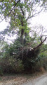
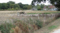
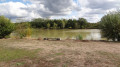
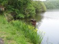
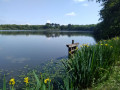
Starting from Millançay, the walk takes in deciduous forests, ponds and sheep pastures set within an unspoilt landscape. A few trees, several hundred years old – survivors of the vast forest that once covered the Sologne – tell their story.

Details

2531971
Creation:
Last update:
Last review:
  • Walking
    Activity: Walking
  • ↔
    Distance: 8.09 mi
  • ◔
    Average duration: 3h 45 
  • ▲
    Difficulty: Moderate

  • ⚐
    Back to start: Yes
  • ↗
    Ascent: + 66 ft
  • ↘
    Descent: - 66 ft

  • ▲
    Highest point: 387 ft
  • ▼
    Lowest point: 305 ft

Photos

Description of the walk

The start is at the car park next to the church or the community hall on Rue du Plessis, near the fire station, 150 metres from the church.

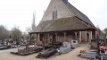
(S/E) Turn onto Rue des Hauts Châteaux (D60), with the church on your right. Pass the cemetery, then the hamlet of Le Petit Villesavin.

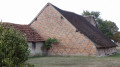
(1) Keep right onto a gravelled track called ‘la Boucarderie’ at the Fork in the road shortly after the last houses in the hamlet, heading towards ‘SCEA du Gué Celin’. After 200m, keep left at the Fork in the road, cross the small stream known as ‘la Bonne Heure’, and pass the farm known as ‘la Boucarderie’. The gravel track named after Gué Celin gives way to a grassy track which you follow as it winds its way round, skirting a pond before running alongside the La Fourchetterie estate.

(2) The grassy track gives way to a lovely hard-surfaced track at La Fourchetterie. This leads to Monplaisir and its pond, then joins a cross-road (D60).

(3) Turn left onto the D60, then immediately right onto the grassy track. Continue in the same direction until you reach a gravel track called Le Rondit. This becomes tarmac for a few hundred metres at the hamlet of Le Rondit, then gives way to another gravel track, continuing southwards until you reach the D122.

(4) Continue straight on along the forest track, still heading south, until you reach a crossroads just before the hamlet of La Carelle.

(5) Turn left at the hairpin bend onto the path, which soon leads onto a gravel track. Pass Les Petites Bourdinières, then the Château des Grandes Bourdinières. The track eventually gives way to a tarmac road as you reach the first houses of Le Petit Montault

(6) Turn right at the junction with the D122, Rue du Plessis, heading towards the church (S/E).

Waypoints

  1. S/E : mi 0 - alt. 341 ft - Church car park (or Salle des Associations)
  2. 1 : mi 1.08 - alt. 325 ft - On the right: ‘SCEA du Gue Celin’
  3. 2 : mi 2.39 - alt. 331 ft - Straight ahead on a gravel track
  4. 3 : mi 3.08 - alt. 312 ft - Turn left onto the D60
  5. 4 : mi 5 - alt. 374 ft - Opposite (D122)
  6. 5 : mi 5.79 - alt. 377 ft - A hairpin bend to the left
  7. 6 : mi 7.94 - alt. 341 ft - Turn right at the junction with the D122
  8. S/E : mi 8.09 - alt. 344 ft - Church car park

Notes

The walk can be enjoyed in all seasons.
At the start, the route follows the quiet D60 for 1.7 km.

Worth a visit

The appeal of this walk lies in immersing yourself in the Sologne of yesteryear to enjoy its cool, peaceful atmosphere.

Reviews and comments

4.1 / 5
Based on 3 reviews

Reliability of the description
4.3 / 5
Ease of following the route
4.7 / 5
Route interest
3.3 / 5
eaugoyard
eaugoyard

Overall rating : 4.7 / 5

Date of your route : Feb 05, 2024
Reliability of the description : ★★★★★ Very good
Ease of following the route : ★★★★★ Very good
Route interest : ★★★★☆ Good
Very busy route : No

A lovely walk, quite shaded as it runs largely through woodland.

Machine-translated

Jean-Louis Pinault
Jean-Louis Pinault

Thank you for your comments,
Have a nice day,
Jean-Louis

Machine-translated

albatach
albatach

Overall rating : 4.7 / 5

Date of your route : Sep 26, 2019
Reliability of the description : ★★★★★ Very good
Ease of following the route : ★★★★★ Very good
Route interest : ★★★★☆ Good

A lovely walk after setting off along the road
main avenue

Machine-translated

Jean-Louis Pinault
Jean-Louis Pinault

Well, yes, there were no nasty surprises, as I mentioned in the description that the route starts on a tarmac road. Feel free to suggest an alternative!
Jean-Louis

Machine-translated

Digou4
Digou4

Overall rating : 3 / 5

Date of your route : Sep 20, 2019
Reliability of the description : ★★★☆☆ Average
Ease of following the route : ★★★★☆ Good
Route interest : ★★☆☆☆ Disappointing

This Millançay route could do with some improvement to avoid the tarmac section of over 1,700 metres at the start!
And at the end of the route => same goes for the tarmac!!!
The wooded section is superb whatever the season.

Machine-translated

Other walks in the area

For more walks, use our search engine .

The GPS track and description are the property of this route's author. Please do not copy them without permission.