Upstream from the rivers starting from Montrigaud

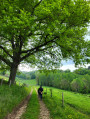
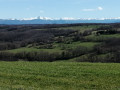
A lovely walk in the Drôme des Collines, a very undulating route winding from hill to hill and from stream to stream. Stunning panoramic views of the Vercors and the surrounding valleys.

Details

n°3671671
Creation:
Last update:
Last review:
  • Walking
    Activity: Walking
  • ↔
    Distance: 9.11 mi
  • ◔
    Average duration: 5h 05 
  • ▲
    Difficulty: Moderate

  • ⚐
    Back to start: Yes
  • ↗
    Ascent: + 1,073 ft
  • ↘
    Descent: - 1,079 ft

  • ▲
    Highest point: 1,736 ft
  • ▼
    Lowest point: 1,240 ft

Description of the walk

Park in the car park in the centre of the village of Montrigaud.

(S/E) In the centre of the village, at the small junction with signposts for walking routes, head down between two houses along a grassy path to the D 67. Turn right onto it and follow it for about a hundred metres, until you reach a path junction at the edge of a wood

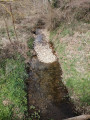
(1) Turn left here and you’ll soon reach the River Herbasse. Ford the river twice. Head up the hill along a grassy path, skirting the fences and following the valley. You’ll come out onto a road at the La Plume junction.

(2) Cross the road and continue uphill through the woodland towards Font Froide. You’ll come to a tarmac road at a farm; follow it to the left and leave it at the next bend to take the path straight ahead through the woodland. Follow the signposts carefully. At the end of a field, don’t miss the path on the left and head for the Font-Froide crossroads.

(3) Turn left towards Gravelière and head for the Les Rousses crossroads.

(4) Turn left, then quickly turn right and head down towards the River La Verne. Make your way to the D 228, where there is a campsite on the left. Cross the road and take the road opposite. You’ll reach the pretty hamlet of La Gravelière.

(5) Continue along the path on the left. Take the road that follows it. Leave this road atthe first bend, continue right along the path to emerge onto a plateau. After skirting the edge of a wood, you’ll reach the Ruisseau du Chénard.

(7) Ford the stream, head up through the meadow and reach Combe Petosan. Turn left here at almost 180°, head down along the edge of a wood and reach a barn at the junction with the Route de Many.

(8) Turn right onto this road, follow the River Herbasse at a distance, cross it via a bridge and you will come immediately afterwards to the
D 67.

(9) Cross it and head up the Chemin du Charvat on the opposite side. At the highest point, you’ll reach a crossroads at a place called La Croix de Lérié.

(10) Turn left and continue in this direction until you rejoin the D 137. Turn left onto it and pass through the hamlet of Le Bourg. Turn right onto the Chemin des Jeux de Boules. In Montrigaud, rejoin the D 228; turn left onto it to return to the car park in the centre of the village of Montrigaud (S/E).
Waypoints

  1. S/E : mi 0 - alt. 1,539 ft - Car park in the centre of the village of Montrigaud
  2. 1 : mi 0.56 - alt. 1,273 ft - Wooded crossroads. Towards the - Herbasse (rivière)
  3. 2 : mi 1.19 - alt. 1,503 ft - La Plume
  4. 3 : mi 3.2 - alt. 1,650 ft - Font-Froide
  5. 4 : mi 3.57 - alt. 1,726 ft - Les Rousses
  6. 5 : mi 4.48 - alt. 1,608 ft - La Gravelière
  7. 6 : mi 4.86 - alt. 1,617 ft
  8. 7 : mi 5.5 - alt. 1,526 ft - Le Chénard stream
  9. 8 : mi 6.5 - alt. 1,562 ft - Le Many crossroads
  10. 9 : mi 7.24 - alt. 1,385 ft - D67 junction
  11. 10 : mi 7.8 - alt. 1,699 ft - The Croix de Lérié
  12. S/E : mi 9.11 - alt. 1,526 ft - Car park in the centre of the village of Montrigaud

Notes

Car park: in the village
In wet weather, wear high, waterproof shoes to wade across the Herbasse.

Reviews and comments

3.8 / 5
Based on 2 reviews

Reliability of the description
4 / 5
Ease of following the route
4 / 5
Route interest
3.5 / 5
VaninaMJ
VaninaMJ
• Edited:

Overall rating : 3 / 5

Date of your route : Oct 13, 2022
Reliability of the description : ★★★☆☆ Average
Ease of following the route : ★★★☆☆ Average
Route interest : ★★★☆☆ Average
Very busy route : No

A walk with a very vague description...
A GPS is essential, particularly in the woods where junctions are not mentioned in the description – and this happens on several occasions.
There’s also some confusion in point 10 of the route description: when it mentions taking the ‘Chemin des jeux de boules’, there are other junctions further along the route which aren’t mentioned in the description.
Personally, I found the first half of the walk rather uninteresting due to the numerous stretches through the forest, where there has recently been a great deal of logging, leaving the landscape looking almost apocalyptic.
The second half is more pleasant.
There are no particular difficulties on this walk.

Machine-translated

cathyferrer
cathyferrer

Overall rating : 4.7 / 5

Date of your route : Sep 26, 2020
Reliability of the description : ★★★★★ Very good
Ease of following the route : ★★★★★ Very good
Route interest : ★★★★☆ Good
Very busy route : No

I extended the walk a little by taking the GR de Pays route through the Bois de Roques, covering 19 km.
A lovely walk through beautiful forests, though the views were a bit limited as the rainy weather meant I couldn’t see very far.
As a seasoned hiker in the Drôme, I recognised this route as Number 78 in the 1998 ‘Drôme des Collines’ hiking guide.
It’s a shame the chestnuts are small or even non-existent this year!! ...
Thanks to the author.

Machine-translated

Other walks in the area

For more walks, use our search engine .

The GPS track and description are the property of this route's author. Please do not copy them without permission.