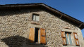
In the woods of Montrigaud

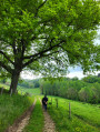
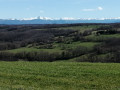
An easy walk, partly through the Montrigaud communal woods.

Details

50518963
Creation:
Last update:
Last review:
  • Walking
    Activity: Walking
  • ↔
    Distance: 6.97 mi
  • ◔
    Average duration: 3h 50 
  • ▲
    Difficulty: Moderate

  • ⚐
    Back to start: Yes
  • ↗
    Ascent: + 682 ft
  • ↘
    Descent: - 682 ft

  • ▲
    Highest point: 1,690 ft
  • ▼
    Lowest point: 1,368 ft

Description of the walk

Parking is available near the start of the walk, close to the water tower or the transformer station, or along the D265.
You can also start the walk by parking in the large car park at (3) and heading to the Étang de Joanna-Maria at the end of the walk.

(S/E) Leave the water tower on your left and join the D137.

(1) Turn left and follow the road to the last house, then take the path on the left. Continue through the fields, enter the woods and join the tarmac road.

(2) Follow this road to the right, then the track to La Limone. Carry on straight ahead and climb the track to the tarmac road at the edge of the woods. Follow it past the large car park.

(3) Take the path branching off to the left and follow it to a three-way junction. Take the path furthest to the left, heading due south.

(4) As you emerge from the woods, facing the house, turn right and follow the ridge path – first through the woods and then across the meadow – to the mobile phone mast.

(5) Turn left and head downhill until you reach the RD265. Continue along the road to the left.

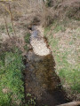
(6) After the bridge over the Limone, take the path leading off to the right, then turn right again to reach the halfway point up the slope.

(7) Walk down into the valley, go round the fallen tree on the left and follow the path, which widens. Continue across the meadow to the junction, take the path furthest to the right and reach a four-way crossroads.

(8) Head straight on along the edge of the field. As you enter the woods, continue along the path that leads downhill. You’ll reach the edge of the woods.

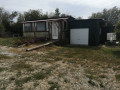
(9) Turn left, following the path back into the woods. Continue to the exit and you’ll reach a tarmac road with a house opposite.

(10) Turn left and follow this track uphill to the junction.

(11) Follow the main ridge path to the right and reach a crossroads.

(12) Take the path on the right and head down to the road. Follow the road to the left for about a hundred metres.

(13) Turn left onto the path that climbs up to the horse riding centre, then head straight on along the RD265 to return to the start (S/E).

Waypoints

  1. S/E : mi 0 - alt. 1,680 ft - Car park on the RD265
  2. 1 : mi 0.1 - alt. 1,667 ft - D137, turn left.
  3. 2 : mi 0.49 - alt. 1,637 ft - Tarmac road, on the right
  4. 3 : mi 1.24 - alt. 1,690 ft - Car park, turn left
  5. 4 : mi 1.66 - alt. 1,670 ft - At the edge of the woods, turn right
  6. 5 : mi 2.78 - alt. 1,578 ft - Telephone box, on the left
  7. 6 : mi 3.24 - alt. 1,371 ft - Path on the right
  8. 7 : mi 3.88 - alt. 1,578 ft - Descent into the valley
  9. 8 : mi 4.38 - alt. 1,634 ft - Crossroads, opposite
  10. 9 : mi 4.79 - alt. 1,562 ft - Edge of the wood
  11. 10 : mi 5.15 - alt. 1,555 ft - Tarmacked road, house – on the left
  12. 11 : mi 5.39 - alt. 1,647 ft - Crossroads, turn right
  13. 12 : mi 5.93 - alt. 1,634 ft - At the crossroads, take the right-hand path.
  14. 13 : mi 6.38 - alt. 1,512 ft - Path on the left
  15. S/E : mi 6.97 - alt. 1,680 ft - Car park on the RD265

Notes

In wet weather, make sure you wear sturdy footwear.

Worth a visit

In the village, Auberge de Clément (bar and restaurant) opens in early June 2024.
Route de la Verne (RD228): campsite with a pizzeria open from April to September.
15 km away: Hauterives and Postman Cheval’s Ideal Palace.
13 km away is Saint-Antoine l’Abbaye, listed as one of the most beautiful villages in France.

Reviews and comments

4.3 / 5
Based on 2 reviews

Reliability of the description
4.5 / 5
Ease of following the route
4.5 / 5
Route interest
4 / 5
pallandre chantal
pallandre chantal

Overall rating : 4 / 5

Date of your route : Jun 16, 2026
Reliability of the description : ★★★★☆ Good
Ease of following the route : ★★★★☆ Good
Route interest : ★★★★☆ Good
Very busy route : No

Taken on a hot day – no problem, as it was well shaded.

Thanks to the author

Machine-translated

User 19519257

Overall rating : 4.7 / 5

Date of your route : Aug 11, 2025
Reliability of the description : ★★★★★ Very good
Ease of following the route : ★★★★★ Very good
Route interest : ★★★★☆ Good
Very busy route : No

A pleasant, well-shaded route, perfect for summer.

Machine-translated

Other walks in the area

For more walks, use our search engine .

The GPS track and description are the property of this route's author. Please do not copy them without permission.