Heading towards Le Roubion

This short, family-friendly circular path follows the peaceful course of the River Roubion.

Details

n°6782994
Creation:
Last update:
Last review:
  • Walking
    Activity: Walking
  • ↔
    Distance: 2.09 mi
  • ◔
    Average duration: 1h 00 
  • ▲
    Difficulty: Easy

  • ⚐
    Back to start: Yes
  • ↗
    Ascent: + 79 ft
  • ↘
    Descent: - 79 ft

  • ▲
    Highest point: 581 ft
  • ▼
    Lowest point: 489 ft

Photos

Description of the walk

Park on the Place du Monument aux Morts, opposite the Cave des Vignerons de Valléon.

(S/E) From the car park, facing the Cave des Vignerons de Valléon, head left. At the first junction, turn right. Follow Avenue Mont Roubion to the end.

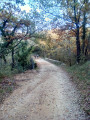
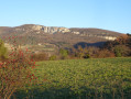
(1) First turn left then right to follow the wide dirt track, Chemin de la Moutette. Walk alongside a stream, then cross it a little further on. The track curves to the right after the stream, crosses fields and emerges in front of the Roubion.

(2) Turn right to walk upstream along the Roubion (several paths lead there and offer the chance to spot grey herons and little egrets). Pass the water treatment plant and arrive at the entrance to the village.

(3) Turn left onto the Chemin du Pré Damigue; there is a ‘Stop’ sign 150 metres ahead.
Pass a wash house and continue onto the Route du Pont. Turn right twice. Ignore the next junction and head for the T-junction.

(4) Turn left, pass the town hall and the school, and arrive at Place de l’Hôpital. Turn right and, at the roundabout, turn right again to reach Place du Monument aux Morts (S/E).

Waypoints

  1. S/E : mi 0 - alt. 568 ft - Place du Monument aux Morts
  2. 1 : mi 0.28 - alt. 574 ft - Junction
  3. 2 : mi 1 - alt. 489 ft - Edge of the - Roubion (rivière)
  4. 3 : mi 1.74 - alt. 522 ft - Village entrance
  5. 4 : mi 1.91 - alt. 571 ft - Turn left towards the town hall and the school
  6. S/E : mi 2.09 - alt. 568 ft - Place du Monument aux Morts

Worth a visit

Finish the route with a visit to the old village, entering via the Porte du Point du Jour, and return to the starting point on the Route de Montélimar.

Reviews and comments

4.7 / 5
Based on 1 review

Reliability of the description
5 / 5
Ease of following the route
5 / 5
Route interest
4 / 5
EvrrdM
EvrrdM
• Edited:

Overall rating : 4.7 / 5

Date of your route : Aug 21, 2024
Reliability of the description : ★★★★★ Very good
Ease of following the route : ★★★★★ Very good
Route interest : ★★★★☆ Good
Very busy route : No

A short route, mainly through fields, enjoyed as a family; it’s not at all difficult. Unfortunately, the Roubion was dry, but the route was still pleasant.

Machine-translated

Other walks in the area

For more walks, use our search engine .

The GPS track and description are the property of this route's author. Please do not copy them without permission.