El Faro d’Albir

A return trip to the Albir lighthouse. This is a very easy and popular walk, suitable for the whole family (including pushchairs) as the path is wide, tarmac-surfaced and without any difficulties. It is also very popular with cyclists.

Details

n°28563273
Creation:
Last update:
Last review:
  • Walking
    Activity: Walking
  • ↔
    Distance: 2.99 mi
  • ◔
    Average duration: 2h 05 
  • ▲
    Difficulty: Easy

  • ⚐
    Back to start: Yes
  • ↗
    Ascent: + 820 ft
  • ↘
    Descent: - 801 ft

  • ▲
    Highest point: 302 ft
  • ▼
    Lowest point: 46 ft

Photos

Description of the walk

The starting point for this walk is at the Albir and Serra Gelada Natural Park information centre. To get there by car, see the ‘Practical Information’ section.

(S/E) Head towards the information centre building and walk past it to join the wide track. You’ll reach an area with tables and benches. You’ll also find an information board offering a superb view of Puig Campana, the peak overlooking the town of Benidorm andthe second-highest peak in the province of Alicante.

(1) Then go through a tunnel and continue on to reach another sign positioned on the rocks.

(2) Turn south, still on the Route de Vell del Far, and cross a small stream at a bend in the road.

(3) Then head due east: this is the start of the path leading down to Cala de la Mina, a magnificent spot for a swim. Please note that this is a mountain path and you should be suitably equipped if you wish to go there.

(4) Continue along the path down to see the ochre mines. Please note: this is a mountain path and you should be properly equipped if you wish to go there. You will then reach the Albir Lighthouse, the final stop on this walk.

(5) Follow the same route back in the opposite direction to return to the car park at the Albir Information Centre (S/E).

Waypoints

  1. S/E : mi 0 - alt. 161 ft - Albir Information Centre
  2. 1 : mi 0.07 - alt. 177 ft - Picnic area
  3. 2 : mi 0.54 - alt. 246 ft - Information board about the rocks
  4. 3 : mi 1.1 - alt. 253 ft - Descent to Cala de la Mina
  5. 4 : mi 1.27 - alt. 236 ft - Descent into the ochre mines
  6. 5 : mi 1.47 - alt. 105 ft - Albir Lighthouse
  7. S/E : mi 2.99 - alt. 157 ft - Albir Information Centre

Notes

To get to the start by car:
From Alicante city centre, take the A31 motorway (from Calle México) towards Madrid and take exit 236A towards Benidorm and Valencia.
Continue on the AP7 (which is currently toll-free: this is 2022) towards Benidorm.
Take exit 65 for Benidorm Levante, then take the N332 towards Altea and Valencia.
At the roundabout, follow signs for L’Albir. At the next roundabout, take the second exit towards L’Albir (CV753).
Carry on following signs for L’Albir or the Natural Park until you reach the car park at Calle Neptu No. 26 (you’re now in L’Alfaz del Pi).

For your information: by car from Alicante, the journey is 60 km and takes about 45 minutes.

Worth a visit

(2) Information board: I’d like to draw particular attention to this information board as it highlights an interesting feature regarding the rock inlays that are quite commonly found in the mountains. If you’ve never noticed them before, this is a good way to learn about them.
(5) Albir Lighthouse: there is a lighthouse visitor centre (check opening times).
To the right, you can enjoy views of the Alto del Gobernador, the highest peak in the Serra Gelada, and to the left, views of Altea Bay, Calpe with the famous Peñón de Ifach, as well as the offshore fish farms.
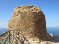
Next to the lighthouse, you can also see the remains of a tower: the Torre Bombarda, dating from the 6th century and built to defend against pirate raids.

Reviews and comments

5 / 5
Based on 1 review

Reliability of the description
5 / 5
Ease of following the route
5 / 5
Route interest
5 / 5
User 26711999

Overall rating : 5 / 5

Date of your route : Jul 28, 2025
Reliability of the description : ★★★★★ Very good
Ease of following the route : ★★★★★ Very good
Route interest : ★★★★★ Very good
Very busy route : Yes

Not really a hike, but a magnificent walk in a magical setting.
My wife is in a manual wheelchair with electric assistance and had no problems at all along the 2.3 km route.
Without assistance, it would have been more difficult because the slope is not very steep but it goes on for a long time.
She was enchanted by this walk to the lighthouse, where the view is breathtaking.
Be careful, it can get very hot in the middle of the day, so it's best to go in the morning or evening.

Machine-translated

Other walks in the area

For more walks, use our search engine .

The GPS track and description are the property of this route's author. Please do not copy them without permission.