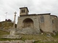
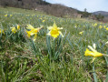
Loop east of Usson-en-Forez

An easy hike that shortens the PR®4 (yellow markings) and offers shaded trails rising above Usson en Forez. It is not particularly difficult and offers beautiful shaded sections. The climbs are not particularly difficult and are mostly in the woods. The few sections on roads are in areas with little traffic

Details

81592925
Creation:
Last update:
Last review:
  • Walking
    Activity: Walking
  • ↔
    Distance: 4.16 mi
  • ◔
    Average duration: 2h 15 
  • ▲
    Difficulty: Easy

  • ⚐
    Back to start: Yes
  • ↗
    Ascent: + 430 ft
  • ↘
    Descent: - 413 ft

  • ▲
    Highest point: 3,350 ft
  • ▼
    Lowest point: 2,936 ft

Description of the walk

Park in the small car park near the Usson-en-Forez lake.

(S/E) Take the path that climbs towards the tree-top adventure park, following the yellow PR®4 signs. Join the tourist train track.

(1) Follow it on the right, towards Estivareilles, for a few metres, then leave it on the left. Cross the hamlet of Hermet, then reach the crossroads of the hamlet of Bourette.

(2) Turn right at a 90° angle and you will quickly reach a pond.

(3) Continue following the yellow markings, crossing the railway line at the disused station.

(4) Go around it and continue to the left, crossing the road at the hamlet of Danizet. You will then reach Aurelle.

(5) Keep right and enter the forest. An easy climb will take you to the crossroads of a wider track at a place called Les Vernets.

(6) Take it on the right and follow it slightly downhill to the village of Daniecq.

(7) Continue straight ahead, turn left at the next crossroads, then leave the road by turning right. Continue along the path to reach the hamlet of Le Monet.

(8) Keep to the path opposite and return to the car park at the Usson-en-Forez lake (S/E).

Waypoints

  1. S/E : mi 0 - alt. 2,936 ft - Car park - Plan d'eau d'Usson-en-Forez
  2. 1 : mi 0.23 - alt. 2,966 ft - Railway
  3. 2 : mi 0.55 - alt. 2,999 ft - Bourette crossroads
  4. 3 : mi 0.85 - alt. 2,966 ft - Mare
  5. 4 : mi 1.07 - alt. 2,982 ft - Disused railway station
  6. 5 : mi 1.85 - alt. 3,169 ft - Aurelle
  7. 6 : mi 2.44 - alt. 3,346 ft - Place called Les Vernets
  8. 7 : mi 3.06 - alt. 3,202 ft - Daniecq
  9. 8 : mi 3.65 - alt. 3,061 ft - Le Monet
  10. S/E : mi 4.16 - alt. 2,936 ft - Car park - Plan d'eau d'Usson-en-Forez

Notes

Bring water to stay hydrated during the trip: there are no drinking water sources along the way.
No particular difficulty, but wear suitable walking shoes.

Worth a visit

Always be cautious and plan ahead when you're outdoors. Visorando and the author of this route cannot be held responsible for any accidents occurring on this route.

The GR® and PR® markings are the intellectual property of the Fédération Française de Randonnée Pédestre.

Reviews and comments

4.8 / 5
Based on 2 reviews

Reliability of the description
5 / 5
Ease of following the route
5 / 5
Route interest
4.5 / 5
MJO'
MJO'

Overall rating : 5 / 5

Date of your route : Feb 02, 2026
Reliability of the description : ★★★★★ Very good
Ease of following the route : ★★★★★ Very good
Route interest : ★★★★★ Very good
Very busy route : No

A very beautiful hike, with little elevation gain and few paved roads.
We did an extra 1.5-kilometre circular route, turning right 100 metres before reaching the village of Daniecq to see
the polishers at the Roche du Diable.

Machine-translated

Dompie
Dompie

Overall rating : 4.5 / 5

Date of your route : Dec 07, 2025
Reliability of the description : Not used / Not applicable
Ease of following the route : ★★★★★ Very good
Route interest : ★★★★☆ Good
Very busy route : No

A lovely walk on a chilly, cloudy afternoon.
The paths were badly damaged in one section by forestry machinery, which was a shame!
But a very pleasant and easy hike.

Machine-translated

Other walks in the area

For more walks, use our search engine .

The GPS track and description are the property of this route's author. Please do not copy them without permission.