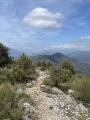
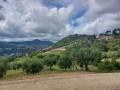
Nature Getaway from Saint-André-de-la-Roche to L’Abadie

This 5.6-kilometre walk invites you to explore a mosaic of panoramic views, charming hamlets and hidden natural spots. Allow around 2 hours to savour every stage of this journey.
It is advisable to undertake this walk outside periods of intense heat. The ‘moderate’ difficulty of this walk is due to a steady climb and a tricky section before reaching the hamlet of ‘La Colle’.

Details

n°38884497
Creation:
Last update:
Last review:
  • Walking
    Activity: Walking
  • ↔
    Distance: 3.57 mi
  • ◔
    Average duration: 2h 25 
  • ▲
    Difficulty: Moderate

  • ⚐
    Back to start: Yes
  • ↗
    Ascent: + 932 ft
  • ↘
    Descent: - 932 ft

  • ▲
    Highest point: 1,119 ft
  • ▼
    Lowest point: 180 ft

Photos

Description of the walk

Parking is available along the Quai de la Banquière, near the starting point.

(S/E) The starting point for this adventure is Place Jules Musso. Throughout the route, be sure to follow the yellow markings.
Cross the Banquière and turn left after the bridge to find marker 733, the first landmark on your exploration. Head right to the end of the car park.

(1) Turn left onto a small path that leads you to marker number 733, behind the car park fence, pointing towards Le Broch.
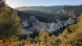
The path climbs, offering you a splendid view of the dry-stone walls of Terra Blanca. Further up, you’ll pass through an olive grove before being treated to a magnificent view of the castle and “Nissa la Bella”.

(2) Cross the road carefully and take the path opposite. Cross the road again to rejoin the path, then continue your ascent straight ahead along the Vieux Chemin de l’Abadie (a tarmac side road). Follow it to its end, then carry on straight ahead to the next junction.

(3) Keep going straight ahead on this path until you reach marker 769 at the foot of the Sainte-Claire Chapel. There, you’ll find a water tap where you can freshen up.

(4) Turn left onto the descending road to continue your journey towards Rue de la Vierge, until you reach the Corniche des Oliviers.

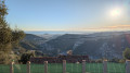
(5) Turn right onto the Corniche des Oliviers, where the view opens up. A panoramic view of the old hamlet of L’Abadie unfolds, evoking the history that brings these places to life. Continue along the Corniche des Oliviers until you reach a junction (Les Ardoins bus stop). Take the road leading down to your left towards “La Colle” until you reach a footpath on the right, just past the hairpin bend.

(6) Take the narrow footpath, followed by steps and signpost 130. Be careful, keep well to your right and ensure you have a firm footing. Stay at the same level, walking alongside the property wall on your right.

The hamlet of La Colle welcomes you with views over Falicon, offering you a chance to take a break. Take the time to explore this spot. Turn right onto the Chemin de la Vallière, which offers a lovely view of Mont Chauve. You’ll reach a junction with Chemin Rural No. 15, marker 738.

(7) Turn left onto the narrow path, Chemin Rural No. 15, beginning your return journey via the Château de Saint-André-de-la-Roche. Further down, rejoin the Vieux Chemin de la Colle (tarmac road). Stay on the path marked in yellow. When you reach the road, head straight on until the next hairpin bend.

(8) Pass two of them. The cobbled path takes you back to Saint-André-de-la-Roche, offering a panoramic view of the Banquière valley and Nice on the horizon. Continue to follow the yellow markings until you rejoin the road at marker 737. Follow it to the left and then, at the end, head towards Place Jules Musso via the safe departmental road, keeping to the left (S/E).


Waypoints

  1. S/E : mi 0 - alt. 187 ft - Place Jules Musso
  2. 1 : mi 0.08 - alt. 187 ft - End of the car park
  3. 2 : mi 0.5 - alt. 577 ft - View of Nice from a beautiful olive grove
  4. 3 : mi 1.11 - alt. 899 ft - Old Abadie Path
  5. 4 : mi 1.47 - alt. 1,115 ft - Sainte-Claire Chapel and fountain
  6. 5 : mi 1.52 - alt. 1,106 ft - Corniche des Oliviers
  7. 6 : mi 2.08 - alt. 1,056 ft - Short path to the right
  8. 7 : mi 2.3 - alt. 873 ft - Country Lane No. 15
  9. 8 : mi 2.81 - alt. 502 ft - Road markers
  10. S/E : mi 3.57 - alt. 187 ft - Place Jules Musso

Worth a visit

This walk is an invitation to immerse yourself in the beauty of the countryside and to experience the history and energy of each place. Make the most of every moment and every panoramic view that awaits you at every bend in the path. Nature and history await you. Enjoy your walk!

Reviews and comments

4 / 5
Based on 2 reviews

Reliability of the description
4 / 5
Ease of following the route
4 / 5
Route interest
4 / 5
Paninoche
Paninoche

Overall rating : 4 / 5

Date of your route : Dec 15, 2024
Reliability of the description : ★★★★☆ Good
Ease of following the route : ★★★★☆ Good
Route interest : ★★★★☆ Good
Very busy route : No

We went on the walk on Sunday 15 December; it was a lovely walk, with beautiful views over Nice, and gave us the chance to explore the Abadie neighbourhood!
However: most of the walk is along tarmac paths running alongside houses; you shouldn’t have a heart condition as there are quite a few dogs in the gardens of the houses that come running out to bark at you, which can be quite a surprise. There’s a section just after point 6 where the house’s fence is very close to the path, and the dog is very protective of its territory and gets very close to you (well, there is a fence, mind you, but it’s quite unnerving), and to make matters worse, the path is quite steep as it goes downhill at that point.

Machine-translated

BOMEL
BOMEL
• Edited:

Hello,
I wanted to familiarise myself with the Vallon de Porquier route.
It’s a bit confusing around the car park – there are three or four of them…
After climbing up the Vallon, 10 metres from the road, the track is blocked by a collapsed bridge; it’s impossible to get past: 4 metres wide, 4 metres deep, with a steep drop.
For the time being, it’s best to cross this route off the list of walks.
Gérard BOMEL

Machine-translated

Espedaillac
Espedaillac

Overall rating : 4 / 5

Date of your route : Nov 29, 2024
Reliability of the description : ★★★★☆ Good
Ease of following the route : ★★★★☆ Good
Route interest : ★★★★☆ Good
Very busy route : No

Thank you for this route on the outskirts of Nice – it’s short but demanding right from the start, though an enjoyable ride. I did it in the morning, followed by the western circular route starting from Saint-André-de-la-Roche.

Machine-translated

Other walks in the area

For more walks, use our search engine .

The GPS track and description are the property of this route's author. Please do not copy them without permission.