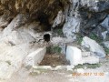
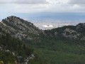
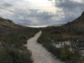
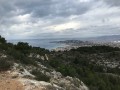
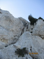
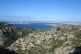
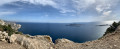
From the Vallon de la Jarre to Callelongue – Views of the Marseille coastline.

An easy walk offering views of the coastline to the north and south of Marseille, before following the coast from the Calanque de Marseilleveyre to the Calanque de Callelongue. To the north, you’ll be able to see the city of Marseille, the Stade Vélodrome, the Estaque hills, Mont Rose and the beaches; to the south, Cap Canaille, the Riou archipelago, and so on…

You are in the Calanques National Park, which is subject to specific regulations. Failure to comply with these regulations may result in a fine of up to €1,500.

Details

413168
Creation:
Last update:
Last review:
  • Walking
    Activity: Walking
  • ↔
    Distance: 4.68 mi
  • ◔
    Average duration: 3h 00 
  • ▲
    Difficulty: Moderate

  • ⚐
    Back to start: No
  • ↗
    Ascent: + 978 ft
  • ↘
    Descent: - 1,201 ft

  • ▲
    Highest point: 909 ft
  • ▼
    Lowest point: 13 ft

Photos

Description of the walk

(S/E) The walk starts from Boulevard Louis Pierotti (Vallon de la Jarre) in the Baumettes neighbourhood.

Follow the path marked in red, which continues from the boulevard. At the start of the route, go through the metal gate.

(1) Leave the wide track to follow the path on the left and continue straight on until you reach the Fontaine de Voire. After a short rocky passage, you will reach one of the crossroads on the walk.

(2) Take the first path on the right (marked in red) to a small platform with a splendid view over Marseille. Take the path on the left, which slopes gently downwards, to the cave below the Col de la Selle; ignore all the paths branching off to the right and follow the path on the left to reach the pass.

(3) Take the path which first descends to the right and then turns immediately to the left.

(4) At the crossroads, turn left onto the Malvallon path and continue to a fork.

(5) Turn right, leaving the path leading to the Col de la Galinette on your right, and continue to the Calanque de Marseilleveyre.

(6) Turn right onto theGR® marked in red and white.

(7) At the junction with the Calanque de la Mounine, turn left to stay on the GR®. Keep left at the next junction to go round the old semaphore tower and reach the Calanque de Callelongue and the bus stop for bus no. 20, which runs from Callelongue to the Madrague de Montredon and on to the town centre (E).


Waypoints

  1. S : mi 0 - alt. 240 ft - Vallon de la Jarre
  2. 1 : mi 0.16 - alt. 269 ft - Leave the track and turn left
  3. 2 : mi 0.64 - alt. 518 ft - Fontaine de Voire junction
  4. 3 : mi 1.73 - alt. 909 ft - Col de la Selle (275m)
  5. 4 : mi 1.91 - alt. 748 ft - At the junction, turn left towards Malvallon
  6. 5 : mi 2.21 - alt. 410 ft - At the junction, turn right
  7. 6 : mi 3.21 - alt. 43 ft - Marseilleveyre Calanque
  8. 7 : mi 3.98 - alt. 26 ft - Calanque de la Mounine
  9. E : mi 4.68 - alt. 13 ft - Calanque de Callelongue

Notes

The start and finish are accessible by public transport (bus 23 for the start and bus 20 for the finish).

Much of the route is shaded, but the final stretch (from the Calanque de Marseilleveyre) is much less so (make sure you bring a hat and water).

Please note: walking in the calanques is not permitted all year round (particularly in summer). Please check with the relevant authorities.

Always be cautious and plan ahead when you're outdoors. Visorando and the author of this route cannot be held responsible for any accidents occurring on this route.

The GR® and PR® markings are the intellectual property of the Fédération Française de Randonnée Pédestre.

Reviews and comments

3.6 / 5
Based on 4 reviews

Reliability of the description
3 / 5
Ease of following the route
4 / 5
Route interest
3.8 / 5
benoit tredez
benoit tredez

Overall rating : 4.3 / 5

Date of your route : Jun 03, 2024
Reliability of the description : ★★★★☆ Good
Ease of following the route : ★★★★★ Very good
Route interest : ★★★★☆ Good
Very busy route : No

Hello
🥾 A magnificent hike starting from Marseille’s 8th arrondissement and Pointe Rouge, taking us to the summit and the cross at Marseilleveyre – a real treat for the eyes. Group package with Mondoramas – Tailor-made group holidays
👉 See https://youtu.be/V6sNNPd2gF0

Machine-translated

elanavava
elanavava

Overall rating : 4.7 / 5

Date of your route : Mar 09, 2020
Reliability of the description : ★★★★★ Very good
Ease of following the route : ★★★★★ Very good
Route interest : ★★★★☆ Good

I think the estimated time of 2 hours 45 minutes is an underestimate; even though we’re no longer spring chickens – aged 70 and 55 – we actually walked for 3 hours 15 minutes at a brisk pace, albeit in a strong Mistral wind, on 7 March; there are a few tricky sections, so best avoided in strong winds; it’s better to do this on a weekday rather than at the weekend, as the number 20 bus to the Montredon fish trap is often full, unless you walk there, which is what we did

Machine-translated

Damange
Damange

I can’t click on the link. It doesn’t work.
Here’s my comment
Thank you for the information about the route. The walk is well signposted and pleasant. However, it is not ‘moderate’. I find this rating an understatement. You don’t mention the difficulties we encountered. We came for a leisurely walk, fortunately without young children or the dog, who wouldn’t have been able to manage the ‘Giants’ Staircase’, amongst other things (which isn’t mentioned).
Please reclassify it.
Kind regards

Machine-translated

jean-jacques lopez
jean-jacques lopez

The path was closed to walkers from Callelongue, so we weren’t able to do it!!!

Machine-translated

jopa_elleul
jopa_elleul

When we share, we should listen to those who suggest improvements and take them on board if they help to give a better understanding of a walk. Visorando is, above all, a place for sharing for the sheer joy of it. That’s what makes it so strong.

Thank you for your encouragement.

Machine-translated

gazok54
gazok54 ★

That was a fruitful discussion. Thank you all

Machine-translated

AVFManosque
AVFManosque

Well done and thank you.

Machine-translated

jopa_elleul
jopa_elleul

Thank you for clarifying that.

I have amended the description accordingly.

Machine-translated

AVFManosque
AVFManosque

Overall rating : 3 / 5

Date of your route : Jan 29, 2017
Reliability of the description : ★★☆☆☆ Disappointing
Ease of following the route : ★★★☆☆ Average
Route interest : ★★★★☆ Good

Here are a few more details about the climb to the Col de la Selle:
(1) Leave the wide track and follow the path straight on to the Fontaine de Voire; after a short rocky passage, you’ll reach a junction on the walk.
(2) Take the first path on the right..................................until you reach a small clearing with a splendid view of Marseille; take the path on the left, which slopes gently downwards, to the cave below the Col de la Selle; ignore all the paths branching off to the right and take the path on the left to reach the pass.
(3) Take the path which first descends to the left and then turns immediately to the right (the green marker is a little further on)

Machine-translated

jopa_elleul
jopa_elleul

Hello,

I wasn’t aware that access to park-and-ride facilities was restricted to Transpass cardholders only.

It’s a real shame that the RTM’s pricing policy isn’t more inclusive of people like you.

I’m truly sorry that this journey caused you so much difficulty.

Machine-translated

AVFManosque
AVFManosque
• Edited:

Thank you for your reply, but as you can see below, it’s not that easy for those who aren’t from Marseille

How it works

Reserved for TRANSPASS cardholders
Permanent, annual, 30-day, 7-day, combined, unlimited travel or euro-top-up Pass XLs
(single-journey tickets are not accepted)

Park-and-ride facilities make travelling easier
- you park your car
- you take a return journey by bus, metro, BRT or tram to get into town (the return journey must be validated no later than 2 hours before leaving the car park)
- you collect your car

Rond-Point du Prado car park
Allée Ray Grassi
13008 MARSEILLE

Monday to Friday, 6.30 am to 8 pm
350 spaces

Please note! You are only entitled to preferential rates if you make a return journey by public transport.

Car park closing times refer to when the car park entrance closes. You may therefore collect your car after the car park has closed, provided you do so within 24 hours.

Machine-translated

jopa_elleul
jopa_elleul
• Edited:

Hello,

As for the car park at the Rond Point du Prado, there is a park-and-ride facility which is free when using public transport. You can find this car park here

Otherwise, I realise that ‘difficulty’ is a relative concept, but I agree that we should now rate the final section as ‘Moderate’.

Finally, I hadn’t thought about groups of 20 people for the return journey on the small shuttle bus to Le Mont Rose.

Thank you for your comment.

Machine-translated

AVFManosque
AVFManosque

Overall rating : 2.3 / 5

Date of your route : Jan 29, 2017
Reliability of the description : ★☆☆☆☆ Very disappointing
Ease of following the route : ★★★☆☆ Average
Route interest : ★★★☆☆ Average

There aren’t enough descriptions for the ascent, or some of them are even incorrect. The walk isn’t ‘easy’ but at least ‘moderate’, given the very high steps and the very rocky path towards the end, heading towards Callelongue.
It’s very difficult to park at the Prado roundabout to catch the No. 23 bus (stop: ‘Sormiou Jarre’). (The Negresco car park is very expensive for a full day). On the return journey, take Bus 20 from Callelongue (timetable not very reliable; it’s a small bus, so not suitable for a group of 20 people); at La Madrague, you’ll need to change buses again to return to the Prado roundabout.

Machine-translated

Other walks in the area

For more walks, use our search engine .

The GPS track and description are the property of this route's author. Please do not copy them without permission.