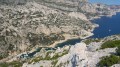
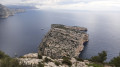
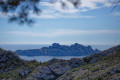
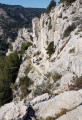
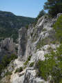
The Calanques of Sormiou, Morgiou and Sugiton from Les Baumettes towards Lumigny

This walk takes in the calanques of Sormiou, La Triperie, Morgiou and Sugiton.
As the start and finish points are different, for the return journey take bus routes B1, 24 or 521 from the ‘Lumigny PN des Calanques’ stop, which is also the departure point for these services.

Details

47867620
Creation:
Last update:
Last review:
  • Walking
    Activity: Walking
  • ↔
    Distance: 9.13 mi
  • ◔
    Average duration: 6h 20 
  • ▲
    Difficulty: Moderate

  • ⚐
    Back to start: No
  • ↗
    Ascent: + 2,464 ft
  • ↘
    Descent: - 2,329 ft

  • ▲
    Highest point: 791 ft
  • ▼
    Lowest point: 3 ft

Description of the walk

The walk starts at the Baumettes car park on the Chemin de Morgiou. It can be reached by bus on route 22 (Les Baumettes stop, the route’s terminus).

(S) Follow the Chemin de Morgiou until you reach a car park.

(1) Cross the car park and follow the red markings to reach the Col des Baumettes.

(2) Leave the track and take a path on the right, heading due south, to reach the Calanque de Sormiou car park. Cross thefirst car park diagonally to the right and take a small path leading to a tarmac road. Turn left towards the sea, then veer left to walk along the upper edge of the beach and reach thesecond car park. Cross it by heading straight ahead.

(3) Take the wide path that runs along the bottom of the calanque. Go round the small harbour, then follow the path marked in red to the left and climb up to a crossroads.

(4) Carry on to the right until you reach another crossroads, aptly named ‘Le Carrefour’.

(5) Follow the blue markings for the Crête de Morgiou to the right. Continue downhill until you reach a crossroads with several directions.

(6) Take the path on the right, heading downhill, and walk round the Calanque de la Triperie to reach Cap Morgiou at the end.

(7) Retrace your steps along the same route to return to the previous crossroads.

(6) Turn right onto the steep path marked in black, which descends to the Calanque de Morgiou and leads directly to the small harbour.

(8) Walk along the harbour and cross to the other side of the calanque. Now follow the red markings. Continue along the path, which includes a short steep section. Caution: this section can become tricky, particularly in wet weather. Continue along the path until you reach a ladder; climb it and carry on until, after passing Cap Sugiton, you arrive at the Calanque de Sugiton.

(9) Head back up the path, then take the track towards the Col de Sugiton. At the top of the track, dotted-line marked paths allow you to cut across the long hairpin bends of the track. You’ll emerge at the Col de Sugiton.

(10) Turn left and continue until you reach the Sugiton viewpoint.

(11) Return to the crossroads at the pass.

(10) Turn left onto the track and follow the signs for ‘Retour Lumigny’, which will take you to the Lumigny university campus (E).

Waypoints

  1. S : mi 0 - alt. 312 ft - Les Baumettes
  2. 1 : mi 0.17 - alt. 374 ft - Baumettes car park
  3. 2 : mi 0.62 - alt. 558 ft - Col des Baumettes (170m)
  4. 3 : mi 1.33 - alt. 46 ft - Sormiou Calanque
  5. 4 : mi 1.91 - alt. 591 ft - Crossroads
  6. 5 : mi 2.24 - alt. 758 ft - A place known as ‘Le Carrefour’
  7. 6 : mi 3.22 - alt. 279 ft - Crossroads towards - Cap Morgiou
  8. 7 : mi 3.84 - alt. 82 ft - Cap Morgiou
  9. 8 : mi 5.03 - alt. 3 ft - Morgiou Calanque
  10. 9 : mi 5.91 - alt. 95 ft - Sugiton Calanque
  11. 10 : mi 7.08 - alt. 705 ft - Sugiton Pass (215m)
  12. 11 : mi 7.52 - alt. 768 ft - Sugiton Viewpoint
  13. E : mi 9.13 - alt. 440 ft - Lumigny University Campus

Worth a visit

The Calanques National Park is subject to regulations and access may sometimes be restricted. Please check carefully before setting out on a hike in this area.

Reviews and comments

4.3 / 5
Based on 2 reviews

Reliability of the description
3.5 / 5
Ease of following the route
4.5 / 5
Route interest
5 / 5
Bnbck
Bnbck

Overall rating : 4.7 / 5

Date of your route : May 18, 2026
Reliability of the description : ★★★★☆ Good
Ease of following the route : ★★★★★ Very good
Route interest : ★★★★★ Very good
Very busy route : Yes

A lovely walk. Do take care, however, between point 8 and point 9. The “short, steep section that can be tricky” is a wall several metres high that you literally have to climb. It’s a technical and very difficult section

Machine-translated

Fred Ardèche
Fred Ardèche

Overall rating : 4 / 5

Date of your route : Apr 26, 2024
Reliability of the description : ★★★☆☆ Average
Ease of following the route : ★★★★☆ Good
Route interest : ★★★★★ Very good
Very busy route : No

The times are underestimated. The terrain is very challenging. It should be classified as ‘difficult’ to bring it into line with the other walks.

Machine-translated

Other walks in the area

For more walks, use our search engine .

The GPS track and description are the property of this route's author. Please do not copy them without permission.