Calanque de l’Escu via the Sormiou and Cortiou passes

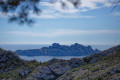
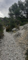
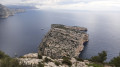
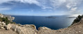
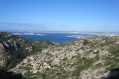
The rugged side of the calanques. Magnificent views of the islands of Riou, Plane and Jarre. A fairly rugged route, requiring suitable footwear.
Moderator’s note: – a slightly tricky section of the route. See the reviews at the bottom of this page

You are in the Calanques National Park, which is subject to specific regulations. Failure to comply with these regulations may result in a fine of up to €1,500.

Details

8932254
Creation:
Last update:
Last review:
  • Walking
    Activity: Walking
  • ↔
    Distance: 3.58 mi
  • ◔
    Average duration: 2h 45 
  • ▲
    Difficulty: Difficult

  • ⚐
    Back to start: Yes
  • ↗
    Ascent: + 1,309 ft
  • ↘
    Descent: - 1,309 ft

  • ▲
    Highest point: 801 ft
  • ▼
    Lowest point: 62 ft

Description of the walk

Car park by the sewage treatment plant, just before the Sormiou barrier.

(S/E) Go through the barrier and head up to the Col de Sormiou.

(1) Head off to the right (west) and follow the green signposts.

(2) At the Col de Courtiou, enjoy the magnificent view of the islands and keep to the left. Descend via tight hairpin bends beneath a rocky outcrop towards Anse de Melette, taking care when crossing a slightly uneven section.

(3) Walk along the coast, staying on the hillside about thirty metres above the water.

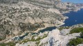
(4) Cross a beautiful pine forest and continue beneath rocky outcrops, following the green dotted lines to the Calanque de l’Escu.

(5) In the calanque you’ll see enormous boulders at the water’s edge, as well as an old cistern.
Warning: swimming is dangerous even in calm seas.

Follow the same route back to the car park (S/E).

Waypoints

  1. S/E : mi 0 - alt. 338 ft - Car park before the Sormiou barrier
  2. 1 : mi 0.56 - alt. 607 ft - Col de Sormiou (181m)
  3. 2 : mi 0.79 - alt. 794 ft - Col de Cortiou (244m)
  4. 3 : mi 1.33 - alt. 62 ft - Anse de la Melette
  5. 4 : mi 1.53 - alt. 115 ft - Pine forest - Cirque des Walkyries
  6. 5 : mi 1.79 - alt. 190 ft - Calanque de l’Escu
  7. S/E : mi 3.58 - alt. 338 ft - Car park before the Sormiou barrier

Reviews and comments

4.6 / 5
Based on 3 reviews

Reliability of the description
4 / 5
Ease of following the route
5 / 5
Route interest
4.7 / 5
Espinet Jean- Charles

Overall rating : 4.7 / 5

Date of your route : Jan 01, 2024
Reliability of the description : ★★★★☆ Good
Ease of following the route : ★★★★★ Very good
Route interest : ★★★★★ Very good
Very busy route : No

As usual, the difficulty of the route is all relative. I didn’t have any trouble at all, but for my partner, who suffers from vertigo, it was a bit of a struggle in places. The rock is very weathered.

The route is magnificent in bright light.

With the GPS track, it’s hard to get lost, even if the description is rather brief.

Thank you for this lovely suggestion.

Machine-translated

baroudeuse13
baroudeuse13

Overall rating : 4.7 / 5

Date of your route : Oct 07, 2023
Reliability of the description : ★★★★☆ Good
Ease of following the route : ★★★★★ Very good
Route interest : ★★★★★ Very good
Very busy route : No

A nice walk. I was expecting the section between points 2 and 3 to be much tougher. It’s the sort of terrain where you certainly don’t want to trip, but it’s doable. Personally, when I’m out in the Calanques, I always take walking poles for the descents – they help. I used them on this walk, but at no point did I feel like I was going to take a tumble… unlike on other walks I’ve done in the Calanques.

The start is incredibly boring as you’re on the road to Sormiou with loads of cars, but as soon as you join the GR98 it gets better. On my walk, I was all on my own at the Calanque de l’Escu – a real treat!

I looked for the rest of the path to carry on towards the Calanque de Podestat in the direction of Callelongue, but I couldn’t find it, so on the way back I took the same route as on the way there.

One thing to note about swimming: even if you feel up to climbing down – and, more importantly, back up – the submerged boulders, it seems the water in this spot is quite polluted due to discharge from nearby, at the Calanque de Cortiou.

Machine-translated

Rev0X
Rev0X

Overall rating : 4.3 / 5

Date of your route : Feb 06, 2022
Reliability of the description : ★★★★☆ Good
Ease of following the route : ★★★★★ Very good
Route interest : ★★★★☆ Good
Very busy route : No

A walk with some interesting views, though there are a few issues with the route description:

At point 1, you need to follow the red-and-white GR markings. It’s at point 2 that the green markings appear.

Between points 2 and 3, perhaps a bit more emphasis should be placed on the difficulty of the terrain: the people I was with weren’t exactly reassured! There’s a fairly steep section to cross, with no rope or chain to help, and in a stretch that’s often exposed to the wind. On the way back, just as the markings changed to dotted green, we saw a sign saying ‘Difficult – danger’. This is indeed a more realistic warning for an inexperienced walker.

In short: if you enjoy a bit of a scramble, the walk is enjoyable. Otherwise, you’ll be left with some bad memories of this section!

Machine-translated

Other walks in the area

For more walks, use our search engine .

The GPS track and description are the property of this route's author. Please do not copy them without permission.