


Fontasse

 Visorando Member
 Premium user
 - Location: Montpezat-sous-Bauzon (07560)
- Gender: man
Sign up:
Published route(s)
 Chames Patroux along "ruisseau du Tiourre" (stream) and through Combe Longue for the trip back
 9.00 mi
 +1,404 ft
 -1,378 ft
 5h 20
5h 20
 Moderate
 Departure from Vallon-Pont-d'Arc (Ardèche)
Between Vallon-Pont-d'Arc and Saint-Remèze, this hike should be done mid-season before it become too difficult to park in "gorges de l'Ardèche" after Pont-d'Arc.The walk offers beautiful view points over the Ardèche and Tiourre valleys, the Saint-Remèze plateau then Pont-d'Arc on the trip back.
Les Balmes de Montbrun - Mirabel
 10.63 mi
+1,923 ft
-1,952 ft
6h 35
Moderate
Departure from Saint-Jean-le-Centenier (Ardèche)
10.63 mi
+1,923 ft
-1,952 ft
6h 35
Moderate
Departure from Saint-Jean-le-Centenier (Ardèche)
The Coiron is a rugged basalt plateau; on its southern face, near Saint-Jean-le-Centenier, a troglodytic settlement developed during the Middle Ages within the basalt cliffs of Montbrun.From Saint-Gineis-en-Coiron, a narrow road winding across the plateau takes you to Mirabel, where you can enjoy magnificent views from the keep.The only downside is that two-thirds of the route is on tarmac roads, although there is very little traffic.
Balazuc - Servière - Chauzon
 11.37 mi
+1,204 ft
-1,207 ft
6h 15
11.37 mi
+1,204 ft
-1,207 ft
6h 15
 Difficult
Departure from Balazuc (Ardèche)
Difficult
Departure from Balazuc (Ardèche)
Starting from the village of Balazuc, a hike along the right bank of the Ardèche with, after leaving the forest, a clear view of the Coiron massif to Mont Lozère via the Tanargue massif.
Only for walkers who are not afraid of stony paths!
Four knolls between Aigue Nègre and Veyradeyre
 8.21 mi
+1,476 ft
-1,457 ft
5h 05
Moderate
Departure from Saint-Martial (Ardèche)
8.21 mi
+1,476 ft
-1,457 ft
5h 05
Moderate
Departure from Saint-Martial (Ardèche)
Between Gerbier de Jonc and Chartreuse de Bonnefoy, the Ardèche plateau offers numerous stone-slab knolls.
This circuit between Aigue Nègre and Veyradeyre passes by four of them and at the top of three.
In order, these are Séponet (tower), Montfol (summit), Lauzière (summit) and Taupernas (summit).
From each of them, there is a beautiful 360° view of Mont Mézenc to the north, the Tanargue massif to the south, Gerbier and Areilladou to the east, and Haute-Loire to the west.
Loop above the meanders of the Lot between Saint-Géry and Vers
 8.47 mi
+1,243 ft
-1,237 ft
5h 00
Moderate
Departure from Saint-Géry (Lot) (Lot)
8.47 mi
+1,243 ft
-1,237 ft
5h 00
Moderate
Departure from Saint-Géry (Lot) (Lot)
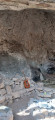
This hike, along cliff-top paths, offers superb views of several meanders of the Lot, which you will cross. Several small locks are used by pleasure boats. The descent to Vers allows you to discover the village and its river of the same name with its port at the confluence with the Lot.
Circular around the Causse de Cuzals - Vieux-Sauliac
 9.70 mi
+1,568 ft
-1,568 ft
5h 50
Moderate
Departure from Orniac (Lot)
9.70 mi
+1,568 ft
-1,568 ft
5h 50
Moderate
Departure from Orniac (Lot)
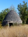
From cazelles to dolmens, above Château de Cuzals and its open-air museum, passing through old Sauliac and its cliffside houses.
Chirols - Sainte-Marguerite - Aubignas circular
7.14 mi
+2,421 ft
-2,395 ft
5h 25
Moderate
Departure from Chirols (Ardèche)
Starting from the Pont de Veyrières silk mill eco-museum, climb towards Chirols and then the Sainte-Marguerite Chapel, a summit bristling with various antennas and the highest point of the route, offering a magnificent view of the Coiron and the Ardèche Cévennes. Return via the Revescu ridges, with views over the plateau, and descend via the hamlet of Aubignas to the starting point.
The circular of the peatland in Lentillac-du-Causse
 9.17 mi
+761 ft
-755 ft
4h 55
Moderate
Departure from Lentillac-du-Causse (Lot)
9.17 mi
+761 ft
-755 ft
4h 55
Moderate
Departure from Lentillac-du-Causse (Lot)
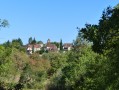
Climbing up the aptly named Combe d'Écoute-s'il-pleut, you arrive at the dry grasslands of Lentillac, where you can discover a magnificent dolmen.
Descend towards the peatland, a clear river that can disappear and reappear a little further on through resurgences.
Circular of the lower Célé valley
 12.27 mi
+2,352 ft
-2,352 ft
7h 40
Difficult
Departure from Orniac (Lot)
12.27 mi
+2,352 ft
-2,352 ft
7h 40
Difficult
Departure from Orniac (Lot)
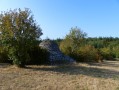
Starting from the hamlet of Les Granges in Orniac, discover the lower Célé valley to its confluence with the Lot. Beautiful view of the cliffs between Bouziès and Saint-Cirq-Lapopie and return via Pech Merle and Cabrerets.
Cros de Géorand - Three streams and a dam
 7.49 mi
+1,686 ft
-1,663 ft
4h 55
Moderate
Departure from Cros-de-Géorand (Ardèche)
7.49 mi
+1,686 ft
-1,663 ft
4h 55
Moderate
Departure from Cros-de-Géorand (Ardèche)
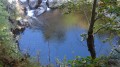
At the confluence of three streams, the Gage, the Sagne-Morte and the Tauron, EDF built a dam known as the Gage dam (Moulin de Peyron on IGN maps) in the 1950s to supply the Montpezat-sous-Bauzon power station. I suggest you take a tour of the dam starting from Cros-de-Géorand, following a hiking route suggested by La Montagne Ardéchoise. You will discover magnificent landscapes as well as paths through beech woods that are over a hundred years old.
The butter trails in Burzet
 10.54 mi
+2,844 ft
-2,844 ft
7h 20
Difficult
Departure from Burzet (Ardèche)
10.54 mi
+2,844 ft
-2,844 ft
7h 20
Difficult
Departure from Burzet (Ardèche)
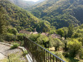
From Burzet to Péreyres, paths lead down from the farms on the Ardèche plateau near the peatland-and-Goudoulet to the nearest town.
The farmers of the plateau brought their butter and cheese to the markets.
Here you will discover two types of paths: one designed for carts, the other for mules at best, but both were used for trade until the middle of the last century.
Cham du Cros circular from Croix de Millet
 10.46 mi
+1,982 ft
-1,965 ft
6h 30
Moderate
Departure from Prunet (Ardèche)
10.46 mi
+1,982 ft
-1,965 ft
6h 30
Moderate
Departure from Prunet (Ardèche)
Between Prunet and Jaujac, the Col de la Croix de Millet offers a beautiful view of the Ligne valley to the south and the Lignon valley to the north.
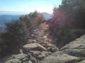
The climb to the Col du Merle and the return after Pissas are through woodland, while the bare ridges of the Cham du Cros offer beautiful views of the southern Ardèche from the Vagorge valley and the Tour de Brison in the Cévennes, the Rhône valley and Mont Ventoux to the east, and Mont Lozère to the west.
Between Volane and Besorgues, Aizac - Rouyon
 8.26 mi
+2,562 ft
-2,562 ft
6h 00
Moderate
Departure from Aizac (Ardèche)
8.26 mi
+2,562 ft
-2,562 ft
6h 00
Moderate
Departure from Aizac (Ardèche)
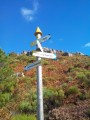
A beautiful walk through the chestnut groves on both the Volane and Besorgues sides. On the upper part, around the Cime de Rouyon, there is an unobstructed view of the Ardèche plateau to the north and west, and to the east and south, the Coiron, the Alps, the Cévennes and the Tanargue.
Rancs, heath and faïsses around Labeaume
 9.17 mi
+863 ft
-876 ft
5h 00
Moderate
Departure from Labeaume (Ardèche)
9.17 mi
+863 ft
-876 ft
5h 00
Moderate
Departure from Labeaume (Ardèche)
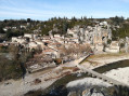
Between Baume, Ardèche and Ligne, vast areas cleared of stones have been, and are still partly, cultivated; olive trees now dominate the landscape.The former silkworm farms have now been converted into homes but retain their old-world charm.Along the riverbank, terraced gardens are still maintained and clearly visible on the sun-facing banks of the Baume.The Ardèche and Chassezac rivers have created a vast plain where vineyards, fruit trees and gardens occupy the landscape.
Saint-Étienne-de-Boulogne - Gourdon circular
 8.54 mi
+1,827 ft
-1,827 ft
5h 30
Moderate
Departure from Saint-Étienne-de-Boulogne (Ardèche)
8.54 mi
+1,827 ft
-1,827 ft
5h 30
Moderate
Departure from Saint-Étienne-de-Boulogne (Ardèche)
This south-facing route offers stunning views across the Tanargue as far as Mont Lozère, passing through the Aubenas basin. It is also a geological discovery trail with information panels placed at regular intervals. After Gourdon, at the top of the tarmac road, the Alpine range stands out on the horizon.Climbing up to the summit platform of the Roc de Gourdon is not the easiest of tasks for everyone, but the 360° view is remarkable.
Lauzes route in Saint-Mélany
 9.11 mi
+1,955 ft
-1,955 ft
5h 55
Moderate
Departure from Saint-Mélany (Ardèche)
9.11 mi
+1,955 ft
-1,955 ft
5h 55
Moderate
Departure from Saint-Mélany (Ardèche)
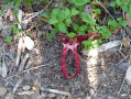
On this route, you’ll discover works by local artists as well as the use of slate in the construction of houses, paths and bridges. Do make a long stop in Dompnac.On the way back, after Merle, crossing the Sueille stream can sometimes be tricky, especially after heavy rain, and you may get wet.
Rieutord circular, Cros du Loup, Les Oulettes, Le Pal, knoll de Bauzon
 10.30 mi
+1,535 ft
-1,516 ft
6h 05
Moderate
Departure from Usclades-et-Rieutord (Ardèche)
10.30 mi
+1,535 ft
-1,516 ft
6h 05
Moderate
Departure from Usclades-et-Rieutord (Ardèche)
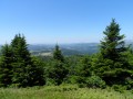
Around the knoll of Bauzon, a young Strombolian volcano, there are numerous hiking trails.
This route combines the volcanic part of the area with the discovery of a section of the Atlantic-Mediterranean watershed.
Circular route from Croix de Bauzon to Col du Pendu, Le Bez, Les Chambons
 9.26 mi
+1,345 ft
-1,348 ft
5h 25
Moderate
Departure from La Souche (Ardèche)
9.26 mi
+1,345 ft
-1,348 ft
5h 25
Moderate
Departure from La Souche (Ardèche)
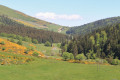
A pleasant route in good weather with beautiful, unobstructed views of the Ardèche plateau.
The return through the forest after Les Chambons allows you to escape the heat of the ridges and, depending on the season, pick mushrooms.
The loop of the Royal Road from Rochecolombe
 10.58 mi
+1,729 ft
-1,713 ft
6h 20
Moderate
Departure from Rochecolombe (Ardèche)
10.58 mi
+1,729 ft
-1,713 ft
6h 20
Moderate
Departure from Rochecolombe (Ardèche)
This history-rich circuit starts at the foot of the old village of Rochecolombe, which you will discover on your return, before reaching Sauveplantade and its Romanesque church and continuing along a section of the Royal Road that linked Villeneuve-de-Berg to Vallon-Pont-d'Arc.
From one bank of the Fontaulière to the other
 4.20 mi
+738 ft
-725 ft
2h 35
4.20 mi
+738 ft
-725 ft
2h 35
 Easy
Departure from Montpezat-sous-Bauzon (Ardèche)
Easy
Departure from Montpezat-sous-Bauzon (Ardèche)
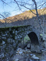
A short walk from Montpezat to the hamlets of Les Grisières and Le Villaret, passing through a chestnut grove - the only slight difficulty on the route - and the humpback bridge, for a family outing.
Laurac-en-Vivarais - Montréal loop
 7.88 mi
+1,079 ft
-1,073 ft
4h 35
Moderate
Departure from Laurac-en-Vivarais (Ardèche)
7.88 mi
+1,079 ft
-1,073 ft
4h 35
Moderate
Departure from Laurac-en-Vivarais (Ardèche)
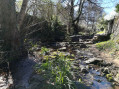
Discover the flora and, if you're lucky, the fauna, as well as the built heritage. This hike can be adapted to suit your preferences by following well-marked trails.
Tour of the Grande Chartreuse Monastery
 5.24 mi
+2,054 ft
-2,037 ft
4h 10
Moderate
Departure from Saint-Pierre-de-Chartreuse (Isère)
5.24 mi
+2,054 ft
-2,037 ft
4h 10
Moderate
Departure from Saint-Pierre-de-Chartreuse (Isère)
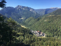
This walk through the woods is very pleasant in warm weather, with a beautiful view from the belvedere over the Grande Chartreuse Monastery and the surrounding peaks.
The difference in altitude, the sometimes narrow path, the balcony-like terrain and the untimely opening of forestry tracks make the return journey difficult.
Please read the recommendations carefully at (6).
L'entrée du tunnel du Roux en boucle depuis l'Air
 6.35 mi
+1,171 ft
-1,155 ft
3h 55
Moderate
Departure from Le Roux (Ardèche)
6.35 mi
+1,171 ft
-1,155 ft
3h 55
Moderate
Departure from Le Roux (Ardèche)
Warning: do not attempt this hike until further notice (reopening scheduled for 2027)!The Cévenol storm in October 2024 caused a landslide above the point (4), which completely destroyed the communal path. A municipal notice prohibiting passage has been posted. There is no alternative route on this part of the circuit.
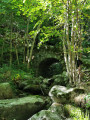
A mid-season hike in spring or autumn starting from L'Air (or L'Herm), with varied landscapes and sections on quiet paved roads. Beautiful views of the Vauclare and Fontaulière valleys.
Tour of Prunet via the Col de la Croix de Millet and the Pont de Cannelle
 7.16 mi
+1,499 ft
-1,512 ft
4h 35
Moderate
Departure from Prunet (Ardèche)
7.16 mi
+1,499 ft
-1,512 ft
4h 35
Moderate
Departure from Prunet (Ardèche)
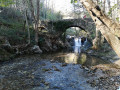
After the Sainte-Philomène Chapel, the highest point (3) of the forest road (890m) offers a stunning aerial view of Jaujac and its volcanic caldera. To the east, the foothills of the Vercors; closer by, the Coiron, the Escrinet and the Roche de Gourdon; below, to the north, Jaujac and the Lignon valley; and to the west, the Tanargue and the Cham du Cros.