From the Trou de l’Enfer to St-Nicolas on the island of Groix

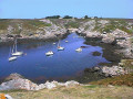
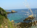
This walk will take you along inland and coastal paths to discover the island’s rural heritage. Between the Trou de l’Enfer and Pointe Saint-Nicolas, you’ll look out over the sea and the cliffs with their jagged rocks.

Details

n°59828099
Creation:
Last update:
Last review:
  • Walking
    Activity: Walking
  • ↔
    Distance: 5.23 mi
  • ◔
    Average duration: 2h 30 
  • ▲
    Difficulty: Easy

  • ⚐
    Back to start: Yes
  • ↗
    Ascent: + 105 ft
  • ↘
    Descent: - 108 ft

  • ▲
    Highest point: 141 ft
  • ▼
    Lowest point: 39 ft
  • ⚐ Country: France
  • ⚐ City: Groix (56590)
  • ⚑
    Start/End: N 47.639469° / W 3.453067°
  • ❏
    IGN map(s): Ref. 0720ET
  • Hour-by-hour weather

Photos

Description of the walk

Cycling and car parking available in the car park near Les Halles. Route de Port Mélite, at the Tour Information Point (next to the market halls in the village centre).

(S/E) At the starting signpost, turn right towards the village. At the Y-junction, carry on straight ahead, then, at the church, turn left for 20 metres.

(1) Carry on straight ahead along Rue Abbé Noël. Continue straight on, then turn right onto Rue du Grao (at the next junction, you can turn right to visit the Chapel of the Trinity). Keep going straight on along the road, then along the stony track, ignoring the paths on either side, until you reach the Kermouzouet junction.

(2) Turn right, then straight on across the road. At the next junction, turn right, then immediately left. Carry on straight ahead along this path, ignoring any turnings. Take the road on the left, then straight on into the Pointe de l’Enfer car park. Carry on straight ahead.

(3) At the sea, turn right (you can do a return trip to Pointe de l’Enfer). Follow the coastline, the signposts and the paths marked by stones on the ground. Continue to the Fontenard wash house.

(4) Keep going in the same direction and, after this, head back up towards Quéhello, taking thesecond wide path on the right. Carry on straight ahead until you reach the road (there is a memorial to airmen who died in 1945 on the right).

(5) Turn left. Leave the road on the right, then carry on straight ahead to the Port Saint-Nicolas junction.

(6) Leave it on your left (a lovely harbour well worth a visit) and carry on to the right, then straight on to Quéhello.

(7) At the road, turn left twice, then take the track on the left to reach the Route du Grand Phare.

(8) Turn left, then right. Head towards Kerdurand (turn right, then carry on straight ahead).

(9) In the centre of the hamlet, turn right and leave the road to continue straight on along the path. At the end, turn left, then right towards Clavezic. Turn left onto the path between the houses. Carry on straight ahead (Clavezic menhir on the right), then turn right before Kermario and continue to Rue des Lilas (fountain and wash house on the right-hand side of the path).

(10) Carry on straight ahead, then turn left, then right. Continue straight ahead along Rue de Kermario and Rue Jean-Pierre Calloch. Go round the church on the right and return to the original junction.

(1) Carry on straight ahead for 20 metres, then turn right until you reach (S/E).

Waypoints

  1. S/E : mi 0 - alt. 112 ft - Les Halles car park
  2. 1 : mi 0.1 - alt. 125 ft - Junction marking the end of the circular loop
  3. 2 : mi 0.76 - alt. 121 ft - Kermouzouët
  4. 3 : mi 1.55 - alt. 128 ft - Trou de l’enfer
  5. 4 : mi 2.19 - alt. 92 ft - Washing house
  6. 5 : mi 2.58 - alt. 128 ft - Route
  7. 6 : mi 2.82 - alt. 39 ft - Port St-Nicolas
  8. 7 : mi 3.2 - alt. 128 ft - Quéhello
  9. 8 : mi 3.55 - alt. 115 ft - Route du Grand Phare
  10. 9 : mi 3.84 - alt. 115 ft - Kerdurand
  11. 10 : mi 4.67 - alt. 102 ft - Rue des Lilas
  12. S/E : mi 5.23 - alt. 112 ft - Les Halles car park

Notes

This route is organised by Lorient Agglomération

This route is included in the Morbihan Departmental Plan for Walking and Hiking Routes and has been accredited by the French Hiking Federation. You can follow the yellow markings. There is an information board with a map and details of heritage sites at the start.

Worth a visit

‘A mineralogist’s paradise, Groix is a veritable treasure trove. A thousand shades of colour adorn the ground beneath our feet. The most varied minerals glisten in the cliffs’ (Charles Barrois, 1883).

- Trinity Chapel: rebuilt in 1894 (Neo-Gothic style).
- Pointe et Trou de l’Enfer: steep cliffs and a deep cave that echoes during storms; according to legend, it was home to a sea monster with a human head that organised bacchanalia there.
- Fontenar Washhouse: a refuge for the Mercury Damselfly (a protected species of Community interest under Natura 2000).
- Port St-Nicolas: a natural harbour in the thalweg (a hollow) surrounded by cliffs.
- Quehello Fountain: a fountain and its water pump
- Kerdurant: traditional houses dating from the 18th to the 20th centuries.
- Clavezic menhir: Neolithic, 5.80 m high
- Mez Er Groez wash house and fountain
- Groix village: Saint-Tudy Church (17th–19th centuries) and its tuna-shaped weather vane.

Reviews and comments

4.7 / 5
Based on 1 review

Reliability of the description
5 / 5
Ease of following the route
5 / 5
Route interest
4 / 5
Patrice 37
Patrice 37

Overall rating : 4.7 / 5

Date of your route : Jun 07, 2025
Reliability of the description : ★★★★★ Very good
Ease of following the route : ★★★★★ Very good
Route interest : ★★★★☆ Good
Very busy route : No

A very pleasant walk with varied scenery. After a few kilometres through the village, the route takes you along paths surrounded by woodland or hedgerows, before leading you out onto moorland with virtually no vegetation. Then there are more surprises: the Hole of Hell and the magnificent port of St Nicolas. What a delight!

Machine-translated

Other walks in the area

For more walks, use our search engine .

The GPS track and description are the property of this route's author. Please do not copy them without permission.