Locmaria and the cats on the Île de Groix

“A mineralogist’s paradise, Groix is a veritable treasure trove. A thousand shades colour the carpet beneath your feet. The most varied minerals glisten in the cliffs” (Charles Barrois, 1883)
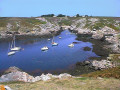
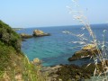
Between land and sea, this walk will take you along inland and coastal paths to discover the typical villages of Groix. Skirting the beaches and overlooking the steep shores, you can explore the François Le Bail Geological Nature Reserve between Locmaria and the Pointe des Chats.

Details

n°59748524
Creation:
Last update:
Last review:
  • Walking
    Activity: Walking
  • ↔
    Distance: 6.51 mi
  • ◔
    Average duration: 3h 10 
  • ▲
    Difficulty: Moderate

  • ⚐
    Back to start: Yes
  • ↗
    Ascent: + 243 ft
  • ↘
    Descent: - 236 ft

  • ▲
    Highest point: 138 ft
  • ▼
    Lowest point: 13 ft
  • ⚐ Country: France
  • ⚐ City: Groix (56590)
  • ⚑
    Start/End: N 47.639208° / W 3.453558°
  • ❏
    IGN map(s): Ref. 0720ET
  • Hour-by-hour weather

Photos

Description of the walk

Cycling and car parking available in the car park near Les Halles. Route de Port-Mélite, at the Trail Information Point (next to Les Halles du Bourg).

(S/E) Walk up Route de Port-Mélite towards the village centre, then turn right towards the church.

(1) Walk round the Place de l’Église (three times to the left). Stop for a moment at Saint-Tudy Church and admire the tuna on the bell tower, a reminder that Groix was France’s leading tuna fishing port. At the town hall, head up to the right along Rue François Le Bail until you reach Place du Leurhé. Turn left, then right twice to take Rue du Grao, until you reach the junction with the Chapelle de la Trinité (which you’ll find on your right).

(2) Cross the main road and head straight on along the dirt track. Take the first path on the left to reach Kermouzouet.

(3) On the descent, take the second right, near the fountain, and walk alongside the pond. Cross the stream, then follow it to the left to reach Kersauze and Locmaria Bay.

(4) At Kersauze, turn left and follow the footpath to the right along the beach and the harbour. Continue along the road to the right (with Locmaria Chapel on your left) until you reach the jetty.

(5) Then follow the path along the coast (turning right four times) to Pointe des Chats.

(6) Turn left and follow the road. Turn right and stay on the coastal path. Turn left to go round the Nosterven battery, and take the road on the right until you reach the vicinity of Fort Surville. Admire the Plage des Sables Rouges and the crystal-clear waters of this coastline!

(7) Leave the road to the right, before Fort Surville. Stay on the path overlooking Grands Sables Beach, then head back towards the interior of the island (twice to the left, then right and straight on until you reach the road; on this stretch, the Kerhoret covered walkway is on the right).

(8) Turn left, then right. Turn right towards Kerampoulo.

(9) Cross the road, head straight ahead, then turn left onto the path. Carry on straight ahead, and straight ahead again when you reach the road. At Kerliet, turn right. Carry on straight ahead along the path, then onto the road. Take the second left, then turn right to return to your starting point, near the market halls in the village (S/E).

Waypoints

  1. S/E : mi 0 - alt. 118 ft - Market halls in the town centre
  2. 1 : mi 0.07 - alt. 118 ft - Saint-Tudy village and church
  3. 2 : mi 0.33 - alt. 138 ft - Junction towards the Chapel of the Trinity
  4. 3 : mi 0.98 - alt. 98 ft - Kermouzouet
  5. 4 : mi 1.44 - alt. 26 ft - Kersauze
  6. 5 : mi 1.9 - alt. 23 ft - Jetty
  7. 6 : mi 2.94 - alt. 16 ft - Pointe des Chats
  8. 7 : mi 4.03 - alt. 112 ft - Fort Surville
  9. 8 : mi 5.12 - alt. 115 ft - Route
  10. 9 : mi 5.47 - alt. 75 ft - Kerampoulo
  11. S/E : mi 6.51 - alt. 118 ft - Market halls in the town centre

Notes

This route is included in the Morbihan Departmental Plan for Walking and Hiking Routes and has been accredited by the French Hiking Federation. You can follow the yellow markings. There is an information board with a map and details of heritage sites at the start.

This route is organised by Lorient Agglomération

Worth a visit

- The village and church of Saint-Tudy: a17th-century building, remodelled around 1850.
- Trinity Chapel: rebuilt in 1894 (Neo-Gothic style).
- Kermouzouët: traditional houses and a fountain and washhouse complex.
- Locmaria and the Chapel of Notre-Dame de Plasmadec (rebuilt around 1764)
- Locmaria dolmen (c. 6000 BC) and ‘amer’ (navigational landmark)
- François Le Bail Geological Nature Reserve and Natura 2000 site
- Pointe des Chats and its lighthouse (1898)
- Nosterven Battery (1848)
- Red Sand Beach (made from ground garnets).
- Fort Surville (1744)
- The Croix Lighthouse (1898)
- Grands Sables Beach: one of the few convex beaches in Europe
- Kerohet Covered Walkway (late Neolithic period)

Reviews and comments

5 / 5
Based on 1 review

Reliability of the description
5 / 5
Ease of following the route
5 / 5
Route interest
5 / 5
c23
c23

Overall rating : 5 / 5

Date of your route : Sep 22, 2025
Reliability of the description : ★★★★★ Very good
Ease of following the route : ★★★★★ Very good
Route interest : ★★★★★ Very good
Very busy route : Yes

A very beautiful route, the coastal path is superb.

Machine-translated

Other walks in the area

For more walks, use our search engine .

The GPS track and description are the property of this route's author. Please do not copy them without permission.