From the Trou de l’Enfer to Kerlard on the Île de Groix

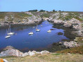
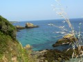
Crossing the island and following the coastline, this route will introduce you to the contrasting landscapes of Groix. Inland, the hedge-lined paths will lead you through the green, cool valleys to discover the hamlets. The coastal paths, from Pointe de l’Enfer to Port Saint-Nicolas and from Porh Melin to the village centre, offer views of the rugged coastline and the ocean.

Details

n°59833112
Creation:
Last update:
Last review:
  • Walking
    Activity: Walking
  • ↔
    Distance: 7.21 mi
  • ◔
    Average duration: 3h 35 
  • ▲
    Difficulty: Moderate

  • ⚐
    Back to start: Yes
  • ↗
    Ascent: + 341 ft
  • ↘
    Descent: - 344 ft

  • ▲
    Highest point: 154 ft
  • ▼
    Lowest point: 10 ft
  • ⚐ Country: France
  • ⚐ City: Groix (56590)
  • ⚑
    Start/End: N 47.639267° / W 3.452939°
  • ❏
    IGN map(s): Ref. 0720ET
  • Hour-by-hour weather

Photos

Description of the walk

Bicycle and car parking available in the car park near Les Halles. Route de Port-Mélite, at the ‘Point Info routes’ sign (next to Les Halles in the village centre).

(S/E) At the starting sign, turn right, then carry on straight ahead to reach the village centre.

(1) Go round the church on the left. Take the third street on the left, Rue du Presbytère, and carry on straight ahead. At the end, turn slightly left. Cross the square and turn left, heading towards the secondary school.

(2) Carry on to the left, past Collège Saint-Tudy. Continue straight on to the end of Rue Pierre Baron. Turn right, then left. Take the third on the right, into Rue du Stade, in Lomener.

(3) Follow the Chemin de Kérigant to the right and turn left. Stay on the road and turn right into the Pointe de l’Enfer car park.

(4) Carry on straight ahead. When you reach the coast (where you can explore the Pointe de l’Enfer), turn right. Follow the coastline, the signposts and the paths marked by stones on the ground. As you approach the Pointe Saint-Nicolas, take thethird turning on the right, after the Fontenar wash house.

(5) Turn left and, as you approach the cliff, follow the circular path to the right which runs along the coast until you reach a crossroads.

(6) Turn left, then carry on straight ahead towards Kerloret. At the gate, follow the path which descends to the left towards the cove.

(7) Walk along the beach to the right and head up the steep path. Continue straight on along this path to Kerlard. Cross through the hamlet (to the right, then to the left) and carry on straight along the path to reach Kerlobraz (the Kerlo-Bihan quarry washhouse is worth a look on the left).

(8) Turn right, then left at the information sign. Follow the path: right, left, then straight on all the way to Kerlivio.

(9) Carry on along the road to the right, then straight on, and turn left onto the path leading to the Kerlivio fountain and washhouse. Continue left along the steep path overlooking the Port Melin water reservoir. Join the coastal path on the right and walk past the dam.

:10:: Keep as close as possible to the coastline, ignoring the paths on the right, until you reach Port Lay.

(11) Turn left, go straight on and then turn right. Continue to the left. Follow the coastline before heading straight on into Rue du Gripp. Turn left, then right onto Rue de la Marine. Turn right and follow the path back up to the starting point. (S/E)

Waypoints

  1. S/E : mi 0 - alt. 115 ft - Route de Port Mélite at the Trail Information Point
  2. 1 : mi 0.07 - alt. 121 ft - Groix village centre
  3. 2 : mi 0.32 - alt. 135 ft - Secondary school
  4. 3 : mi 0.77 - alt. 144 ft - Lomener
  5. 4 : mi 1.52 - alt. 128 ft - Pointe de l’Enfer car park
  6. 5 : mi 2.64 - alt. 121 ft - Route
  7. 6 : mi 3.23 - alt. 105 ft - Junction towards Port Saint-Nicolas
  8. 7 : mi 3.63 - alt. 13 ft - Crique
  9. 8 : mi 4.36 - alt. 105 ft - Kerlobraz
  10. 9 : mi 4.92 - alt. 112 ft - Kerlivio
  11. 10 : mi 5.45 - alt. 13 ft - Dam
  12. 11 : mi 6.36 - alt. 33 ft - Port Lay
  13. S/E : mi 7.21 - alt. 115 ft - Route de Port Mélite at the Trail Information Point

Notes

This route is organised by Lorient Agglomération

This route is included in the Morbihan Departmental Plan for Walking and Hiking Routes and has been accredited by the French Hiking Federation. You can follow the yellow markings. There is an information board with a map and details of heritage sites at the start

Worth a visit

‘A mineralogist’s paradise, Groix is a veritable treasure trove. A thousand shades colour the carpet beneath our feet. The most varied minerals glisten in the cliffs’ (Charles Barrois, 1883)

- Bourg de Groix: Saint-Tudy Church (17th–19th century) and its tuna-shaped weather vane.
- Pointe and Trou de l’Enfer: steep cliffs and a deep cave that echoes during storms; according to legend, it was once home to a sea monster with a human head.
- Fontenar wash house: a refuge for the Mercury damselfly (Agrion). A protected species of Community interest (Natura 2000).
- Port St-Nicolas: a natural harbour in the thalweg (trough) surrounded by cliffs
- Pro Hor Kerloret Fountain
- Kerlard: an authentic village. Don’t miss the Maison Kerlard, a traditional house of fishermen and farmers, a typical19th-century dwelling (tours organised by the Musée de l’Île de Groix).
- Kerlo-Bihan fountain, washhouse and quarry
- Kerlivio fountain and washhouse
- Port Melin Dam (1967): supplies the island with water.
- Port Lay: developed harbour (first jetty built in 1832) and cannery (1864–1952), France’s first fishing school (1895–1951). Venue for the Groix International Island Film Festival (FIFIG), held in late August.

Reviews and comments

4.7 / 5
Based on 1 review

Reliability of the description
4 / 5
Ease of following the route
5 / 5
Route interest
5 / 5
User 2199245

Overall rating : 4.7 / 5

Date of your route : May 29, 2025
Reliability of the description : ★★★★☆ Good
Ease of following the route : ★★★★★ Very good
Route interest : ★★★★★ Very good
Very busy route : No

nice tour on a grey day with a few people around

Machine-translated

Other walks in the area

For more walks, use our search engine .

The GPS track and description are the property of this route's author. Please do not copy them without permission.