From Sancy to Lake Servières via the Chaudefour Valley (GR®4 & GR®30)

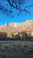
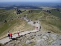
This route, which takes in the Chaudefour Valley, the Puy de Sancy, La Bourboule, the lakes of Guéry and Servières, as well as several state-owned forests, offers varied scenery and numerous panoramic views, allowing you to discover a range of local attractions in a single route!

FYI: we’ve mapped out the walk to plan our camping trip and will be testing it in mid-May, after which we’ll update the details if necessary and add photos!

Details

47741881
Creation:
Last update:
Last review:
  • Walking
    Activity: Walking
  • ↔
    Distance: 51.06 mi
  • ◔
    Average duration: 5 days 
  • ▲
    Difficulty: Difficult

  • ⚐
    Back to start: Yes
  • ↗
    Ascent: + 12,339 ft
  • ↘
    Descent: - 12,326 ft

  • ▲
    Highest point: 6,119 ft
  • ▼
    Lowest point: 2,782 ft

Stages of the route

This route needs several days, find the details below:

Notes

Apart from the sections through the Plaine des Moutons and the Bois de Charlannes, most of the route follows theGR®®4and 30 trails and is therefore signposted.
The route crosses at least two streams a day (usually many more), as well as passing through villages, providing various access points to water.

REGULATIONS: This route passes through the Chaudefour Valley Nature Reserve. Dogs are not permitted on this route. Mountain biking, foraging and wild camping are prohibited. Please stay on the marked paths. Full details at: Chaudefour Valley Nature Reserve

This route passes through multiple protected areas, which may be subject to special regulations:

Worth a visit

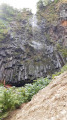
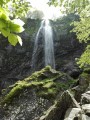
As detailed in the descriptions of the relevant sections of the route, passing through La Bourboule gives you the chance to visit the town or stop for a bite to eat. Similarly, in La Pessade, the route passes a café at midday, where you can have a bite to eat or simply enjoy a drink. There are also various detours available, depending on your pace, how tired you are and what you fancy, particularly to the waterfalls in the Chaudefour Valley.

Always be cautious and plan ahead when you're outdoors. Visorando and the author of this route cannot be held responsible for any accidents occurring on this route.

The GR® and PR® markings are the intellectual property of the Fédération Française de Randonnée Pédestre.

Reviews and comments

4.5 / 5
Based on 1 review

Reliability of the description
Not used
Ease of following the route
4 / 5
Route interest
5 / 5
jvadot
jvadot

On camping options.
No, camping is prohibited in nature reserves and also around lakes, even if you pitch your tent at night and leave at dawn. Park rangers are on duty and will remind you of the rules: we’ve seen them at Sancy and also at Lac de Guery.

Machine-translated

jvadot
jvadot

Overall rating : 4.5 / 5

Date of your route : Sep 09, 2024
Reliability of the description : Not used / Not applicable
Ease of following the route : ★★★★☆ Good
Route interest : ★★★★★ Very good
Very busy route : Yes

The long route takes in some very busy paths and others where you’re completely on your own. The ridge walk must be absolutely stunning, but we had a lot of mist.
Please be sure to observe the (very) numerous bans on camping in the nature reserves and around the lakes of Guery and Servière.
It’s a shame there isn’t a route description with the map – it would have been helpful.
We completed the route in 4 days, entirely self-sufficient with a tent. Campsites with water supplies:
• Ruisseau des Vernières “Grand pré” (point 1192 on the map)
• Lake Guery.
• On the third day, we carried on to the “La Vague Verte” campsite to have a hot shower after a windy, rainy afternoon. This added 7 km and a bit of elevation gain as well.

Machine-translated

Lcms
Lcms

Hello,
Is it actually possible to camp in nature reserves? Do you have any further details about the various stages?
Thank you

Machine-translated

didier tra
didier tra

Thank you

Machine-translated

Marie Jgd
Marie Jgd

Hello!
We won’t be testing the route until mid-May, so I’ll add more details and photos when I get back. Please don’t hesitate to get in touch if you have any further questions!

Machine-translated

didier tra
didier tra

Hello

Could you give me some more details about the hike, the stages and possible campsites?
Thank you

Machine-translated

Other walks in the area

For more walks, use our search engine .

The GPS track and description are the property of this route's author. Please do not copy them without permission.