From Le Revest to the Baou de Quatre Auro and Cap Gros

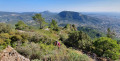
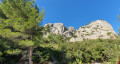
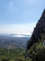
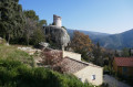
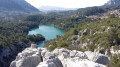
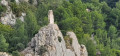
The “Bau dei Quatre Ouros” or “Rocher des 4 vents” is one of the five must-see hills around Toulon. As you approach, there’s a panoramic view stretching from the Cap Sicié harbour to the Giens Peninsula and across the Toulon hinterland. On the other side lie La Ciotat, Sainte-Baume and the Pic de Bertagne. This long and challenging hike requires a good level of fitness. The reward is a bird’s-eye view of the entire region.
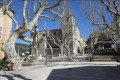
The highlight: setting off from and returning to a typical Provençal village: Le Revest-les-Eaux.

Details

n°15152374
Creation:
Last update:
Last review:
  • Walking
    Activity: Walking
  • ↔
    Distance: 8.76 mi
  • ◔
    Average duration: 5h 55 
  • ▲
    Difficulty: Difficult

  • ⚐
    Back to start: Yes
  • ↗
    Ascent: + 2,201 ft
  • ↘
    Descent: - 2,215 ft

  • ▲
    Highest point: 1,890 ft
  • ▼
    Lowest point: 607 ft

Photos

Description of the walk

Start from the Jean Moulin car park in Revest-les-Eaux.

During this walk, follow the white and redGR® markings, the blue lines and the turquoise dots as indicated.

(S/E) Take Avenue des Poilus, then turn right onto Avenue De Lattre de Tassigny.

(1) At the junction, turn right onto theGR® 51, Chemin des Laurons.

(2) Leave theGR® and turn left onto Chemin d’Evenos. Join theGR® again and continue until you reach a wayside shrine.

(3) Leave theGR® on your left and continue straight on, following the blue markers.

(4) Join theGR® and carry on to the right until you reach a T-junction.

(5) Carry on to the right along theGR®, walk past the hamlet of Les Baumes and join the D62.

(6) Follow the D62 to the right for about a hundred metres, then, at the bend to the right, continue along the path that branches off to the left. Carry on along a footpath. Cross the D62 twice and reach the Col du Corps de Garde.

(7) From the pass, continue south-west along the track, following the turquoise-blue markings. Reach the shoulder of Cap Gros.

(8) Take a round trip to the Croix du Signal to enjoy the view.

(9) Return to the track.

(8) Once back, continue to the left (following the turquoise and blue dotted markings) and head for the next ridge, where you’ll find a car park.

(10) Turn immediately right along the fence and follow the turquoise and then blue marked trails. Stay within the vegetation on the left, following the marked trail to avoid the scree, and climb up to Cap Gros.

(11) Begin the descent along the access track to the old telephone relay station, still following the blue markings.

(12) It would be a shame not to spend 15 minutes (there and back) visiting the hillock to the south, as the view from there is magnificent. Follow the two turquoise blue dots along the path which descends and then climbs back up to the 520-metre contour line. Return. On the descent, follow the trail marked by a turquoise blue dot and, after about 1 km, you’ll find the start of a path on the right (GR®).

(13) Follow this path to the right. Go round a rocky outcrop on the left, then take the path branching off to the left towards the top of a valley. After this, the path continues downhill, following the ridge to the Col du Corps de Garde.

(7) Continue the descent by taking the path you came up on and return to the Jean Moulin car park via the same route (S/E).

Waypoints

  1. S/E : mi 0 - alt. 623 ft - Le Revest car park
  2. 1 : mi 0.75 - alt. 837 ft - GR on the right
  3. 2 : mi 0.84 - alt. 840 ft - Junction
  4. 3 : mi 1.22 - alt. 915 ft - Oratory
  5. 4 : mi 1.35 - alt. 902 ft - Junction with the GR 51
  6. 5 : mi 1.95 - alt. 892 ft - Junction
  7. 6 : mi 2.33 - alt. 791 ft - D62 road
  8. 7 : mi 3.01 - alt. 1,280 ft - Col du Corps de Garde (391m)
  9. 8 : mi 3.64 - alt. 1,260 ft - Junction
  10. 9 : mi 3.7 - alt. 1,250 ft - Croix du Signal
  11. 10 : mi 4.25 - alt. 1,040 ft - Wire fence – Blue trail
  12. 11 : mi 4.58 - alt. 1,808 ft - Cap Gros/Baou de Quatre Ouro
  13. 12 : mi 4.84 - alt. 1,765 ft - A round trip for a panoramic view
  14. 13 : mi 5.49 - alt. 1,657 ft - Junction with the GR51
  15. S/E : mi 8.76 - alt. 623 ft - Le Revest car park

Notes

Sturdy footwear and walking poles are recommended.
Not recommended if you’re afraid of heights.
Do not attempt in wet weather.
Allowing for breaks, a picnic and perhaps even a nap, allow 6 to 7 hours.

Always be cautious and plan ahead when you're outdoors. Visorando and the author of this route cannot be held responsible for any accidents occurring on this route.

The GR® and PR® markings are the intellectual property of the Fédération Française de Randonnée Pédestre.

Reviews and comments

4.3 / 5
Based on 2 reviews

Reliability of the description
4.5 / 5
Ease of following the route
4 / 5
Route interest
4.5 / 5
alexandrarando
alexandrarando
• Edited:

Overall rating : 4 / 5

Date of your route : Jun 05, 2023
Reliability of the description : ★★★★☆ Good
Ease of following the route : ★★★★☆ Good
Route interest : ★★★★☆ Good
Very busy route : No

Please note: this is a very challenging hike from point 10 to point 11… you mustn’t be afraid of heights, as there is a steep slope – bordering on ‘rock climbing’ – on the Pas de la Cavale trail…
Not suitable for children or our four-legged friends. Magnificent views at the summit :-)

Machine-translated

PENEZJean-Louis
PENEZJean-Louis

Overall rating : 4.7 / 5

Date of your route : Nov 13, 2021
Reliability of the description : ★★★★★ Very good
Ease of following the route : ★★★★☆ Good
Route interest : ★★★★★ Very good
Very busy route : Yes

A lovely walk, with a superb view from the summit!
On the way back, you can pop in for a drink in Revest-les-Eaux! Very pleasant....

Machine-translated

Other walks in the area

For more walks, use our search engine .

The GPS track and description are the property of this route's author. Please do not copy them without permission.