


Refine your search for walks in Cap Gros/Baou de Quatre Ouro
Cap Gros/Baou de Quatre Ouro walks


 Baou des 4 Auros
 Association / Club / Walk leader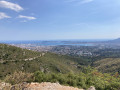
 7.00 mi
 +1,867 ft
 -1,850 ft
 4h 50
4h 50
 Average
 Departure from Ollioules (Var)
A hike in the outskirts of Toulon where you get a 360° view of the amazing countryside. A big meeting place for spies who monitor Toulon harbour.
Baou de Quatre Ouro (576 m) and Croupatier via the caves path
 Visorando Member
 8.84 mi
+3,199 ft
-3,169 ft
6h 50
8.84 mi
+3,199 ft
-3,169 ft
6h 50
 Difficult
Departure from Ollioules (Var)
Difficult
Departure from Ollioules (Var)
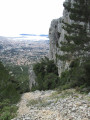
This active route will take you through the Croupatier to the Baou de Quatre Ouro, one of the four "Toulonais brothers". Paths and ledges where you have to use your hands, passages with ropes, discover the main caves of the massif, where the famous caves of the Château du Diable make the route more interesting.
Baou Quatre Ouro via the Vallons des Bonnes Herbes and Vallons des Bagnards
 4.33 mi
+1,535 ft
-1,526 ft
3h 20
Difficult
Departure from Toulon (Var)
4.33 mi
+1,535 ft
-1,526 ft
3h 20
Difficult
Departure from Toulon (Var)
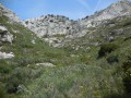
A lovely, challenging circular route along goat paths to the heights of the Baou de Quatre Ouro massif and Cap Gros.Go through two steep valleys.Return via the southern ridge of Baou and the Madema breach, partially descending to the cliff path, then the ups and downs of Hautes Pavègnes and finally the old quarry and the old Bonnes Herbes shooting range.
Le Bau de Quatre Auros via the Pas de la Cavale, at Broussan
 2.87 mi
+833 ft
-833 ft
2h 05
Average
Departure from Évenos (Var)
2.87 mi
+833 ft
-833 ft
2h 05
Average
Departure from Évenos (Var)
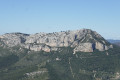
This route, which is relatively short but very strenuous, focuses on the climb to Bau de Quatre Auros via the scree corridor of Pas de la Cavale.
Circular route via the Bau de Quatre Aures and the Croupatier
 6.85 mi
+1,906 ft
-1,896 ft
4h 50
Difficult
Departure from Toulon (Var)
6.85 mi
+1,906 ft
-1,896 ft
4h 50
Difficult
Departure from Toulon (Var)
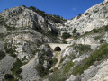
This challenging walk allows you to explore some of the features of these hills overlooking Châteauvallon—whose silhouette is ever-present when you live in the western Var—including the Croupatier and the Bau de Quatre Aures. This route shares a few sections with another walk that includes the Bau, but in the opposite direction, and extends partly along the northern slope towards Le Broussan. Furthermore, we have chosen to take the Pas de la Cavale on the way up and make this the starting point of our route.
From Le Revest to the Baou de Quatre Auro and Cap Gros
 8.76 mi
+2,201 ft
-2,215 ft
5h 55
Difficult
Departure from Le Revest-les-Eaux (Var)
8.76 mi
+2,201 ft
-2,215 ft
5h 55
Difficult
Departure from Le Revest-les-Eaux (Var)
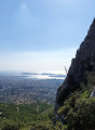
The “Bau dei Quatre Ouros” or “Rocher des 4 vents” is one of the five must-see hills around Toulon. As you approach, there’s a panoramic view stretching from the Cap Sicié harbour to the Giens Peninsula and across the Toulon hinterland. On the other side lie La Ciotat, Sainte-Baume and the Pic de Bertagne. This long and challenging hike requires a good level of fitness. The reward is a bird’s-eye view of the entire region.
The highlight: setting off from and returning to a typical Provençal village: Le Revest-les-Eaux.
Walks near Cap Gros/Baou de Quatre Ouro
The coastline between Six-Fours and Sanary
 6.27 mi
+453 ft
-374 ft
3h 15
Average
Departure from Six-Fours-les-Plages (Var)
6.27 mi
+453 ft
-374 ft
3h 15
Average
Departure from Six-Fours-les-Plages (Var)
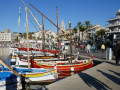
This easy route will take you to Bonnegrâce Beach and the wild coastline of Sanary, as well as offering a glimpse into the history of this cradle of underwater exploration.
Tour of the southern side of the Saint-Mandrier peninsula
4.55 mi
+633 ft
-633 ft
2h 40
 Easy
Departure from La Seyne-sur-Mer (Var)
Easy
Departure from La Seyne-sur-Mer (Var)
To fully enjoy this short hike, it is advisable to start from the Toulon pier and cross the beautiful harbour on board a Mistral boat. The hike itself allows you to discover the south coast and the beautiful panoramas of the Saint Mandrier-sur-Mer peninsula.
Loop of the Crêtes de Notre-Dame du Mai and its coastal path
 2.71 mi
+1,109 ft
-784 ft
2h 15
Average
Departure from Six-Fours-les-Plages (Var)
2.71 mi
+1,109 ft
-784 ft
2h 15
Average
Departure from Six-Fours-les-Plages (Var)
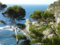
A challenging walk with magnificent views and interesting historical points of interest.
Le Pradet coastal route and customs officers' path.
 6.76 mi
+515 ft
-509 ft
3h 35
Average
Departure from Le Pradet (Var)
6.76 mi
+515 ft
-509 ft
3h 35
Average
Departure from Le Pradet (Var)
Le Pradet is a true paradise for hikers. Its trails offer exceptional views of the Mediterranean, fascinating historical remains and unspoilt nature. This coastal path winds between beaches and cliffs, offering breathtaking views of the sea. It leads to Garonne Beach, passing by coves and exceptional viewpoints, and finally to Fort Saint-Louis.
Hyères - Collobrières
18.99 mi
+2,694 ft
-2,651 ft
11h 05
 Very difficult
Departure from Hyères (Var)
Very difficult
Departure from Hyères (Var)
The Grande Traversée des Maures, or "Montem Maurum" as it was described in the Middle Ages, has never been attempted. This "diagonal route through the Maures" takes us through magnificent Provençal landscapes. A varied, wild vegetation and exceptional views punctuate this route. This adventure begins in Hyères (former Templar commandery) and ends in Collobrières (capital of the Maures) during the first stage.
From Cuges to the Hostellerie via the Col du Saint Pilon
8.71 mi
+3,222 ft
-1,660 ft
6h 50
Difficult
Departure from Cuges-les-Pins (Bouches-du-Rhône)
This walk connects Cuges-les-Pins to the Hostellerie (Plan d’Aups), passing through the Sainte-Baume ridges, the Col du Saint-Pilon and the Grotto of Mary Magdalene. On the ridges, the 360-degree panoramic views are magnificent. The Grotto of Mary Magdalene is steeped in history and spirituality, as it is said that the saint spent the last 30 years of her life there.
This walk is the first stage of a two-day trip, fully accessible via the free bus network of the Pays d’Aubagne et de l’Étoile. The walk starts from Cuges-les-Pins (free bus route 11). At the end of the first day’s walk, the Hostellerie de la Sainte Baume offers affordable accommodation. The following day, the walk continues from the Hostellerie to Saint-Zacharie (free bus routes 8 and 9).
The Jas de Sylvain
8.78 mi
+1,647 ft
-1,765 ft
5h 30
Average
Departure from Cuges-les-Pins (Bouches-du-Rhône)
A lovely walk above Cuges-Les-Pins. The Jas de Sylvain is a restored former sheepfold which offers free overnight accommodation for a few walkers in basic comfort. Beautiful panoramic views over the Cuges plain. The walk is accessible at the start and finish via the free Pays d’Aubagne et de l’Étoile bus route No. 11.