Country:
 City:


The starting point is in the car park at Parc Balzac: Parking Farcy (accessible by bus and tram – get off at the Farcy stop).
(S) Take the central path and take the second right. Turn left at the junction to reach the underwater park.
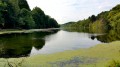
(1) As you pass by, you can take a few photos underwater at this time of year. Then continue along the path, turning right, then right again. Carry on straight ahead until you reach a hillock.
(2) This is a landscaped promontory with a view over the park. Head back down and turn left twice (the path runs alongside it). Take a left, then a right, then another left. Then turn right twice and keep left until you reach the road. Follow it to the left (there’s very little traffic as this road leads nowhere).
Take this road and go through a tunnel.
(3) Carry on straight ahead, past a small hut sheltering the communal bins, and turn right just in front of it. Follow the path, with the old tennis courts on your right. At the three-way junction, head right, continue to the next three-way junction and turn left there. You’ll arrive behind the block of flats; walk past it and rejoin the main path. Turn left. Walk to the Environment Centre (there is a photo exhibition outside). In front of the photos, turn right, then left, and follow the path to the road. The path turns right and runs alongside the road. Walk to the tunnel and go under it. Stay on the Yolande d’Aragon promenade, overlooking the park’s low-lying meadows
(4) Continue along the promenade which runs alongside the River Maine on your right. Carry on to Quai Eric Tabarly.
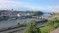
(5) Turn right onto the quay and follow the river. Cross the boulevard, then head right to take the Cale de la Savatte on your left. Superb view of Angers Castle. Continue to the Quai de Carmes.
(6) Walk along this until you reach the Pont de Verdun.
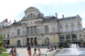
(7) Cross the bridge and turn left onto the Esplanade Cœur de Maine. At the end, walk up Rue Plantagenet until you reach Rue Bodinier on the left, ignoring the junction. At the tram stop, take Rue de la Roé on the right until you reach Place du Ralliement. Cross the square and walk up Rue d’Alsace until you reach Avenue du Maréchal Foch (its terminus). Turn left and continue straight on before crossing the avenue. Place du Mail will be on the pavement opposite (E).

 Visorando Member
 Moderate