Country:

 City:
City:


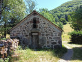
(S) From the lodge, return to the junction you left the previous day to rejoin the GR®.
(1) The descent towards the Mandailles valley takes you first through the woods (which are very damp) and then through the ferns. Before reaching a hairpin bend near the reservoir, there is a spring (the water is apparently drinkable; we didn’t fall ill). After the ferns, the path crosses through the woods again, and over a few streams. Go round the Rocher de Combières on the right along a wide path and you’ll reach a road.
(2) Turn left and immediately leave this road for another fairly wide path on the left, which becomes tarmac a little further on. After passing through the village of Lavaissière, follow the road to Saint-Julien-de-Jordanne (there is a designated area on the banks of the Jordanne where you can swim).
(3) Stay on the right bank of the Jordanne, taking the road that climbs to the left just before the bridge.
(4) Leave this road and take a path on the right before the climb up to the village of La Boudie. Walk at a leisurely pace to Mandailles (perhaps stop for a bite to eat at the restaurant ‘Au bout du monde’ – snacks, sandwiches, etc.). Cross the bridge over the Jordanne, then take the first road on the left after the town hall.
(5) Opposite a buron on the left, take the small path on the right which begins the climb up the other side of the valley, still following theGR®400. After a reservoir (a small building on the left), you’ll reach a junction.
(6) Turn right (GR®400), even though the well-shaded (and therefore tempting) path leading off opposite takes you to Puy Griou. The path, which is not very wide and quite steep, cuts through the forest. After a short descent, you’ll come to a wider path. Turn right. You’ll then come to some mountain pastures (cows), then the D317 (the road leading up to the Col du Perthus). There are a few benches where you can take a breather and an information board.
(7) Take the road to the left and, a few dozen metres further on, the track that winds sharply to the left.
(8) Further on, leave theGR®400, which branches off to the right, and continue straight ahead. A little further on, take the ramp that climbs to the right. You’ll reach a junction and rejoin theGR®400. Follow it to the left, as far as the Col de Gliziou.
(9). From there, there are two options: either follow theGR®400straight on, or take the route via Usclade to the left, which is the route chosen here. The two paths rejoin at another small pass in the forest.
(10) Head towards Puy Griou (GR®400markings). Emerge from the forest at the foot of the scree slopes of Puy Griou. The fairly steep climb between the Griou and the Griounou takes about ten minutes to reach the starting point of the ascent up Puy Griou (the ascent can be made over the rocky terrain via the north face, leaving your rucksack at the foot of the slope).
(11) Head north-east, following theGR®. This will take you to the Col de Rombière.
(12) Continue on to the Col de Cabre, which marks the end of thissecond stage (E).
A very pleasant campsite, far from civilisation, with splendid sunsets and sunrises in good weather (chamois can sometimes be spotted on the north face of Puy Bataillouse).

 Visorando Member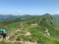
 Difficult
 Tourism professional
 Moderate
 Easy
Easy