Country:

 City:
City:


Start at Les Havres Verts. Parking available on site.
(S/E) From Les Havres Verts, head downhill. At the two Rieu crossroads, go straight on until the third Fork in the road.
(1) Cross the D60. Keep straight ahead, then turn right until you reach the Pont du Rieu.
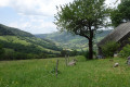
(2) Cross the bridge. Then follow the Doire river and cross the field to the start of the path which climbs left into the forest. Follow the path to a first gap. Cross it and continue to a barn. Enjoy the lovely view here of the Rieu, the valley and the Havres Verts opposite. Continue to the entrance of the next field. At the dirt track, turn immediately right towards La Blatte. This spot is home to an old little castle, and the owner will be happy to tell you its story if he is there, which is often the case in spring and summer.
(3) Walk around the estate before heading back up to the barn a little further up and rejoining the path. You’ll reach a junction known as ‘the Triangle’. You can head straight down to the right to shorten the route.
(4) For the full circular loop, turn left twice towards Labastide.
(5) Then continue straight on along the road to Soulage.
(6) Then turn right, then right again at the junction and head for the village of Girgols.
(7) Head straight on, then turn right at the junction leading to the church and the old wash house.
(8) Turn right twice to climb up to the town hall.
(9) Continue along the road until it turns into a dirt track. Cross the plateau through the fields to reach the junction from the outward journey. Head straight on towards ‘Le Triangle’.
(4) From there, head back down into the forest on the left to the hamlet of La Forge. At the bottom of the path, keep to the right.
(10) At the La Forge bridge, do not cross it. Go through the field on the right and head back up into the forest. Cross a small stream to reach the forest track. Follow it, stopping briefly at the Cascade de la Blatte (it may be dry in summer, as it dries up quite quickly).
(11) Continue straight on, following the Doire river, and rejoin the start of the route just before the Rieu bridge.
(2) Head back up to Les Havres Verts via the reverse route of the outward journey to complete a circular route (S/E).


 Visorando Member
 Easy
Easy 
 Very difficult
 Difficult