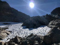
From the Col d’Ornon to Villard-Reymond

A lovely walk linking the family-friendly resort of Col d’Ornon to Villard-Reymond via the Col de Corbière and the Tête de Louis XVI. Return via the same route.

Details

38891994
Creation:
Last update:
Last review:
  • Walking
    Activity: Walking
  • ↔
    Distance: 9.01 mi
  • ◔
    Average duration: 6h 45 
  • ▲
    Difficulty: Moderate

  • ⚐
    Back to start: Yes
  • ↗
    Ascent: + 3,012 ft
  • ↘
    Descent: - 2,999 ft

  • ▲
    Highest point: 6,450 ft
  • ▼
    Lowest point: 4,764 ft
  • ⚐ Country: France
  • ⚐
    Areas: Alps, Ecrins, Dauphiné
  • ⚐ City: Ornon (38520)
  • ⚑
    Start/End: N 45.029203° / E 5.979911°
  • ❏
    IGN map(s): Ref. 3335ET, 3335ETR, 3335OT, 3335OTR, 3336ET, 3336ETR
  • Hour-by-hour weather

Description of the walk

The walk is described starting from the lodge called Le Schuss in the Col d’Ornon ski resort, which is open only in winter. It is also possible to set off from the Le Chantelouve lodge further down, on the road to the Col d’Ornon: 5 minutes by car or 45 minutes on foot. You can park easily on the lay-by in front of Le Schuss.

(S/E) With your back to the lodge, follow the track, negotiate the hairpin bend to the left and continue for about a hundred metres.

(1) At the junction, turn right onto the track, which climbs steeply, sweeping left, then opens out onto a clearing.

(2) Climb up the path that branches off to the right and is quite steep. It cuts across the hillside and then turns sharply to the right after a few hairpin bends, passes directly below the Tête de Louis XVI and reaches the Col de Corbière.

(3) Turn left to take a short detour and climb to the summit known as the Tête de Louis XVI.

(4) Return to the pass.

(3) Turn left onto the path, which then winds downwards and joins a crossroads.

(5) Carry on straight ahead, leaving the path on your right that climbs up the Combe du Grand Renand, and cross a few streams. A herd of livestock is sometimes present in season. You’ll come out onto the D210 at the entrance to the village.

(6) Follow it to the right, crossing a car park and heading up to the village centre, which is charming and well worth a stroll.

(7) Follow exactly the same route in the opposite direction to return to the car park where you started (S/E).

Waypoints

  1. S/E : mi 0 - alt. 4,764 ft - Car park, Le Schuss lodge
  2. 1 : mi 0.29 - alt. 4,905 ft - Crossroads
  3. 2 : mi 0.56 - alt. 5,269 ft - Bois Barlet ski run
  4. 3 : mi 2.1 - alt. 6,316 ft - Junction. Return trip to the summit - Col de Corbière (1926m)
  5. 4 : mi 2.22 - alt. 6,450 ft - The Tête de Louis XVI
  6. 5 : mi 3.12 - alt. 5,558 ft - Junction
  7. 6 : mi 4.37 - alt. 5,269 ft - D210
  8. 7 : mi 4.61 - alt. 5,367 ft - Villard-Reymond
  9. S/E : mi 9.01 - alt. 4,764 ft - The Schuss lodge car park

Notes

At the Col d’Ornon, there is a lodge and restaurant called “Le Chantelouve”, and on arrival (Villard-Reymond) there is a lodge and inn called “L’eau blanche”, so there’s no need to bring a packed lunch!

Reviews and comments

4.3 / 5
Based on 2 reviews

Reliability of the description
4 / 5
Ease of following the route
5 / 5
Route interest
4 / 5
mifa38320
mifa38320

Overall rating : 4.3 / 5

Date of your route : Oct 23, 2023
Reliability of the description : ★★★★☆ Good
Ease of following the route : ★★★★★ Very good
Route interest : ★★★★☆ Good
Very busy route : No

I went hiking along the Col d’Ornon–Tête de Louis XVI route on a very cloudy day with a bit of mist. The view was partly obscured by the clouds. I’ll do this hike again in June or July when the weather’s fine and the meadows are in bloom.

Machine-translated

mifa38320
mifa38320
• Edited:

Overall rating : 4.3 / 5

Date of your route : Oct 23, 2023
Reliability of the description : ★★★★☆ Good
Ease of following the route : ★★★★★ Very good
Route interest : ★★★★☆ Good
Very busy route : No

I went hiking along the Col d’Ornon–Tête de Louis XVI route on a very cloudy day with a bit of mist. The view was partly obscured by the clouds. I’ll do this hike again in June or July when the weather’s fine and the meadows are in bloom.

Machine-translated

Other walks in the area

For more walks, use our search engine .

The GPS track and description are the property of this route's author. Please do not copy them without permission.