From Breuil Mingot to Château Fromage

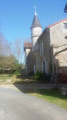
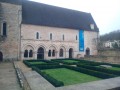
A walk of moderate difficulty, with a slight climb. There are a few sections on roads, but the forest paths are well-maintained. There is some beautiful architectural heritage to be seen in Château Fromage.

Details

n°5545022
Creation:
Last update:
–
Last review:
  • Walking
    Activity: Walking
  • ↔
    Distance: 7.80 mi
  • ◔
    Average duration: 3h 45 
  • ▲
    Difficulty: Moderate

  • ⚐
    Back to start: Yes
  • ↗
    Ascent: + 233 ft
  • ↘
    Descent: - 253 ft

  • ▲
    Highest point: 430 ft
  • ▼
    Lowest point: 302 ft
  • ⚐ Country: France
  • ⚐ City: Poitiers (86000)
  • ⚑
    Start/End: N 46.58997° / E 0.40511°
  • ❏
    IGN map(s): Ref. 1826SB, 1827SB
  • Hour-by-hour weather

Photos

Description of the walk

Starting point: Rue de la Girée, the playground car park a few dozen metres from the Breuil-Mingot school complex.

(S/E) Turn left as you leave the car park, with your back to the school. Follow Rue de la Girée, then at the first junction, continue along Rue de Couteliere, which is an extension of it.

(1) After a right-hand bend, take Rue du Mervent on the right and follow this road.

(2) After the houses, leave the road, take the tree-lined dirt track on the left and continue along this track, which descends into the small valley, passing under a power line. At the lowest point, you’ll notice a dry stream bed which may carry water in the event of flooding. Continue along this track, which climbs quite steeply for about a hundred metres.

(3) Cross the road and carry on straight ahead along this path. When you reach the three-way junction, turn slightly to the left; the path is bordered by a fence on your left.

(4) Cross the road and follow the dirt track.

(5) At this junction, turn right towards Château Fromage. You’ll come across a small pond on your right. After passing under the power line, you’ll reach the road; turn left towards Bignoux. Continue along this small road and admire the rich architectural heritage.

(6) Leave the Bignoux road and turn right. Carry on for about 200 m, take the road on the left for about 150 m and take the second right; you’ll see a sign explaining the origin of the name Château Fromage. Carry straight on along the dirt track until you reach the isolated buildings at Les Près.

(7) Turn onto the small road on your right and continue along the Chemin des Prés.

(8) At the junction, take the Route de Jappe Loup on the left and carry on to the next junction.

(9) At the junction, follow the road straight ahead. After about fifty metres, you’ll see a track on the right leading to a beautiful property offering guest rooms. Continue along the road, which passes under a power line once more.

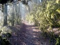
(10) About 300 metres after two houses, leave the road and take the path on the right, then follow this path. Continue along this path, which slopes down slightly.

(11) Turn left onto the path through the woodland and head uphill towards the Montmorillon farm on your right.

(12) After the farm, turn left onto the path by the large tree and carry on until you reach the junction with a road.

(13) When you reach the road, turn right and continue along Rue du Breuil Mingot. Walk past the car park on your left and, at the junction, turn right onto Rue de la Girée. Walk past the school complex on your right and return to the starting car park on your left (S/E).

Waypoints

  1. S/E : mi 0 - alt. 400 ft - Car park in front of the playground
  2. 1 : mi 0.48 - alt. 420 ft - Rue de Mervent
  3. 2 : mi 0.71 - alt. 377 ft - Turn left at the fork
  4. 3 : mi 1.85 - alt. 348 ft - Crossing the road
  5. 4 : mi 2.69 - alt. 413 ft - Cross the road
  6. 5 : mi 3.2 - alt. 420 ft - Turn right at the fork
  7. 6 : mi 3.52 - alt. 430 ft - Turn right
  8. 7 : mi 4.27 - alt. 397 ft - Turn towards Les Prés
  9. 8 : mi 4.6 - alt. 315 ft - Turn left onto Route de Jappeloup
  10. 9 : mi 5.1 - alt. 407 ft - Crossing the road
  11. 10 : mi 5.96 - alt. 331 ft - Path on the right
  12. 11 : mi 6.45 - alt. 335 ft - Follow the path on the left
  13. 12 : mi 7.03 - alt. 381 ft - After the farm with the large tree on the left
  14. 13 : mi 7.53 - alt. 397 ft - When you reach the road, turn right
  15. S/E : mi 7.8 - alt. 400 ft - Car park in front of the playground

Reviews and comments

4.2 / 5
Based on 2 reviews

Reliability of the description
4.5 / 5
Ease of following the route
4.5 / 5
Route interest
3.5 / 5
Chamdom
Chamdom

Hello,
Thank you for your feedback. As regards the sections on roads, it isn’t always easy to create circular routes that take you back to your starting point without using roads; we avoid this as much as possible, but the terrain (with no paths) forces us to use the roads.
As for the scenery, we’re very close to Poitiers, so I can’t take much credit for that!

Machine-translated

AYRAULT DANIELLE
AYRAULT DANIELLE

Overall rating : 3.7 / 5

Date of your route : May 05, 2021
Reliability of the description : ★★★★☆ Good
Ease of following the route : ★★★★☆ Good
Route interest : ★★★☆☆ Average
Very busy route : No

The walk itself was fine, but in my opinion there were too many tarmac roads

Machine-translated

Odeladetout
Odeladetout

Overall rating : 4.7 / 5

Date of your route : Apr 25, 2021
Reliability of the description : ★★★★★ Very good
Ease of following the route : ★★★★★ Very good
Route interest : ★★★★☆ Good
Very busy route : No

We only did half the walk, the section on the Breuil side.
The sections through the forest are very pleasant and the scenery is lovely;
However, it isn’t very varied.
And a bit too much road for my liking.

Machine-translated

Other walks in the area

For more walks, use our search engine .

The GPS track and description are the property of this route's author. Please do not copy them without permission.