From Sainte-Croix Abbey to the centre of Saint-Benoît through the woods

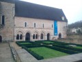
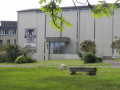
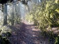
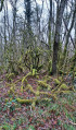
A picturesque little walk through the forest, between Sainte-Croix Abbey and the centre of the village of Saint-Benoît. A great way to explore this magnificent little town with its rich heritage, south of Poitiers, criss-crossed by a myriad of paths.

Details

926518
Creation:
Last update:
Last review:
  • Walking
    Activity: Walking
  • ↔
    Distance: 2.70 mi
  • ◔
    Average duration: 1h 20 
  • ▲
    Difficulty: Easy

  • ⚐
    Back to start: Yes
  • ↗
    Ascent: + 121 ft
  • ↘
    Descent: - 121 ft

  • ▲
    Highest point: 397 ft
  • ▼
    Lowest point: 246 ft

Photos

Description of the walk

Sainte-Croix Abbey car park.

(S/E) Leave the abbey and head for the entrance by the D741.

(1) Cross the D741 carefully and turn right towards Poitiers. A few metres further on, cross the next road.
Under the sign for “D741, Poitiers 8km”, take the path that leads into the woods on the left, heading north-west. Near a wire fence, go round it on the right, and 20 metres further on, turn right towards the houses. Continue left along Rue du Hameau du Cherpe. At the Stop sign opposite the cemetery entrance, head down Rue des Bergers to the left as far as the bakery, then turn right towards the centre of Saint-Benoît.

(2) At the war memorial square, take the road on the right, then, 50 metres further on, turn right again onto Rue du Square. Follow the signposted paths and turn right. After the bridge over the Miosson, turn immediately left onto the Jean Lebon path (yellow markings), which climbs upwards, skirting the car park. Take the second path on the left, which climbs into the woods.

(3) When you reach the Médoquerie plateau, take the tarmac road on the right (Rue des Charmilles). After 500m, leave the road by turning left onto the wooded path (Jean Lebon). Cross the D741 carefully and continue straight ahead into the woods, passing to the right under the power line. 50m after the bend, turn right onto the forest track which winds its way uphill.

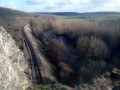
(4) When you reach the old road, with large stones (traveller site), turn left. After passing over the railway line, the entrance to the abbey is on the left.

(1) Follow the path back to the car park (S/E).

Waypoints

  1. S/E : mi 0 - alt. 367 ft - Car park - Abbaye Sainte Croix (bénédictines)
  2. 1 : mi 0.27 - alt. 390 ft - Entrance to the abbey
  3. 2 : mi 1.21 - alt. 253 ft - War memorial
  4. 3 : mi 1.53 - alt. 381 ft - Tarmac road to La Médoquerie
  5. 4 : mi 2.27 - alt. 397 ft - Travellers’ site
  6. S/E : mi 2.7 - alt. 367 ft - Car park - Abbaye Sainte Croix (bénédictines)

Notes

Plenty of shops

Worth a visit

Reviews and comments

4.4 / 5
Based on 4 reviews

Reliability of the description
4.5 / 5
Ease of following the route
4.5 / 5
Route interest
4.3 / 5
louis35
louis35

Overall rating : 5 / 5

Date of your route : Jun 30, 2026
Reliability of the description : ★★★★★ Very good
Ease of following the route : ★★★★★ Very good
Route interest : ★★★★★ Very good
Very busy route : No

We parked the car at the entrance to the abbey and walked along the path, which is nicely shaded and perfect for getting some fresh air before the midday heat sets in.

Machine-translated

famille talbot
famille talbot

Overall rating : 5 / 5

Date of your route : Sep 02, 2025
Reliability of the description : ★★★★★ Very good
Ease of following the route : ★★★★★ Very good
Route interest : ★★★★★ Very good
Very busy route : No

To make parking easier, starting in the village where there are car parks would not change the hike but would make it easier to park.
Start point 1 could be moved to the place of 4, and so on

Machine-translated

Mardelet
Mardelet

Overall rating : 4 / 5

Date of your route : Jun 10, 2024
Reliability of the description : ★★★★☆ Good
Ease of following the route : ★★★★☆ Good
Route interest : ★★★★☆ Good
Very busy route : Yes

Something to enjoy doing...

Machine-translated

Netra
Netra ★

Hello,

I’m sorry to read this reference to ‘serious abuse’.

Same question as for the other walk starting from the abbey: what practical parking options, which do not obstruct other road users, can be recommended nearby? Thank you in advance.

Machine-translated

Abbaye Sainte-Croix
Abbaye Sainte-Croix

The Abbey will no longer allow its grounds to be used as a car park... This decision was taken following serious misuse. Thank you!

Machine-translated

fabienlacaze
fabienlacaze

Overall rating : 3.7 / 5

Date of your route : Jul 29, 2019
Reliability of the description : ★★★★☆ Good
Ease of following the route : ★★★★☆ Good
Route interest : ★★★☆☆ Average

Hello
First, a lovely little woodland section, then the descent through the streets towards Saint-Benoît, which I found less interesting
The end of the walk through the woods is lovely

Machine-translated

Ajoury
Ajoury

We didn’t want to leave the car in the abbey car park, which was on private property. We couldn’t see where the walk started.

Machine-translated

Other walks in the area

For more walks, use our search engine .

The GPS track and description are the property of this route's author. Please do not copy them without permission.